
Route: Low Fell
Area: Western Lake District
Date of walk: 20th May 2015
Walkers: Andrew
Distance: 5.6 miles
Weather: Sunny with some cloud, windy on top
I parked just before Thackthwaite and on entering the village took the path uphill, helpfully signposted ‘Low Fell’. The path is an easy one to follow and the views back over Lorton Vale and over to Crummock Water improve as height is gained. The path snakes round the side of the fell and then zig zags up to the summit ridge
The walk along the ridge is a walk in heaven with wonderful views all the way. The best view of all is from the far end of the ridge, just below the southern cairn, and is described by Wainwright as a ‘view of classical beauty, an inspired and inspiring vision of loveliness…a scene of mountains arranged to perfection’
His words are no exaggeration and I stood in awe for some moments until the bitterly cold wind got the better of me. I decided to descend down the northern face of the fell, the only reason being that I’ve not done this before, despite having climbed Low Fell nearly 30 times. I knew the route would be steep, so the steepness came as no surprise, but it was an unpleasant few minutes – not life threatening in any way, but not a route I’d use again
After reaching a more sensible gradient near the bottom, I followed the path to Foulsyke, which enjoys a fabulous view – nearly as good as that from Low Fell itself – then walked along the quiet lane back to Thackthwaite
For other walks here, visit my Find Walks page and enter the name in the ‘Search site’ box
Click on the icon below for the route map (subscribers to OS Maps can view detailed maps of the route, visualise it in aerial 3D, and download the GPX file. Non-subscribers will see a base map)

Scroll down – or click on any photo to enlarge it and you can then view as a slideshow

Walking into Thackthwaite from the small parking spot

I leave the lane at this sign in the village

I follow a rough track uphill

Whiteside and Grasmoor

I follow a line of trees uphill

A lovely view towards the Western Fells, a hint of what’s in store

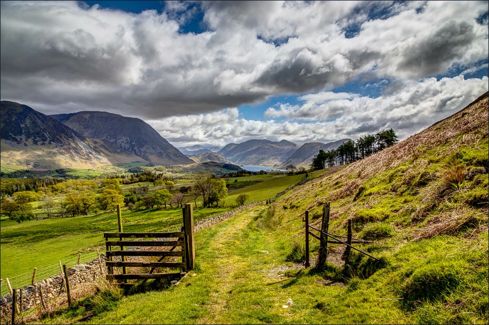
I follow an old drove road in the direction of Fellbarrow

Another hint of things to come as Crummock Water comes into view

Looking back to Lorton

Sweet Lorton Vale

The views disappear for a while as I walk round the fellside


Looking towards Fellbarrow

I’ve now gained the main ridge of Low Fell and there follows a short walk in heaven - this is looking at Rannerdale Knotts and Crummock Water

Mellbreak towards the right of the picture

The insignificant summit cairn on the north top looking towards the south top, but don’t turn back here or you will miss a treat

Looking back to Fellbarrow, with the Solway Firth and Scotland in the far distance

A short down and up before the South top

Crummock Water and an array of Western Fells


Mellbreak and Mosedale

Holme Wood and Loweswater

That view again, from the end of the ridge

Whiteside and Grasmoor

Start of the steep descent beside the fence

Scale Hill and Lanthwaite Wood


Crummock Water again

Scale Hill

Whinny Ridding Wood

Rannerdale Knotts, with Haystacks and Great Gable beyond

Further along the woodland path

I pass by Woodend before turning left along the lane back to Thackthwaite

The wonderful view from Foulsyke

The lane to Thackthwaite

Looking across to the Low Fell ridge

Back to Thackthwaite and the end of the walk - watch out for speeding squirrels

On the other side of the valley, later that day


