
Route: Around Loughrigg Fell
Area: Central Lake District
Date of walk: 13th February 2014
Walkers: Andrew
Distance: 5.6 miles
Ascent: 900 feet
A swollen knee and a negative weather forecast were the deciding factors in the choice of a low level walk today. I’d last climbed Loughrigg Fell 3 months ago and today was a good day to pay another visit to this lovely little fell
It was hailing heavily as I parked the car at Pelter Bridge near Rydal. I followed the course of the River Rothay for a short distance before heading uphill along the flanks of Loughrigg Fell
It wasn’t long before the first ‘wow moment’ – a glorious view of the snow covered Langdale Pikes across Loughrigg Tarn. The second such moment came about half an hour later – the sublime view over Grasmere from Loughrigg Terrace. Although the weather was poor for most of the walk, with overcast skies and plenty of hail, I was lucky to enjoy some sunshine at just the right time to enjoy these views
To complete the circuit of the fell, I walked along the shore of Rydal Water back to Pelter Bridge. What a fantastic walk it had been!
For other walks here, visit my Find Walks page and enter the name in the ‘Search site’ box
Click on the icon below for the route map (subscribers to OS Maps can view detailed maps of the route, visualise it in aerial 3D, and download the GPX file. Non-subscribers will see a base map)

Scroll down – or click on any photo to enlarge it and you can then view as a slideshow

The start of the walk at Pelter Bridge car park near Rydal

A very full River Rothay

The stepping stones are redundant today

Further along the path

Looking back towards Low Pike and Red Screes

Looking up to Loughrigg Fell

Windermere in the distance

Langdale is just around the corner………

Langdale

The unmistakeable outline of the Langdale Pikes

Skelwith


Further along the path, with the slopes of Loughrigg Fell on my right

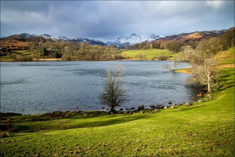
Loughrigg Tarn

Zooming in on the Langdale Pikes

A view across Loughrigg Tarn

The route passes along a short section of quiet road

Entering Deer Bolts Wood


The start of a short walk in heaven - Loughrigg Terrace

Grasmere from Loughrigg Terrace

Looking along Loughrigg Terrace

Rydal Water

Looking across Rydal Water to Nab Scar

Not far to go now - it’s been a beautiful walk throughout

Back to the start - Pelter Bridge
