
Route: Lanthwaite Green
Area: Western Lake District
Date of walk: 26th August 2020
Walkers: Andrew and Gilly
Distance: 2.7 miles
Ascent: 500 feet
Weather: Mostly cloudy, some sunny patches
A dull murky morning caused us to delay the start of today’s planned fell walk, and by the time conditions cleared there was insufficient time left. We decided instead to revisit our favourite local viewpoint, Lanthwaite Hill
We varied our normal route by parking in the free National Trust car park at Lanthwaite Green, adjacent to Lanthwaite Green Farm. After crossing the Buttermere road we headed towards Whin Ben, the ridge which leads up to Whiteside. We then crossed Liza Beck via a footbridge and set off along the elevated path which heads north along Lorton Vale. This is a wonderful section of the walk, with views north along the valley and west across it
All too soon we arrived above Beck House, and here we left the path to descend west. Just before the road we had to cross Liza Beck again. There’s no footbridge here and, after recent heavy rain, the beck was running high and fast. We managed to ford the beck and keep our boots dry. After crossing the road we passed through a gate into Brackenthwaite, and here started the gentle ascent of Brackenthwaite Hows, also known as Lanthwaite Hill. The path here is very faint at times, and it peters out at times, but there are no dangers or difficulties and it’s just a case of aiming for the ridge leading to the top of the hill
After gaining the ridge we paused to enjoy the wonderful view over Crummock Water. There were four walkers at the top, the only people we saw on the route, so we didn’t linger there and made our way around the edge of Lanthwaite Wood back to the start of a lovely short walk
For other walks here, visit my Find Walks page and enter the name in the ‘Search site’ box
Click on the icon below for the route map (subscribers to OS Maps can view detailed maps of the route, visualise it in aerial 3D, and download the GPX file. Non-subscribers will see a base map)

Scroll down – or click on any photo to enlarge it and you can then view as a slideshow

A few photos taken earlier in the month which didn't feature in walks - barn below Whiteside in Lorton Vale

Crummock Water

Southern end of Lorton Vale

Misty dawn at Crummock Water and in Newlands Valley

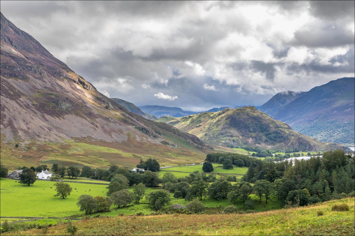
On with today's walk - this is looking back to Lanthwaite Green Farm at the start, with the car park out of sight to the left

We head towards Whiteside and Whin Ben - our path will take us along the foot of the fell

Low Fell on the far side of Lorton Vale

Another view back to the start with Mellbreak dominating the scene, and a glimpse of Crummock Water at its foot

We cross the footbridge over Liza Beck

Looking back to the Loweswater Fells - Loweswater itself is just out of sight

Start of the elevated path which runs the full length of Lorton Vale as far as High Lorton, about 3 miles away

Looking across to Lanthwaite Hill, or Brackenthwaite Hows, where we'll be later

We continue along the valley path

The Loweswater Fells again, with Lanthwaite Hill in the foreground

Zooming in on Carling Knott and Burnbank Fell

We part ways with the valley path to pass through this gate

We head across the fields in the direction of Low Fell

Looking back to Whiteside End

Having forded Liza Beck, we cross the Buttermere road at Beck House, and continue through the gate beyond

We follow a path beside the dry stone wall, and pass by Pickett Howe...


We're now on Brackenthwaite Hows, and start the gentle ascent to its top

Low Fell on our right

Looking back along the faint path, which is quite hard to follow when covered in bracken

We aim for a point to the right of the rock outcrop

Heather on the flanks of Lanthwaite Hill...


We gain the ridge to the top

Lorton Vale from Lanthwaite Hill

Looking the other way towards Rannerdale Knotts. Our start point, Lanthwaite Green, is below on the left

Crummock Water and the High Stile Range

We pass through the deer gate leading into Lanthwaite Wood

The path hugs the edge of the wood


We leave the wood at this point to head back towards Lanthwaite Green

Sunshine on Rannerdale Knotts

Lanthwaite Green Farm ahead

