
Route: Lanthwaite Hill
Area: Western Lake District
Date of walk: 20th October 2017
Walkers: Andrew and Gilly
Distance: 2.8 miles
Ascent: 500 feet
Weather: Low cloud, the odd patch of sun
The higher fells were shrouded in low cloud today but later in the morning a few patches of sun appeared and we decided to revisit one of our favourite places in the district – Lanthwaite Hill, which is shown on the OS map as Brackenthwaite Hows
We usually climb this wonderful little hill from Scalehill Bridge but went a different way today. We parked in the small car park by Lanthwaite Green Farm and, saving the hill for last, walked away from it in the direction of Whiteside. We crossed the footbridge over Liza Beck and joined the lovely footpath which runs the length of Lorton Vale. After 15 minutes or so we reached a gate in the wall at a point opposite Pickett Howe and here we descended through the fields to the Buttermere road. We crossed the road and passed through the gate on the other side, following a narrow grassy path not shown on the OS map but which leads up to the ridge line of Lanthwaite Hill
An easy short climb soon took us to the top of the hill, from where there are superb views in all directions
We then descended into Lanthwaite Wood and followed the path around the edge of the wood, leaving it to walk back across the fields to Lanthwaite Green. It was a wonderful short walk to a place that never fails to delight
For other walks here, visit my Find Walks page and enter the name in the ‘Search site’ box
Click on the icon below for the route map (subscribers to OS Maps can view detailed maps of the route, visualise it in aerial 3D, and download the GPX file. Non-subscribers will see a base map)

Scroll down – or click on any photo to enlarge it and you can then view as a slideshow

Red squirrel in the garden before we set off this morning

Hazelnuts in the feeder, many of which are buried around the garden in readiness for winter...

...this one is about to be buried in the plant pot

Later that morning, looking along the Buttermere road as we cross it from the car park

Heading towards Whin Ben, a spur which leads up to Whiteside

Looking back to Lanthwaite Green Farm and Lanthwaite Wood

We cross the footbridge over Liza Beck

The beck flows down the deep trench of Gasgale Gill, which divides Whiteside and Grasmoor

A view back to the start, with Mellbreak in the background

We follow the path above the dry stone wall

Lorton Vale

The foot of Mellbreak

Further along the path

We turn off the path to descend through the field on the left...


Looking back to Whin Ben

We cross Liza Beck again


The path passes above Pickett Howe

Looking back along Lorton Vale...


The foot of Low Fell

We arrive on the ridge leading to Lanthwaite Hill...


Just below the top, a view along sweet Lorton Vale

Rannerdale Knotts

Looking towards Loweswater

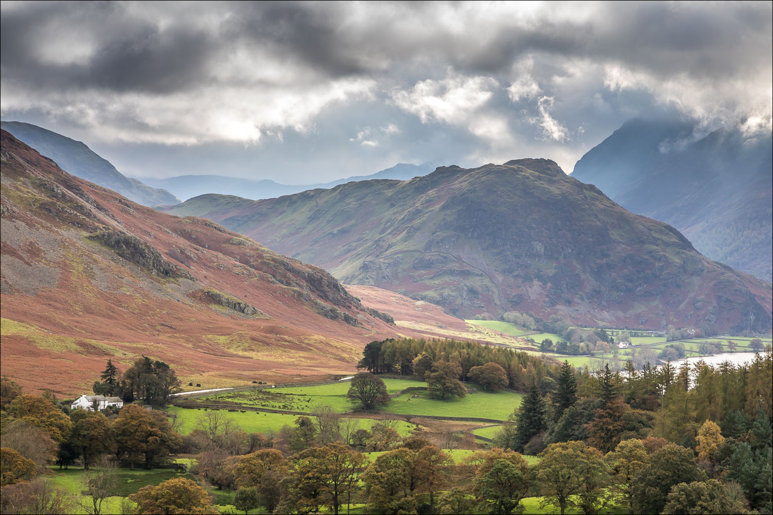
Crummock Water and Mellbreak

We descend towards Lanthwaite Wood

We pass through the deer gate below and enter the wood

The path skirts round the edge of the wood...


We leave the wood and follow a path towards Whin Ben - Whiteside has its head in the clouds

Lanthwaite Green Farm ahead, marking the end of a short but very sweet walk

Back home, more red squirrel activity...


The day after the walk I made an early morning visit to a very breezy Buttermere. Here are a few photos....

Comb Beck waterfalls...


Bothy at the head of the lake

Fleetwith Pike

Low Crag

Honister Pass
