
Route: Langdale Pikes
Area: Central Lake District
Date of walk: 1st October 2015
Walkers: Andrew
Distance: 5.1 miles
Ascent: 2,500 feet
Weather: Sunny and warm, no cloud, no wind
I parked in the National Trust car park at Sticklebarn near the New Dungeon Ghyll Hotel (parking is free for members of the Trust) and headed uphill towards Mark Gate. After passing through a gate I made a schoolboy error and without checking the map followed some other walkers along a path which leads up the wrong side of Dungeon Ghyll. The path was very clear at first, no doubt others have made the same mistake, and it’s not until higher up the fellside that it peters out. Retracing my steps would have wasted considerable time so I clambered down to the ghyll and then up a very steep grassy bank – a horrible 10 minutes or so, with the constant risk of a slip back down to the ghyll. For anyone following this walk, the maps page shows the correct route
I emerged panting at the proper path and continued up to the first fell on this round of the Langdale Pikes, Loft Crag. From there it was a short walk to Pike o’Stickle. The final rocky section of the pike is very steep, needing hands on the ascent and bottom on the descent, but there are no difficulties
I then made my way across to Harrison Stickle, an easy climb. From this third and final fell of the round I made my way down to Stickle Tarn, and from there back to the start via Stickle Ghyll
For other walks here, visit my Find Walks page and enter the name in the ‘Search site’ box
Click on the icon below for the route map (subscribers to OS Maps can view detailed maps of the route, visualise it in aerial 3D, and download the GPX file. Non-subscribers will see a base map)

Scroll down – or click on any photo to enlarge it and you can then view as a slideshow

Crummock Water at dawn before I set off for Langdale


Buttermere

On the way to Langdale, I drove past Rydal Water


The moon behind Loft Crag, one of today’s targets

Start of the walk from Sticklebarn

Looking back along Great Langdale as I start the climb up to Mark Gate

Looking towards the head of the valley

Pike o’Blisco and Crinkle Crags

Great Langdale…

…and again, with Windermere making an appearance top right

Zig zagging path leading up to Blea Tarn

Windermere and Blea Tarn

Crinkle Crags

Summit cairn on Loft Crag

Bow Fell and Mickleden

I follow the ridge towards the shapely outline of Pike o’Stickle

Mickleden and Oxendale

Mickleden Beck

Looking back to Loft Crag, with Lingmoor Fell beyond

Harrison Stickle, which will be the third and last fell of today’s round

I met these friendly fellow walkers on the interesting scramble to the top of Pike o’Stickle - I hope you all enjoyed the rest of your walk

Mickleden Beck again

Walking across the featureless hinterland of the Pikes towards Harrison Stickle

Windermere and Lingmoor Fell from Harrison Stickle

Oxendale and Crinkle Crags, with Loft Crag to the right

Loft Crag and Pike o’Stickle, where I’d been earlier, and Bowfell and Scafell Pike beyond

I start the descent towards Stickle Tarn

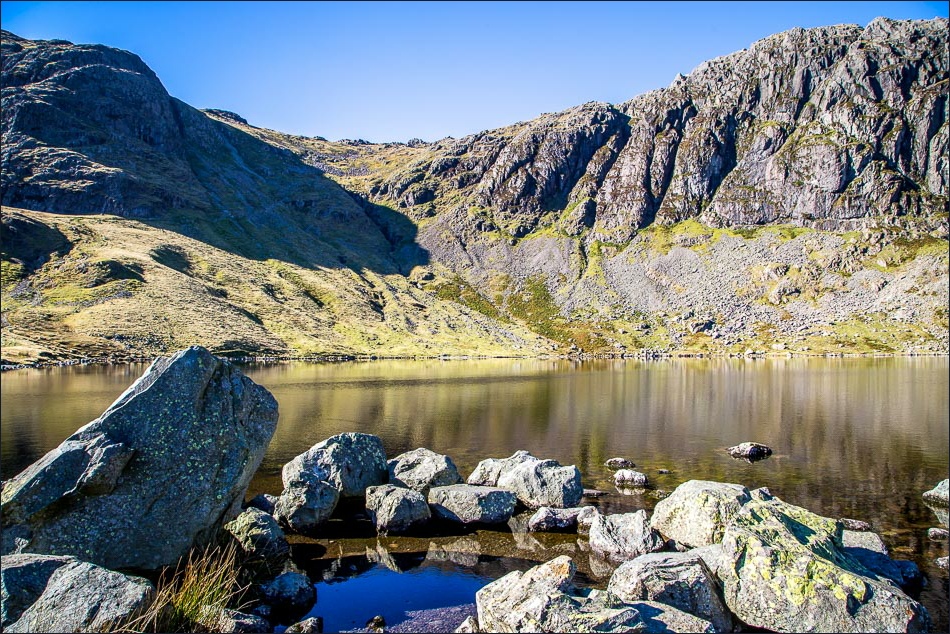
Stickle Tarn and Pavey Ark


Side Pike seen as I follow the path beside Stickle Ghyll

Heading back down into Great Langdale

Stickle Ghyll


Back to the start at Sticklebarn

On the way back home, I stopped the car to admire the view of Loft Crag and Harrison Stickle
