
Route: Brodick to Lamlash
Area: Scotland, Isle of Arran
Date of walk: 16th October 2021
Walkers: Andrew, Gilly and James
Distance: 5.3 miles
Ascent: 650 feet
Weather: Dull and overcast, some light drizzle
On the first day of a short walking holiday on the Isle of Arran we awoke to low cloud and grey skies. Our plan to climb Goatfell, the highest mountain on the island, would have to be postponed, as the clouds were below its 2,800 feet summit. We decided instead on a low level linear woodland walk
From our rented cottage in the attractive coastal village of Lamlash (Brae House, which I can highly recommend) we caught the 9.30am bus to Brodick Ferry Terminal, where we’d disembarked from the ferry yesterday. Times vary, so anyone following this walk should check the latest Stagecoach timetable
We walked along the seafront in Brodick for a short distance before turning inland at a junction with Alma Road. The road became a track and later on a narrow path which took us through attractive mixed woodland (apart from a couple of areas where large scale felling had taken place)
When we reached the car park and picnic area at Croc na Dail we made a short detour to see a small stone circle of the same name, reputedly a meeting place where crofters would meet in the past to discuss matters of common concern. Whilst the circle may be interesting historically, it’s a little underwhelming from a visual point of view
Back on the main path, the remainder of the route was close to the roadside. The woodland was attractive but there was some traffic noise which detracted slightly
A highlight of the walk was the view of Holy Isle as we arrived at the outskirts of Lamlash. From here we followed the footpath back into the village to complete the walk, one which we all enjoyed despite the dull skies and drizzle
Click on the icon below for the route map (subscribers to OS Maps can view detailed maps of the route, visualise it in aerial 3D, and download the GPX file. Non-subscribers will see a base map)

Scroll down – or click on any photo to enlarge it and you can then view as a slideshow

The day before the walk, we took the CalMac Ferry from Ardrossan to Arran, seen here in the distance as we leave harbour

Approaching the Isle of Arran

The mountains of North Arran

Goatfell, the highest mountain on the island, which we'd climb on our final day here

Next day, a rather gloomy and dull one, as we look out over Lamlash Bay to Holy Island. From here we catch the bus to Brodick and will walk back

A short while later, a heron meets us off the bus in Brodick Bay

We walk away from the pier at Brodick and along the seafront

Views of Goatfell, which we'll climb on the last day of our stay on Arran...


We turn off and follow the sign to Lamlash

We follow the track through woodland

The track turns into a narrow path through an area known as Fairy Glen


The hills around us are the Clauchland Hills and we continue to the top of the rise ahead

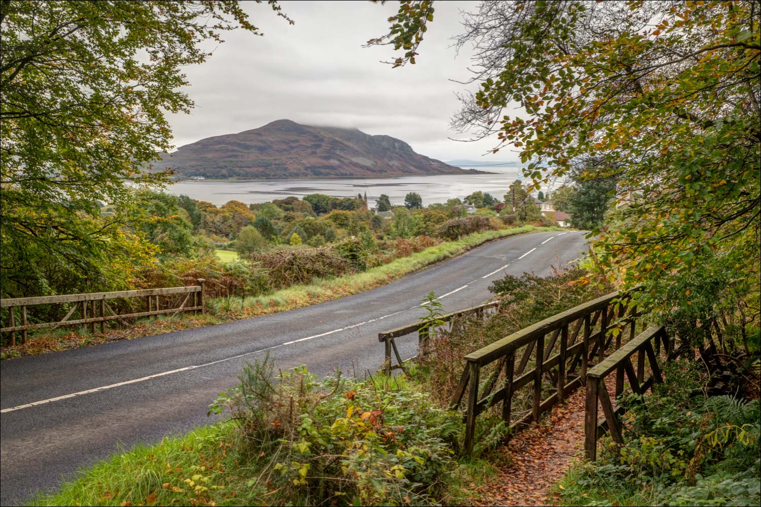
The views are mostly restricted by trees, but open up at the highest point of the walk, the viewpoint at Cnoc na Dail

On reaching Cnoc na Dail, the path continues but we make a short detour to seek out a stone circle on the other side of the road...

We manage to locate it. It's a small circle with small stones, and is marked on the OS map but in truth is not really worth the detour

Back on the path, we descend gently through woodland towards Lamlash. The road from Brodick to Lamlash is on our left

Autumn colours in the woodland...


We emerge from the woods at the outskirts of Lamlash to be greeted with this view of Holy Island

We walk past the golf course

We arrive in Lamlash, looking across Lamlash Bay to Holy Island

Oystercatcher in Lamlash Bay

Common Redshank

A family of swans by Lamlash Pier

The village of Lamlash

Looking across Lamlash Bay to Holy Island - a walk over the tops of the island was high up our wish list for this holiday, but the weather prevented it

Back to the bus stop in Lamlash, and the end of our walk

It wasn't the end of the day however, and we drove over to Kildonan on the south of Arran in search of wildlife - a heron, with the lighthouse on the small island of Pladda in the background

Seals may be found anywhere around the coast of Arran, but this is a particularly good place to spot them

Lolling seals....

Follow the link for more walks in Scotland (44)
