
Route: Huggate Circular
Area: East Yorkshire
Date of walk: 22nd May 2025
Walkers: Andrew
Distance: 5.2 miles
Ascent: 450 feet
Weather: Mixed sun and cloud
Today’s walk would make it a hat trick of walks on the Yorkshire Wolds in as many days, the other two being Millington Dale and Thixendale.
Huggate village is claimed to be the highest village on the Yorkshire Wolds at around 558 feet above sea level. However, nearby Fridaythorpe makes the same claim and is said to be 561 feet. I’m not sure which is correct. I’ve walked from Huggate several times before, but today’s Huggate circular was a new route for me, slightly shorter than the others
I parked in a free public car park at the edge of the village on the Driffield road. I’d encourage anyone following this route to park here, as it keeps cars out of the village and only adds 5 minutes to the walk. I followed a public footpath into the villlage and arrived at the village green, home to one of the deepest wells in England at 116 yards deep which previously supplied the inhabitants with water
I followed the lane heading north out of Huggate. The lane is virtually traffic free as it’s a dead end and only serves a couple of local farms. Following a section of the Yorkshire Wolds Way I walked along the entrance drive to Northfield Farm for a short distance and then headed down into Horse Dale, one of four dry chalk valleys visited during the walk. The views from here were wonderful, especially those from one of the carved poetry benches which so enhance the Wolds Way. I continued into Harper Dale and when I arrived at Harper Dale Plantation I climbed out of the valley onto North Field. An easy walk across the field brought me to Rabbit Dale, where I descended to the valley floor and continued into Cow Dale. At the end of Cow Dale I arrived back at the lane into Huggate, where I made a short diversion to St Mary’s Church which dates back to the 12th century and is Grade I listed. The church has recently been renovated thanks to a National Lottery Heritage Fund. From here I retraced my steps back to the start of another wonderful walk on the wolds
For other walks here, visit my Find Walks page and enter the name in the ‘Search site’ box
Click on the icon below for the route map (subscribers to OS Maps can view detailed maps of the route, visualise it in aerial 3D, and download the GPX file. Non-subscribers will see a base map)

Scroll down – or click on any photo to enlarge it and you can then view as a slideshow

The start of today's walk from the car park at the edge of Huggate. Instead of following the road into the village I follow a public footpath which emerges near the village green

Huggate village well, one of the deepest in England

I follow a lane out of the village, heading north past St Mary's Church, which I'll visit at the end of the walk...


Further along the lane

Cow Dale on my right - I'll return via the dale at the end of the walk

Entrance to Northfield Farm, which is also part of the Yorkshire Wolds Way

I carry on ahead at the sign

I pass through the gate into Horse Dale

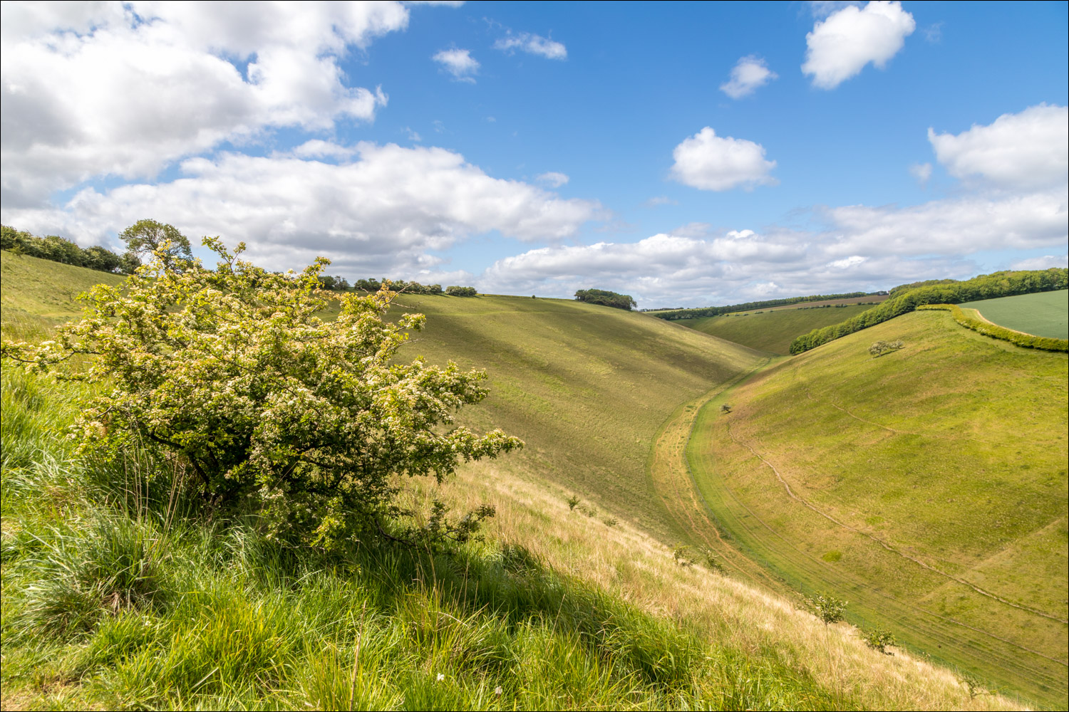
A wonderful path follows the contours above the valley

Looking back along Horse Dale to Horsedale Plantation

I arrive at one of the poetry benches which adorn the Yorkshire Wolds Way. The bench was designed by artist Angus Ross, who created it to represent the curves of the dry valleys along the Yorkshire Wolds Way. The bench is carved with a poem by John Wedgwood Clarke

The poem reads: 'We have ripped the earth with our desire to be here and not there. We have driven the dale's wedge of hush home between us. But you move, as we moved, in the ghost of water. A hare rips away from the dead. Thuds down the dyke and out into everywhere the grasses foam'

Looking back along the path

I descend to a point where three valleys meet - Horse Dale, Holm Dale and Harper Dale

A last look back along Horse Dale

I descend to the valley floor

There follows a lovely walk along Harper Dale...


At the edge of Harper Dale Plantation I climb uphill and join a chalk track

Looking back into Harper Dale

I follow the track through North Field


I carry straight ahead at this sign

Looking across to the next valley on the walk - Rabbit Dale

I descend into Rabbit Dale and turn right along the valley floor...


Another merger of three valleys - Rabbit Dale, Oxlands Dale and Cow Dale. I turn right here into Cow Dale

I walk along Cow Dale, following a section of the Chalkland Way...


I reach the end of Cow Dale, looking back to two walkers in the distance, the only other people I'd seen on the walk

I arrive back at the lane out of Huggate and retrace my steps into the village...


A make a short diversion to St Mary's Church to end another superb walk on the Wolds
Follow the link for more walks in East Yorkshire (117)
