
Route: Horsey
Area: North Norfolk
Date of walk: 28th January 2022
Walkers: Andrew, Gilly and James
Distance: 4.8 miles
Ascent: 100 feet
Weather: Fog and mist at first, gradually clearing
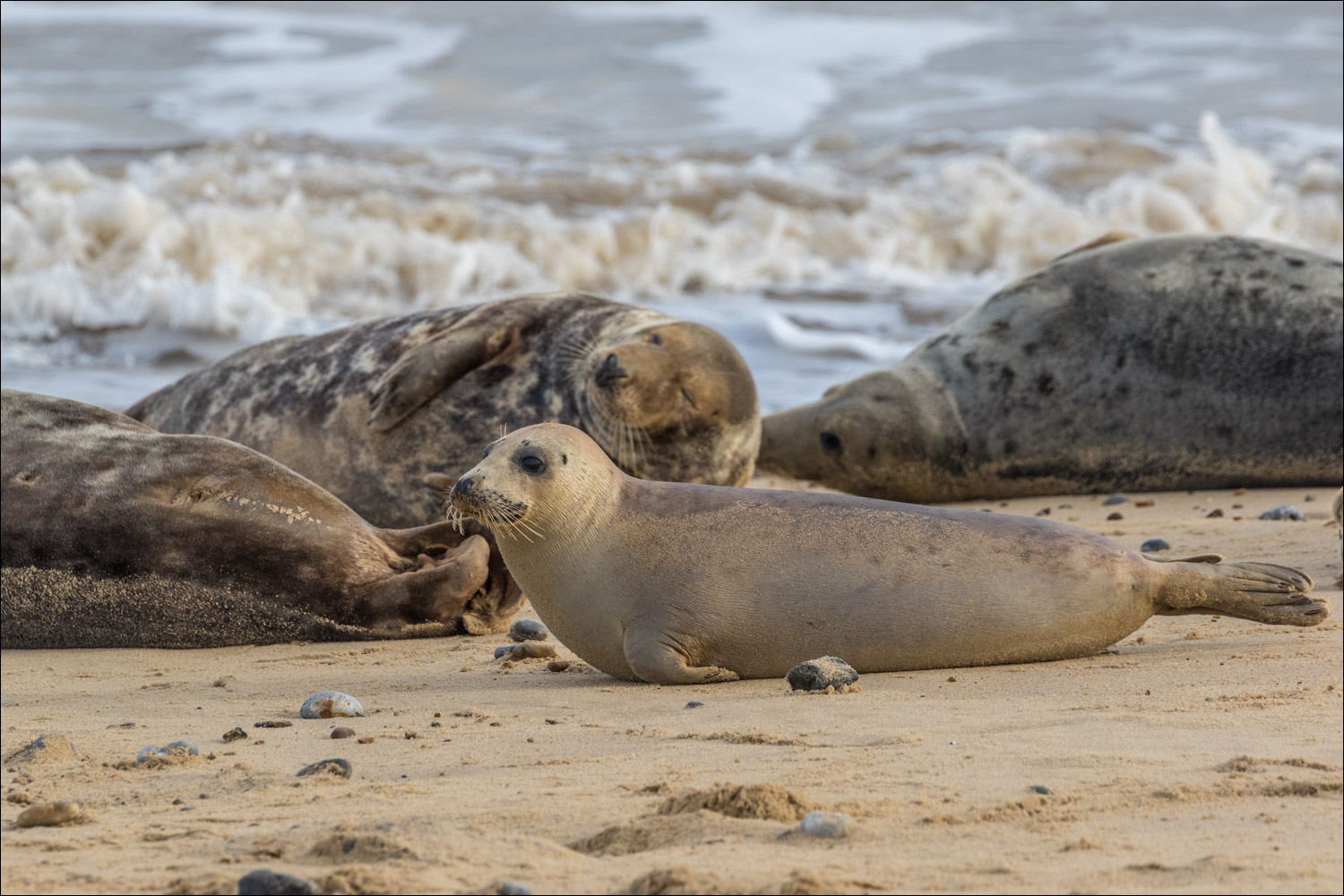
The beach near Horsey is part of a stretch of coastline which is home to one of the largest breeding colonies of Atlantic grey seals in the country. Pupping takes place during December and January so this would be one of the last opportunities in the season for sightings. Seal pups are unable to swim for three or four weeks, so the suckling seals lie above the tide line while their parents loll around nearby
We parked inland, at the National Trust car park at Horsey Mere which is an important bird reserve and worth a visit in its own right. It was a misty morning as we walked past Horsey Windpump, built in 1912 in order to assist in draining the fens
The landscape in these parts is as flat as a pancake and we made quick progress across the fields to Crinkle Gap, a break in the concrete and dune barrier that protects the land from flooding. As soon as we entered onto the beach we were greeted by the sight of a pair of seals swimming in the sea and, to our right, we spotted a large colony of seals lying around on the beach. It’s important not to disturb these creatures and we chatted with one of the seal warden volunteers in order to find out where we could safely walk. Depending on tide times it may not be possible to walk along the beach and it may be necessary to follow a path behind the dunes. Our luck was in and we were able to keep to the beach provided that we stayed as far away from the seals as possible
It was a wonderful section of the walk, with large groups of seals on our right as we walked as far as Horsey Gap. At this point we turned inland to head back to the start to follow a series of paths, tracks and a short road section back to the start. Back at Horsey Mere we had a close encounter with a Chinese Water Deer which leapt out of the reed beds and almost landed on us, before sprinting off down the path – a memorable end to the walk
Click on the icon below for the route map (subscribers to OS Maps can view detailed maps of the route, visualise it in aerial 3D, and download the GPX file. Non-subscribers will see a base map)

Scroll down – or click on any photo to enlarge it and you can then view as a slideshow

A misty start to today's walk as we look across to Horsey Windpump, or Horsey Drainage Mill. The mill was built in order to drain the fens and continued to operate until struck by lightning in 1943

The landscape is flat and featureless, but atmospheric

Reed beds on either side as we head to the coast

Roe deer in the fields


Approaching the dunes

The sea lies beyond the dunes. We didn't know at this point whether we'd have to walk beside the dunes, with no views of the sea, or along the beach beyond them


We pass through this gap and enter onto the beach

An immediate sighting of a pair of grey seals in the sea...


After chatting to one of the helpful seal warden volunteers we established that we could safely walk along the beach without disturbing the seals, as long as we kept to the edge of the dunes - which we did

Grey seals in various stages of lolling...


The pupping season is over, but many of the pups are too young to take to the sea

Scratching an itch


We continue beside the dunes, which are reinforced by a concrete wall


A sanderling, one of many

More seal sightings as we continued along the beach

Just before this groyne we turn inland

We leave the beach and pass through Horsey Gap

We pass by All Saints' Church Horsey which is thatched and built of flint rubble. The church dates back to Saxon times

We arrive back at Horsey Windpump and the end of the walk

We make a short diversion to Horsey Mere, easily accessible from the car park, and an internationally important site for wildlife including the rare Common Crane and Swallowtail Butterfly

We'd run out of time and contented ourselves with this view along the mere

Later that day, promising skies tempted us to drive back to Cley Windmill, which we'd walked past yesterday...

A wonderful end to the day
Follow the link for more walks in Norfolk (10)
