
Route: High Rigg to Castlerigg Stone Circle
Area: Central Lake District
Date of walk: 1st February 2019
Walkers: Andrew
Distance: 5.4 miles
Ascent: 1,300 feet
Weather: Cloudy with sunny patches, very cold on the tops
I’ve climbed High Rigg many times and it’s one of my favourite fells. I was looking for a variation of my usual route, and looking at the OS map it appeared that an ascent of the fell could be combined with a visit to Castlerigg Stone Circle, one of the earliest British circles, raised in about 3000 BC during the Neolithic period. As this would be a linear walk I’d need transport at the end of it, and Gilly kindly volunteered for the job
I started as usual from one of the roadside spaces on the A591 near Legburthwaite, and after crossing the nearby ladder stile made my way up Wren Crag towards the ridge. The flanks of the crag are adorned by some fine old pine trees and it’s a great shame that a number of these – perhaps 20 or 30 – have fallen victim to the gales last year, the so called ‘Beast from the East’ being the presumed villain.
When I reached the knobbly summit ridge I followed the undulating path up and down and after about 1.5 miles arrived at the summit of High Rigg, from where there are lovely views, particularly those looking towards Blencathra
I then descended in the same direction as the ridge to reach the hause between High Rigg and Low Rigg. From here I followed the lane leading west, leaving it when it turned left to continue in the same direction across the fields. The path brought me to the A591 and, after walking beside the road for 50 yards or so, I joined a path which took me past Low Nest and High Nest
From here there followed a gentle ascent to Castlerigg Stone Circle, a wonderfully atmospheric place where I was able to enjoy good views back to High Rigg – a fitting end to the walk
For other walks here, visit my Find Walks page and enter the name in the ‘Search site’ box
Click on the icon below for the route map (subscribers to OS Maps can view detailed maps of the route, visualise it in aerial 3D, and download the GPX file. Non-subscribers will see a base map)

Scroll down – or click on any photo to enlarge it and you can then view as a slideshow

Red squirrel before we set off this morning

Gilly dropped me off by this ladder stile on the verge of the A591, and if all went to plan we'd meet up later at Castlerigg Stone Circle

An early view back as I start the climb up to Wren Crag

Wren Crag ahead, and some of the fallen pine trees

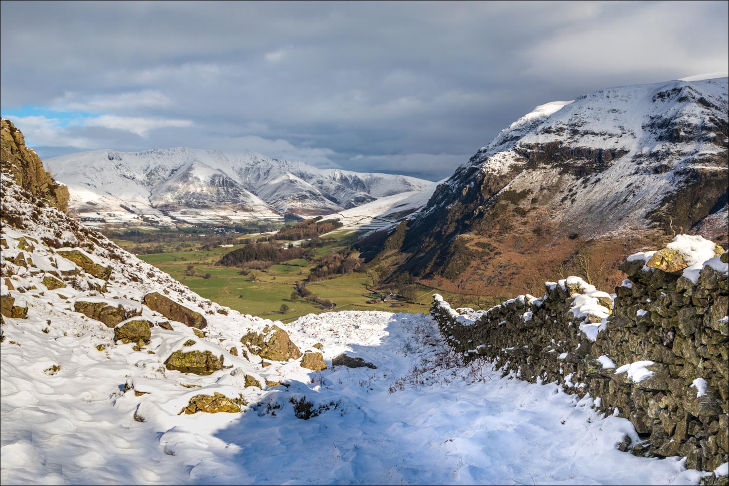
The imposing face of Castle Rock below Watson's Dodd

Further up Wren Crag

Looking back to Great How, and Thirlmere to its right

I continue uphill between the pine trees

Looking back along the A591

Castle Rock again...


The Central Fells on my left

Last of the pine trees as I arrive on the summit ridge, known as Long Band

Looking along the ridge - the summit of High Rigg is at the end

A final look back to Thirlmere

Blencathra, and St John's in the Vale below to my right

Blencathra again, with its three buttresses of Gategill Fell, Hall's Fell and Doddick Fell

Threlkeld Knotts and St John's in the Vale

A down and an up as I continue along the undulating ridge

Frozen tarn, looking across to Great Dodd

A view back along the path

The summit of High Rigg is to my left, and is reached after a short climb

Summit cairn on High Rigg, looking towards Blencathra

St John's in the Vale and the Eastern Fells

Skiddaw Little Man, with Skiddaw itself in the clouds

Looking across St John's in the Vale

Start of the descent as I head down in the direction of the Youth Centre

I follow the icy track heading west...


At the entrance to Sykes Farm I leave the road and continue to head west across the fields

Looking back to High Rigg

Beyond the bridge I aim for Nest Brow (where United Utilities are carrying out some unsightly infrastructure works, though the land will be restored once completed)

After following the A591 for about 50 yards I branch off and pass by High Nest

Looking across to High Rigg

The end of the walk is just around the corner...

...Castlerigg Stone Circle, thought to have been constructed about 3000 BC

Looking towards Blencathra...

...High Rigg


Panorama view (click to expand), with High Rigg again in the background

Later that day, Orion's Belt above Lorton Vale
