
Route: Haystacks
Area: Western Lake District
Date of walk: 24th August 2019
Walkers: Andrew, Gilly and James
Distance: 5.2 miles
Ascent: 1,800 feet
Weather: Sunshine and blue skies, very warm
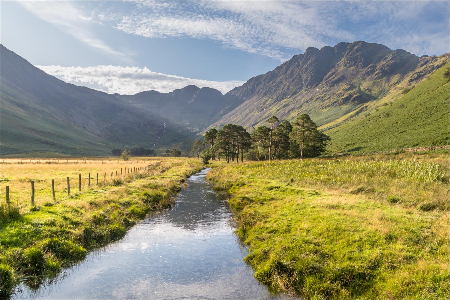
Haystacks was the favourite fell of Alfred Wainwright and it’s one of mine too – it’s a fascinating place and there’s always something new to see. Today would make it my 18th time up here, and I could never tire of it. As this was a bank holiday weekend, and the forecast was for sun and blue skies, we made an early start and parked in the car park at Gatesgarth Farm just after 8am. We walked through the farm and crossed Peggy’s Bridge at the head of Buttermere. The climbing starts below a small triangular shaped copse, and from here we followed the easy path up to Scarth Gap
Beyond Scarth Gap the going gets much steeper and rockier, and there are are five or six scrambly sections where hands are needed. There are no dangers though, and it’s an enjoyable clamber. A final steep section brought us to the summit area, which is full of interest. We wandered around here for a while, taking in the views, which were as wonderful as ever
A direct descent from the summit is impossible and it’s necessary to walk across some complicated knobbly terrain – Haystacks is a bad place to be if lost in mist. We soon arrived at the contradiction in terms which is Innominate Tarn and lingered here for a while enjoying the lovely views, especially those towards Pillar. We continued to follow the path in the direction of Dubs Quarry before arriving at one of the two possible descent paths to Warnscale Bottom. I normally take the first one, but on such a sunny day as this we were in no hurry, so carried on to join the alternative path on the far side of Warnscale Beck. This provides an easy way down, with wonderful views ahead along Warnscale Bottom and Buttermere for most of the way
It was another wonderful visit to this special place
For other walks here, visit my Find Walks page and enter the name in the ‘Search site’ box
Click on the icon below for the route map (subscribers to OS Maps can view detailed maps of the route, visualise it in aerial 3D, and download the GPX file. Non-subscribers will see a base map)

Scroll down – or click on any photo to enlarge it and you can then view as a slideshow

From Gatesgarth Farm we follow the path across the head of Buttermere towards High Crag

Our target, Haystacks

From Peggy's Bridge, looking along Warnscale Beck to Haystacks

Looking the other way, towards Buttermere, from the bridge

Haystacks again

Buttermere seen at the start of the climb

Looking back along our path with Gatesgarth Farm mid right

The head of Buttermere

Zooming in to the bothy 'The White Hut'

A view back along our path towards Buttermere

Haystacks and Scarth Gap Pass beyond the gate

Looking back to Robinson

Fix the Fells have been hard at work on the path

Another view back to Buttermere

James arrives at Scarth Gap - this is an important junction for anyone bound for Ennerdale, but our path lies to the left

James and Bonnie admire the view over Buttermere and Crummock Water

After some clambering we reach the summit area of Haystacks, with Fleetwith Pike on the right

A small unnamed tarn below the summit, with Pillar in the background

Looking towards Fleetwith Pike from the summit of Haystacks

Great Gable from the summit

Great Gable again as we aim for Innominate Tarn

Innominate Tarn, looking towards Pillar...


After lingering at the tarn we continue along the path in the direction of Fleetwith Pike and its hinterland...


Green Crag ahead...

We follow a path around the back of Green Crag...


A view of Buttermere and Crummock Water as we continue to traverse around Green Crag


That view again

After fording Warnscale Beck, we follow a path downhill, with the beck on our left

Haystacks and High Crag

Warnscale Beck below, flowing into Buttermere

A final glance back as we arrive on the valley floor

From here it's an easy stroll back to Gatesgarth

Looking up the Honister Pass as we arrive back at Gatesgarth to end a wonderful walk
