
Route: Hayeswater
Area: Eastern Lake District
Date of walk: 28th May 2022
Walkers: Andrew and Gilly
Distance: 5.1 miles
Ascent: 900 feet
Weather: Cloudy with sunny spells
Hayeswater is one of the remotest lakes in the district, and sits in a corrie at an altitude of 1,400 feet below the mountain ridge of High Street. The lake is natural, having been formed by glacial activity and, although it once served as a reservoir for Penrith, it has now been restored to its original state
Today’s walk to the lake started from the attractive village of Hartsop. The small car park beyond the edge of the village was full today, so we parked in a nearby field, where the owner charges £5. We walked back through the village and joined a track beside Hayeswater Gill. The gill would be our constant companion until we reached our destination. After a steady uphill climb we arrived at the foot of Hayeswater. We decided to walk to the head of the lake, following a narrow path above the lake shore. At this point a decision has to be made – to return via the same path or to make a circuit of the lake. There’s no path across the head of Hayeswater and the terrain is very soggy in parts. We managed to keep our boots dry as we forded a couple of streams and avoided the worst of the wet areas. Having made it to the other side, we picked up a faint path which brought us back round to the foot of the lake. We continued downstream with Hayeswater Gill on our left and crossed it via a footbridge shown on the OS map
This brought us back to our original ascent path, which we followed for a short distance before crossing the beck again just before the Filter House, which was built in 1926 in order to cleanse the water supplied by Hayeswater. We descended beside the gill, with views of the eastern fells ahead, before rejoining the ascent path when we reached valley level. It just remained to walk back through Hartsop to the end of an enjoyable walk
Click on the icon below for the route map (subscribers to OS Maps can view detailed maps of the route, visualise it in aerial 3D, and download the GPX file. Non-subscribers will see a base map)

Scroll down – or click on any photo to enlarge it and you can then view as a slideshow

At the edge of Hartsop village we follow this track in the direction of Gray Crag

Looking across to Pasture Bottom at the foot of Gray Crag

A view back along the track, with St Sunday Crag in the distance

Pasture Bottom again, with Threshthwaite Mouth (hard to pronounce even when sober) at its head

We keep to the right here, and will return via the path on the left

Looking back to an old barn

Eastern fells, including Dove Crag, Hart Crag, and Helvellyn to the right of the picture

Hayeswater Gill on our left as we continue uphill

One of a series of waterfalls in Hayeswater Gill

We reach the foot of Hayeswater and follow a narrow path above the shoreline...


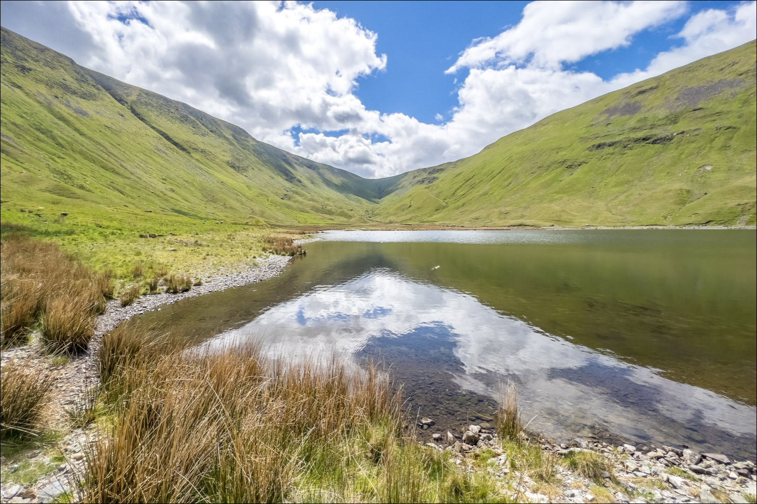
The head of the lake

It's not possible to walk across the head of Hayeswater, so we carry on up the valley for a short distance

Marshy terrain at the head of Haweswater. We aim for the other side of the lake at this point

We ford Hayeswater Gill here. Note the moraines left behind by a moving glacier

After a mostly pathless crossing over boggy terrain, we reach the other side of the lake

Looking back to the head of Hayeswater, with the long ridge of High Street on the left

We follow a faint path above the shore

Looking back

After passing by the foot of Hayeswater, we cross Hayeswater Gill and briefly retrace our steps along the original ascent path

We leave the path here to join a fainter and rougher one leading down to the Filter House below

The Filter House, once used for water purification

Waterfall in Hayeswater Gill

We cross the footbridge over Hayeswater Gill and pass by the Filter House

Beyond the Filter House we cross Calfgate Gill

We continue downhill, with Hayeswater Gill on our left

Looking across to Pasture Bottom and Threshthwaite Mouth, with our earlier path and the old barn below

We rejoin the original path and retrace our steps to Hartsop

Wood Side and Hartsop above How

We arrive back in Hartsop and stroll back through the lovely village to the end of the walk...


