
Route: Hayburn Wyke
Area: North Yorkshire
Date of walk: 6th February 2019
Walkers: Andrew and Gilly
Distance: 4.5 miles
Weather: Some weak sunshine but mostly dull and grey
We were staying in the village of Hackness, and drove over to nearby Cloughton. We parked just outside the village in one of the few roadside spaces along Newlands Lane. We walked along the lane with enticing views of the North Sea ahead as we did so and, after about ½ mile at the end of the lane, we joined the Cleveland Way which runs along the top of the cliffs
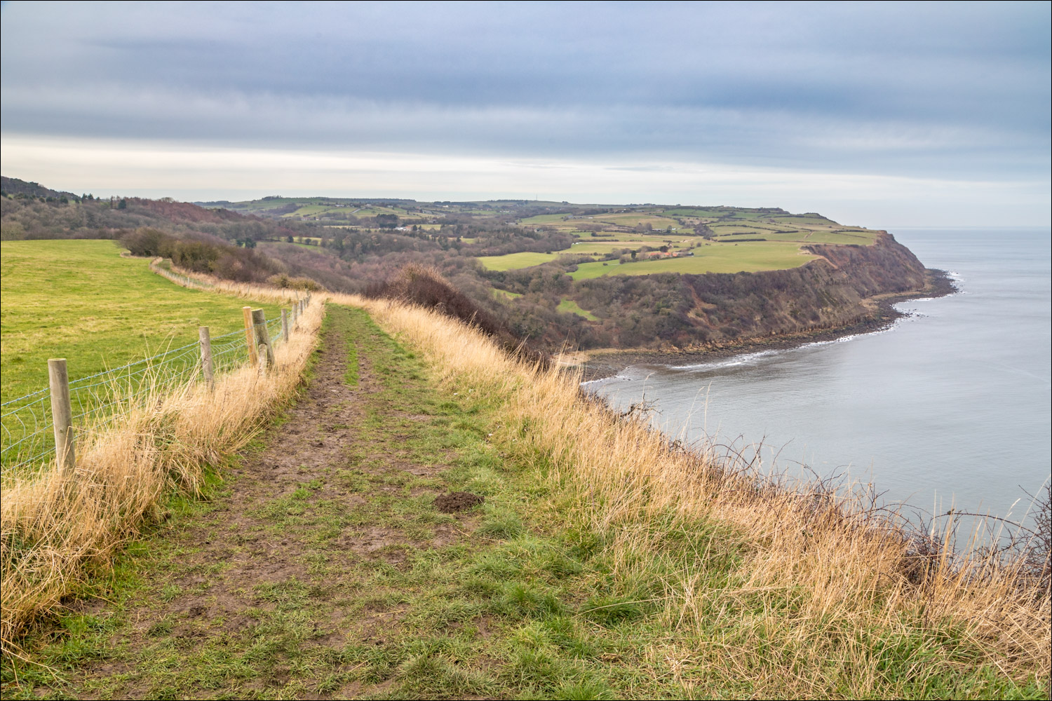
There were innumerable ups and downs as we followed the cliff top path as far as Hayburn Wyke. ‘Wyke’ is a local word used to describe the many small, sheltered bays below the crumbling cliffs
We descended to the stony beach where there is a waterfall marking the end of Hayburn Beck. This drops into a pool at the head of the beach, and it was on good form today. From here we retraced our steps for a short distance before climbing up to join the access road which runs past the Hayburn Wyke Inn
Just beyond the hotel we turned off to start the return leg along the ‘Cinder Track’, which is the course of the disused Yorkshire Coast Railway. This provided a very easy and quick way back to the start
Despite the rather indifferent weather it was a great little walk and one that I can highly recommend
For other walks here, visit my Find Walks page and enter the name in the ‘Search site’ box
Click on the icon below for the route map (subscribers to OS Maps can view detailed maps of the route, visualise it in aerial 3D, and download the GPX file. Non-subscribers will see a base map)

Scroll down – or click on any photo to enlarge it and you can then view as a slideshow

The start of the walk as we follow Newlands Lane towards the North Sea...


We descend gently downhill and will turn left where the lane ends

The cliff top section takes us along the Cleveland Way in the direction of Ravenscar

We set off along the undulating path...


Looking back...

Scarborough Castle in the distance

Approaching Hayburn Wyke

Zooming in on the eroding cliffs

Walking above Little Cliff...


We descend through woodland to Hayburn Wyke...


The waterfalls of Hayburn Beck below left

We continue down through the woods

We turn right here to visit the beach, and will retrace our steps, to follow the sign to Hayburn Wyke Inn

Hayburn Beck falls in good form today...


We climb back up through the woods and walk past the Hayburn Wyke Inn

The start of the easy return along the CinderTrack, the route of the old railway line

Woodland on our left...


Further along the inviting path


We leave the Cinder Track here to climb the steps by the bridge over Newlands Lane and retrace our steps back to the start
Follow the link for more walks in North Yorkshire (152)
