
Route: Harter Fell (Eskdale)
Area: Southern Lake District
Date of walk: 28th March 2019
Walkers: Andrew and Gilly
Distance: 5.4 miles
Ascent: 1,800 feet
As the crow flies, it’s only 14 miles from our home in the north west Lake District to the start point of the walk, but it took us nearly one and a half hours to get there – numerous intervening fells make this a very circuitous journey
We parked in the small car park at Jubilee Bridge, at the foot of the Hardknott Pass. After crossing a small footbridge over Hardknott Gill we started the ascent, which is initially up an easy slanting path. The going became a little steeper as we rounded a corner near Spothow Gill. There are several faint paths and navigation requires a little more concentration in this area
The weather had been cloudy at the start of the walk but as we approached the summit of Harter Fell, a few gaps opened up in the clouds, shining a welcome spotlight on the surrounding fells. From the summit there were wonderful views, including the Scafell group with some lingering cloud still over their tops
The official summit of the fell is the OS column, but it it surrounded by three nearby crags which are clearly a little higher, and require hands on rock. I’d climbed the highest of the three when last up here, but contented myself with bagging the trig column on this occasion
We then set off on the descent, which is in the direction of the top of the Hardknott Pass. The paths are faint and unclear in this area, sometimes disappearing altogether, only to reappear further down. It’s not a difficult descent in terms of steepness, but it’s important to stay on the correct bearing, which is appoximately north east. We eventually joined the Hardknott Pass near its highest point and, after following the road down for a few yards, joined a signed footpath which leads to the Roman fort of Hardknott Castle
There are some well preserved ruins of this ancient fort, founded in the 2nd century under Hardrian’s rule. We walked around here for a while, wondering what life must have been like for the defenders of the fort, based in such a remote and inhospitable location. Beyond the fort, it’s a short stroll back down to Jubilee Bridge and the end of a superb fell walk
For other walks here, visit my Find Walks page and enter the name in the ‘Search site’ box
Click on the icon below for the route map (subscribers to OS Maps can view detailed maps of the route, visualise it in aerial 3D, and download the GPX file. Non-subscribers will see a base map)

Scroll down – or click on any photo to enlarge it and you can then view as a slideshow

The start of today's walk as we cross this small footbridge over Hardknott Gill

We follow an easy slanting path along the slopes of Birker Fell

Looking back to Yew Crags below Hard Knott

Further along the path, with Kepple Crag ahead

The head of Eskdale, with the higher fells shrouded in cloud at this point

The formidable line up of the Herdwick United six-a-side team - two at the back, three in midfield and one up front

Looking back into Eskdale...

...and looking up to Harter Fell

We avoid the crags by heading to the right of them

Eskdale...


Views of Green Crag...


Looking back along Eskdale

Squelchy ground below at the foot of Ulpha Fell

Onwards and upwards to Harter Fell

Devoke Water makes an appearance beyond Green Crag

Eskdale, as we approach the summit of Harter Fell

'Official' summit of Harter Fell, with its true summit in the background

A view towards the Scafells, with their heads in the clouds

Start of the descent as we follow the ridge line down, with Dunnerdale on our right...


Dramatic light on Hard Knott, the direction in which we're heading

Dunnerdale

Esk Pike on the right and Scafell Pike in the clouds to the left

Further down the ridge

Wild mountain scenery at the head of Eskdale


We head towards Hard Knott

Hardknott Pass is unseen from here

Approaching the Pass

We follow the road for a short distance before branching off to the right, with the remains of the Roman fort of Hardknott Castle ahead...


We head towards the fort

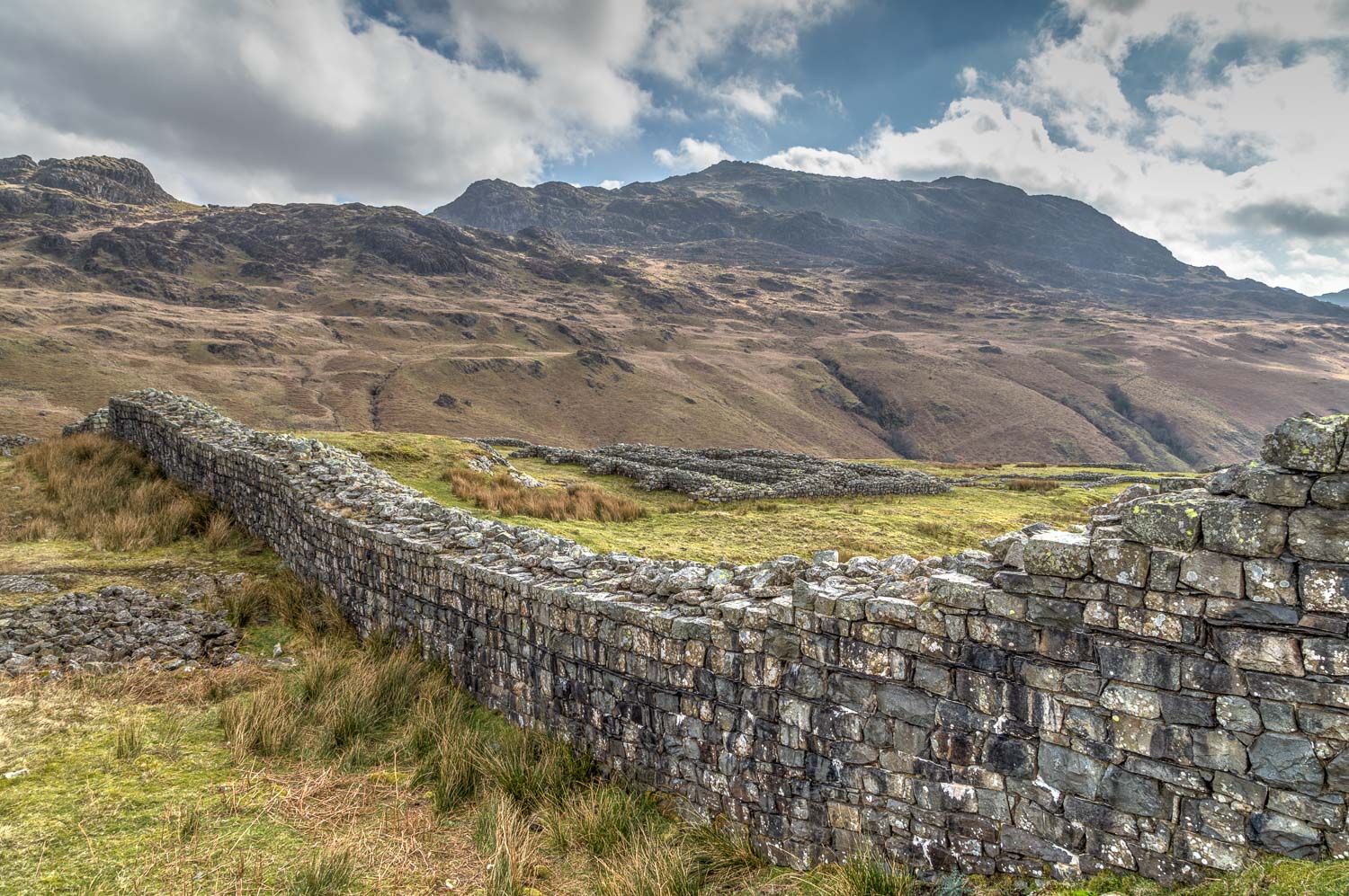
We reach the outer walls of the fort...


The Granaries in the foreground

Looking back up the Hardknott Pass

A view along Upper Eskdale

Scafell now visible but Scafell Pike still in the clouds

Harter Fell, where we'd been earlier in the day

We walk down through the fort

Our earlier descent route had been beyond the crags above - Horsehow Crags and Demming Crag

Looking back up to Hard Knott...


Eskdale

The Scafells again

Eskdale, as we leave the fort and descend back to the start

Eskdale, and our original ascent path to the left...

The end of a wonderful walk

On the way home, a short detour to admire the classic view along Wastwater to the south face of Great Gable...

...and an hour later another classic view to the opposite face of Great Gable from the northern lakes

Spring flowers in the garden this week
