
Route: Great Calva
Area: Northern Lake District
Date of walk: 26th May 2018
Walkers: Andrew and Gilly
Distance: 7.7 miles
Ascent: 2,000 feet
Weather: Mostly sunny, but very hazy and very strong winds
On a Bank Holiday weekend (as was the case today), the quiet and remote Back o’ Skiddaw fells are a good choice when many of the better known fells are likely to be a little too busy. We last walked this circuit over 5 years ago, so a return visit was well overdue
We parked in a small roadside parking area opposite Peter House Farm, not far from Bassenthwaite village, and joined a tarmac track which is part of the Cumbria Way. After a while this turned into a stonier path but it was very easy going all the way – apart from a very strong wind which seemed determined to blow us back whence we came. We arrived at a point above the top of the waterfalls of the Whitewater Dash and after crossing Dash Beck by a stony bridge we left the Cumbria Way to joint a faint path leading very steeply uphill beside a post and wire fence, with Dry Gill on our left. This was quite a struggle but fortunately was soon over and as the gradient eased we were able to stroll over to the summit of Little Calva, marked by a small cairn
The views from the top were nothing special and without ado we set off for Great Calva. A beeline approach would have meant an up and a down so we stuck to the contours by following the fence to a stile, and then turning right. The land between Little and Great Calva is potentially very boggy during wet weather. We had no such issues today following a long dry spell. The climb to the summit of Great Calva was a straightforward affair but we were unable to linger there. An almost gale force wind caused us to move on without delaying. Sadly the hazy conditions obscured the otherwise good views – one of which is along the Great Central Fault which runs through the district. As Wainwright puts it, the vista is ‘like looking along the sights of a gun, through the heart of the district to the low Windermere fells in the extreme south’. The vista was not on display today and the views were poor
We made an easy descent down the slopes of the fell, rejoining the Cumbria Way at Dead Beck. From here we soon arrived at Dry Gill to complete our circuit, and then retraced our steps back to the start. Despite the lack of long distance views, we’d enjoyed the walk – this is very remote terrain, there is a real sense of wilderness about it, and we felt we’d found the perfect Bank Holiday refuge
For other walks here, visit my Find Walks page and enter the name in the ‘Search site’ box
Click on the icon below for the route map (subscribers to OS Maps can view detailed maps of the route, visualise it in aerial 3D, and download the GPX file. Non-subscribers will see a base map)

Scroll down – or click on any photo to enlarge it and you can then view as a slideshow

View from the roadside parking space at the start of today's walk, looking towards Bassenthwaite Lake

Heading along the Cumbria Way towards Cockup - hopefully not a sign of things to come

We follow the easy track, a good way to gain some initial height

Looking back to a mountain wave cloud formation, caused when air is forced up over a hill and down the other side. As the air rises it cools, condenses, cloud forms and as it descends the other side it warms and cloud dissipates. Despite the strong winds, the cloud 'sits' over the highest point (thanks to a follower of this site for this information)

The Uldale Fells seen from the path

Looking across to Brocklecrag (the house) and Brockle Crag (the mound of rocks above it)

The main track leads to Dash Farm ahead, but we branch off right here to continue along the Cumbria Way

This old slate sign points us on our way

We head towards the end of the valley, with Dash Beck below on our left

Whitewater Dash waterfall ahead, and our path snaking above it

Looking back, with Binsey in the distance

Bonnie

Looking back along Dash Beck and its valley

Approaching Black Nettle Hause

Having reached the hause and crossed Dry Gill we start a very stiff climb up to Little Calva - much steeper than appears from the photo

Looking back towards Dead Crags and Bakestall as Gilly wages a battle against gravity

A view back along our path

Another view back as Skiddaw appears beyond Bakestall

At last the gradient eases and we follow a grassy groove

Skiddaw again as we make the final push for Little Calva

The insignificant cairn on Little Calva, looking towards Great Calva - our next objective

Skiddaw and its Little Man from Little Calva

We follow the line of the fence, initially in the direction of Knott...

...and after a right turn at a stile we're now heading for Great Calva

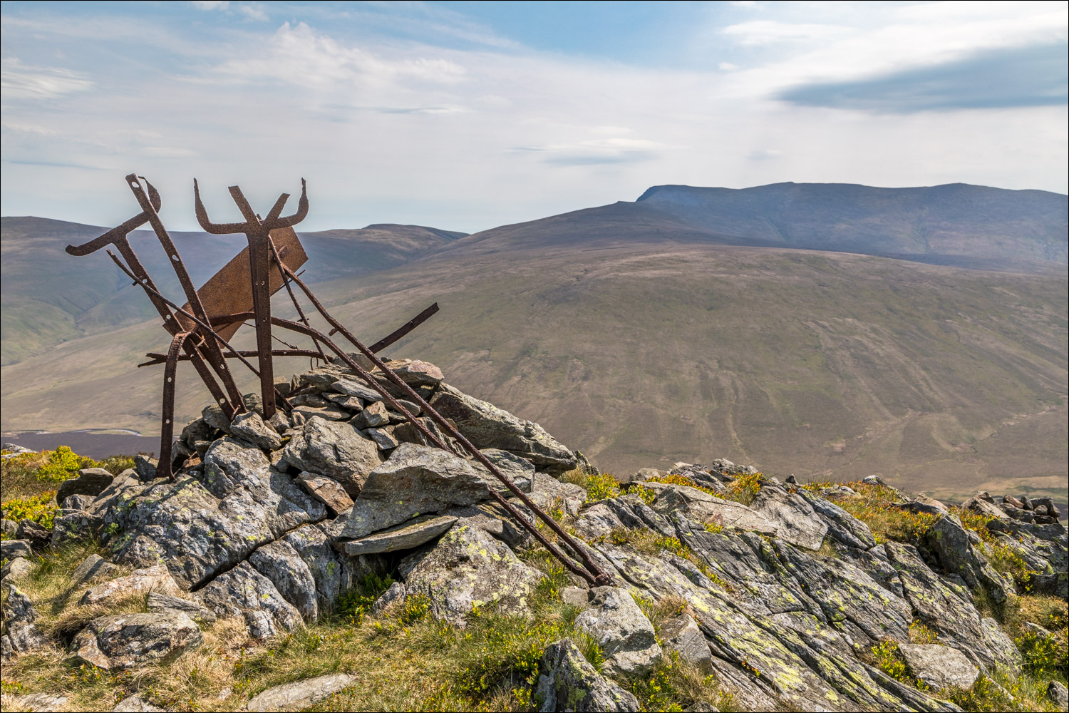
Summit of Great Calva

Lonscale Fell and a hazy view of Thirlmere along the Great Central Fault

Skiddaw and Skiddaw Little Man again

Blencathra from the southern cairn on the summit, where it was blowing a gale and it was a challenge standing up straight, let alone holding the camera steady

Without ado we started our descent

Heading down to the misnomer that is Skiddaw Forest - just a few lone trees encircling Skiddaw House left of picture

It's an easy descent, as we head down to the Cumbria Way

We join the Cumbria Way at this small bridge over Dead Beck

We've been walking in some very remote territory, but navigation is straightforward from this point

Approaching the hause, where we'll rejoin our original path

Retracing our steps now beneath Dead Crags on Bakestall...


The mountain wave cloud formation seen at the start is still hovering above, despite the strong winds

The end of a very enjoyable walk is in sight
