
Route: Grange Fell
Area: Central Lake District
Date of walk: 1st September 2018
Walkers: Andrew, Gilly, Phil and Denise
Distance: 3.5 miles
Ascent: 1,100 feet
Weather: Cloudy, a few bright patches, warm
We parked in the National Trust Bowderstone car park and from here followed a path which goes through beautiful woodland, gradually curving around the steep crags above
A rocky staircase then leads to Long Moss near the summit of the fell. Grange Fell has 3 separate tops, King’s How being the loveliest, though slightly lower than nearby Brund Fell. Today we visited King’s How. From the summit there is a superb view over Derwent Water looking one way and Borrowdale looking the other, although the long distance views were rather poor today on account of thick low lying cloud
A direct descent from here is out of the question thanks to the crags on the west side of the fell, so we followed a narrow path which snakes round the other side of the fell and which eventually ends at the Borrowdale road. We followed the road for a short distance – there’s a narrow footpath most of the way – then crossed over at the sign indicating the Bowderstone. We followed this path through the woods, past the massive Bowderstone and back to the car park
What Grange Fell lacks in height it more than makes up for in beauty – this is a wonderful short fell walk at any time of the year
For other walks here, visit my Find Walks page and enter the name in the ‘Search site’ box
Click on the icon below for the route map (subscribers to OS Maps can view detailed maps of the route, visualise it in aerial 3D, and download the GPX file. Non-subscribers will see a base map)

Scroll down – or click on any photo to enlarge it and you can then view as a slideshow

The night before the walk, a skyful of stars over Lorton Vale...


Next day, a buzzard on the fence before we set off to Borrowdale

The start of the walk as we pass through this gate at the far end of the National Trust Bowderstone car par

We walk through Cummacatta Wood, home to some lovely silver birches...


Looking back to Castle Crag, one of the 'Jaws of Borrowdale'. King's How, our target today, is the other

There were mushrooms galore as we walked through the woodland...


Looking across Borrowdale to the foot of Maiden Moor

Greatend Crag on King's How - our route will take us to the left of the crags and around the back of the fell

Castle Crag again

Gilly and Denise at the start of the climb, which becomes steeper higher up without being difficult in any way

One of several huge boulders which have tumbled down from the crags above


A glimpse of Derwent Water as we gain height

Bonnie takes a breather

We arrive at a level area known as Long Moss, adorned by more silver birches...


Above the tree line now as we aim for the summit of King's How on Grange Fell

A murky view of Derwent Water, with Skiddaw in the clouds beyond

Looking across to Maiden Moor, and Catbells far right

Brund Fell, also known as Jopplety How, from the summit of King's How

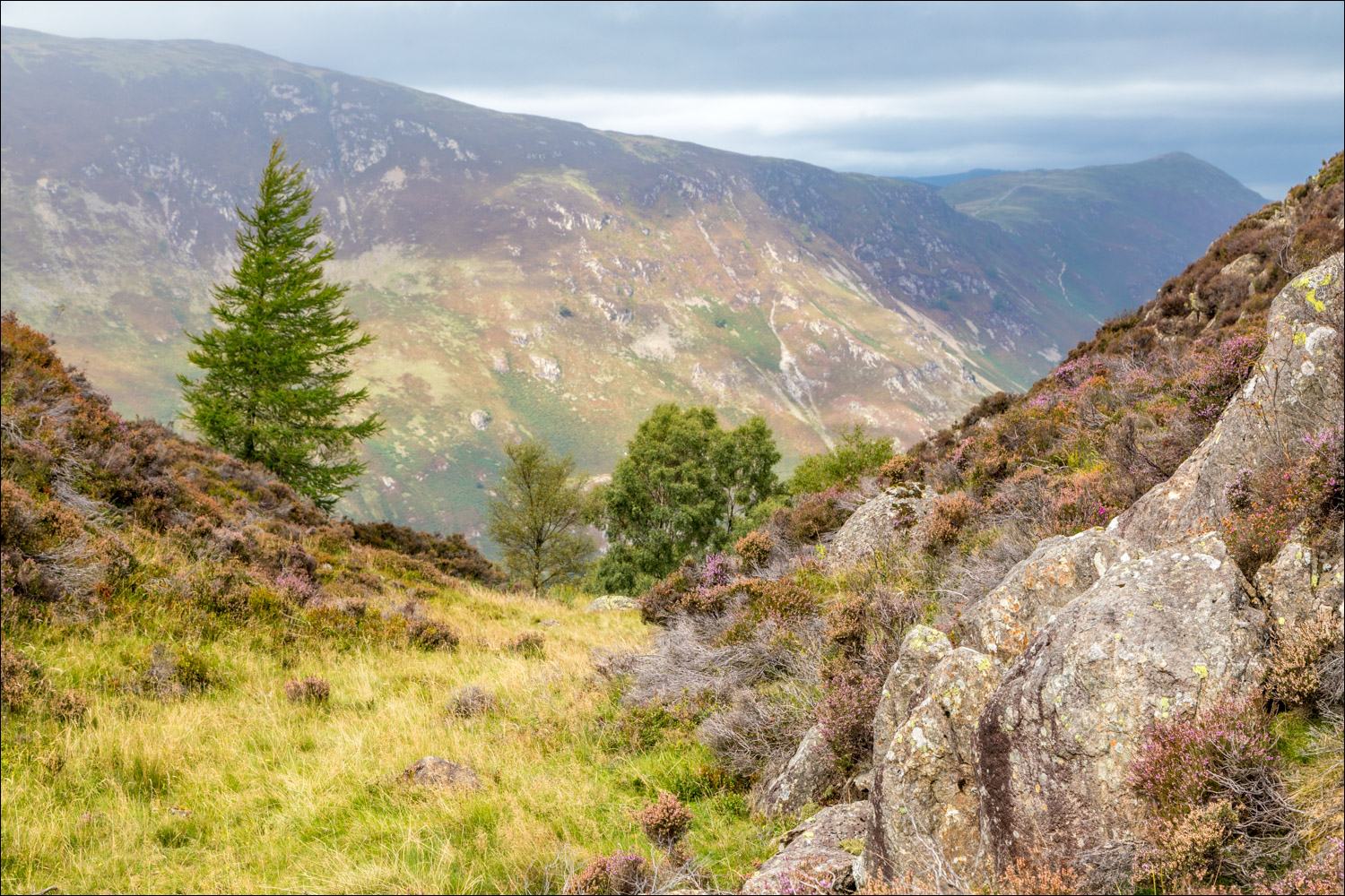
Start of the descent into Borrowdale

Brund Fell again...


We pass by this lone birch on the way down

Borrowdale...


...and views across Borrowdale...


Denise leads the way

The River Derwent below

We follow the rocky path back down to valley level

We arrive at the Borrowdale road and turn right here

We follow a narrow path beside the road for a short distance

A quick detour to the shore of the River Derwent

The famous Bowderstone, where rock climbers practice their skills


We follow this path back to the car park, and the end of a short but very sweet walk
