
Route: Grange Fell and Watendlath
Area: Central Lake District
Date of walk: 8th October 2020
Walkers: Andrew and Gilly
Distance: 4.5 miles
Ascent: 1,400 feet
Weather: Sunny, some clouds later on
Grange Fell is wonderful place, full of lumps and bumps and boasting views of many of the lakeland fells. It consists of three separate tops – King’s How, Ether Knott and Brund Fell. The latter is the highest of the three and the one we were aiming for today
We drove over to Borrowdale and parked in the National Trust car park in the village of Rosthwaite. After leaving the village we crossed the Borrowdale road and followed the track to Hazel Bank Hotel, set in a wonderful position overlooking the valley. We followed the path around the left side of the hotel and started the steady climb up the rocky path leading to Puddingstone Bank. There are superb retrospective views over Borrowdale along the way
From Puddingstone Bank we descended to the hamlet of Watendlath, owned and preserved by the National Trust. Watendlath Tarn adjoins the hamlet, which is located in a classic ‘hanging valley’ – it’s an idyllic spot
After refreshments at the small National Trust cafe (open during the main season), we retraced our steps for a few yards and picked up a faint path leading to a rocky area known as Black Waugh. The path is easily missed, and the key to the ascent is to keep the dry stone wall on your right. The path draws closer to the wall as height is gained. Grange Fell is a soggy place at the best of times, and anyone coming this way is advised to wear waterproof boots
We arrived at the rocky prominence of Brund Fell, the highest point on Grange Fell, and climbed to the summit to enjoy the extensive views. We then descended along another juicy path back to Puddingstone Bank. From here we retraced our steps back to the start, enjoying the wonderful views of Borrowdale for a second time
For other walks here, visit my Find Walks page and enter the name in the ‘Search site’ box
Click on the icon below for the route map (subscribers to OS Maps can view detailed maps of the route, visualise it in aerial 3D, and download the GPX file. Non-subscribers will see a base map)

Scroll down – or click on any photo to enlarge it and you can then view as a slideshow

From Rosthwaite we join the track leading to Hazel Bank Hotel

The path skirts around the hotel grounds

Views back over Borrowdale


We follow the path up to Puddingstone Bank...


Autumn colours as we keep pausing to look back over Borrowdale...


Last of the views as we reach Puddingstone Bank and head towards Watendlath


The tiny hamlet of Watendlath

Watendlath Tarn...


Watendlath Beck, which flows over Lodore Falls and into Derwent Water

We visit the National Trust cafe, where a chaffinch shares some flapjack with us

We cross the footbridge over Watendlath Beck again and retrace our steps uphill for a short distance


Looking back to Watendlath at the start of the climb up to Grange Fell - the faint path is easily missed at the start

Another look back - the dry stone wall is the key to navigation

The rocky prominence of Brund Fell, the highest of the three tops on Grange Fell

We follow the path up Brund Fell

Lenticular cloud over Bleaberry Fell from the summit of Brund Fell

The complicated expanse of Grange Fell, now looking towards Derwent Water and the Skiddaw massif

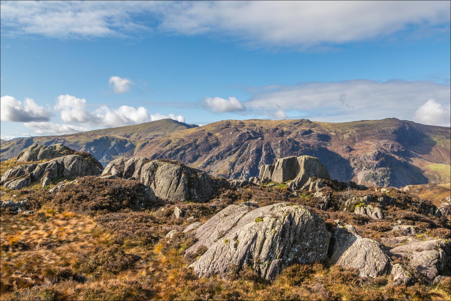
High Spy and Dale Head from Brund Fell

We descend from Brund Fell

We cross the ladder stile and follow a path over very soggy terrain

Lenticular cloud over Borrowdale

We descend to the path we'd followed to Watendlath, and from there we retrace our steps

Views of Borrowdale as we follow the path back down to the valley

Rosthwaite below...


Autumn colours...


We arrive back on the valley floor and pass by this old barn

We cross the bridge over Stonethwaite Beck and arrive back in Rosthwaite at the end of a superb walk

Back home, a red squirrel in the garden

