
Route: Glenridding Beck and Greenside
Area: Eastern Lake District
Date of walk: 4th January 2017
Walkers: Andrew and Gilly
Distance: 4.5 miles
Weather: Sunny
Just over a year ago, and after a month of heavy rainfall, Glenridding Beck burst its banks during the infamous Storm Desmond and the village was several feet underwater and cut off for 3 days
Since that time, huge efforts have been made to restore the terrible damage, including the installation of new flood defences, and the area is well and truly open for business. There are numerous walks starting from Glenridding, most of which we’ve tried before, but today’s route was a new one for us which we gleaned from ‘Easy Rambles around Patterdale and Ullswater’ by Vivienne Crow, a Christmas present to Mrs Andrewswalks purchased from excellent local outdoor shop Catstycam.com
We left the village and picked up a path beside the beck which we followed up the valley to a point just beyond the old Greenside mine buildings, and from there we started the mid level return journey along the flanks of Birkhouse Moor. The views got better and better the further we progressed, and towards the end there was a wonderful vista of Ullswater
We then descended back into the village to complete a superb little circuit, and one which we’d happily repeat tomorrow
For other walks here, visit my Find Walks page and enter the name in the ‘Search site’ box
Click on the icon below for the route map (subscribers to OS Maps can view detailed maps of the route, visualise it in aerial 3D, and download the GPX file. Non-subscribers will see a base map)

Scroll down – or click on any photo to enlarge it and you can then view as a slideshow

Red squirrel in the garden the day before the walk…


Better weather next day, and the view from our parking space at the start of the walk, looking towards Birkhouse Moor

Walking out of Glenridding

Glenridding Beck, the cause of so much damage in December 2015

We climb up the valley beside the beck

We fork off to the right here to cross the beck


Looking back along Glenridding Beck from the footbridge

We follow a grassy path to the Greenside road

Looking back to Place Fell

Greenside Road

Approaching Greenside, once the largest lead mine in the country

We pass by the old mine buildings, now occupied by outdoor centres

We carry on up the valley beyond Greenside for a short distance…

…before crossing the beck at the halfway point of the walk to head back down the valley - Catstye Cam is in the background

We follow an old leat, which was once used to transport water for the mining industry at Greenside

Looking down to Greenside, which we’d walked through a few minutes ago


Glenridding, Ullswater and Place Fell come into view

Mind the gap

Bonnie contemplates the way ahead

We descend from the leat to join a lower level path which follow a dry stone wall

Glenridding

Pine clad Keldas ahead

Just before Keldas we start to descend towards Glenridding

Crossing Mires Beck

We follow a narrow path beside the wall

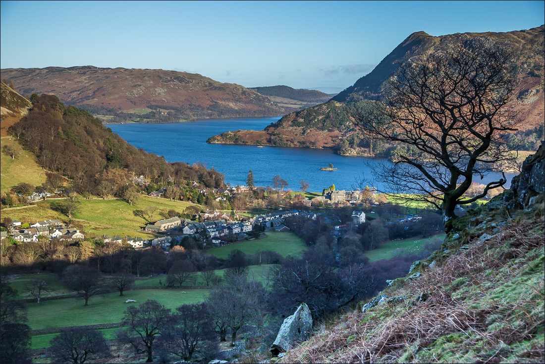
...and suddenly a glorious vista appears over Glenridding and Ullswater

We descend into Glenridding below

Back in Glenridding with the new reinforced wall beside Glenridding Beck…


Back to the start, and an information sign showing Catstycam outdoor shop during the floods, and behind it the real thing - open for business
