
Route: Fulletby, Tetford and Belchford
Area: Lincolnshire Wolds
Date of walk: 1st December 2020
Walkers: Andrew and Gilly
Distance: 7.9 miles
Ascent: 600 feet
Weather: Sunny and cold
Fulletby is the second highest village in the Lincolnshire Wolds, sitting at 450 feet above sea level. On a clear day Lincoln Cathedral and both the Lincolnshire and Norfolk coasts can be seen from here. On a cold and crisp November morning we parked just outside Fulletby, near a small grassy triangle where there is roadside parking for several cars. This walk could be started just as conveniently from the neighbouring village of Belchford, which is visited along the way
After crossing the road, known as Furlong Lane, we climbed a stile and were greeted by a wonderful vista over open countryside, with a grassy path beckoning us east. We crossed another stile and walked beside Salmonby Carr into the small settlement of Salmonby, passing by an attractive pond along the way
A short road section followed, taking us out of Salmonby, and we then headed across the fields to the small village of Tetford (which has a pub). After passing by the small church we joined a bridleway known as Platts Lane, which is part of a Roman salt road, one of a number linking the east coast salt producing area with Lincoln. Salt was important to the Romans as a means of preserving meat, fish and beans. At the end of Platts Lane we arrived at a road known Lowfield Lane where we turned left to walk into Belchford (originally a Danish name ‘Belt’s Ford’). In 1536 the local parson Nicholas Leach joined the Lincolnshire Rising against Henry VIII, when 3,000 men marched on Lincoln. The rising was unsuccessful and Nicholas ended up being hung, drawn and quartered in London (information gleaned from the information board in the village)
When we reached the Blue Bell Inn we turned left to join the Viking Way, a 147 mile long distance path. This signalled the final leg of the route, a lovely walk back into Fulletby
As with our other walks in the Lincolnshire Wolds the paths were well waymarked and navigation was a simple affair. Some of the paths were muddy at times. Thanks to the gently rolling nature of the landscape we made quick progress, averaging about 2.5 mph for the walk, including stops
Click on the icon below for the route map (subscribers to OS Maps can view detailed maps of the route, visualise it in aerial 3D, and download the GPX file. Non-subscribers will see a base map)

Scroll down – or click on any photo to enlarge it and you can then view as a slideshow

Welcome to Fulletby

We parked on a grassy area near this information board – the start of the walk is just a few yards away…

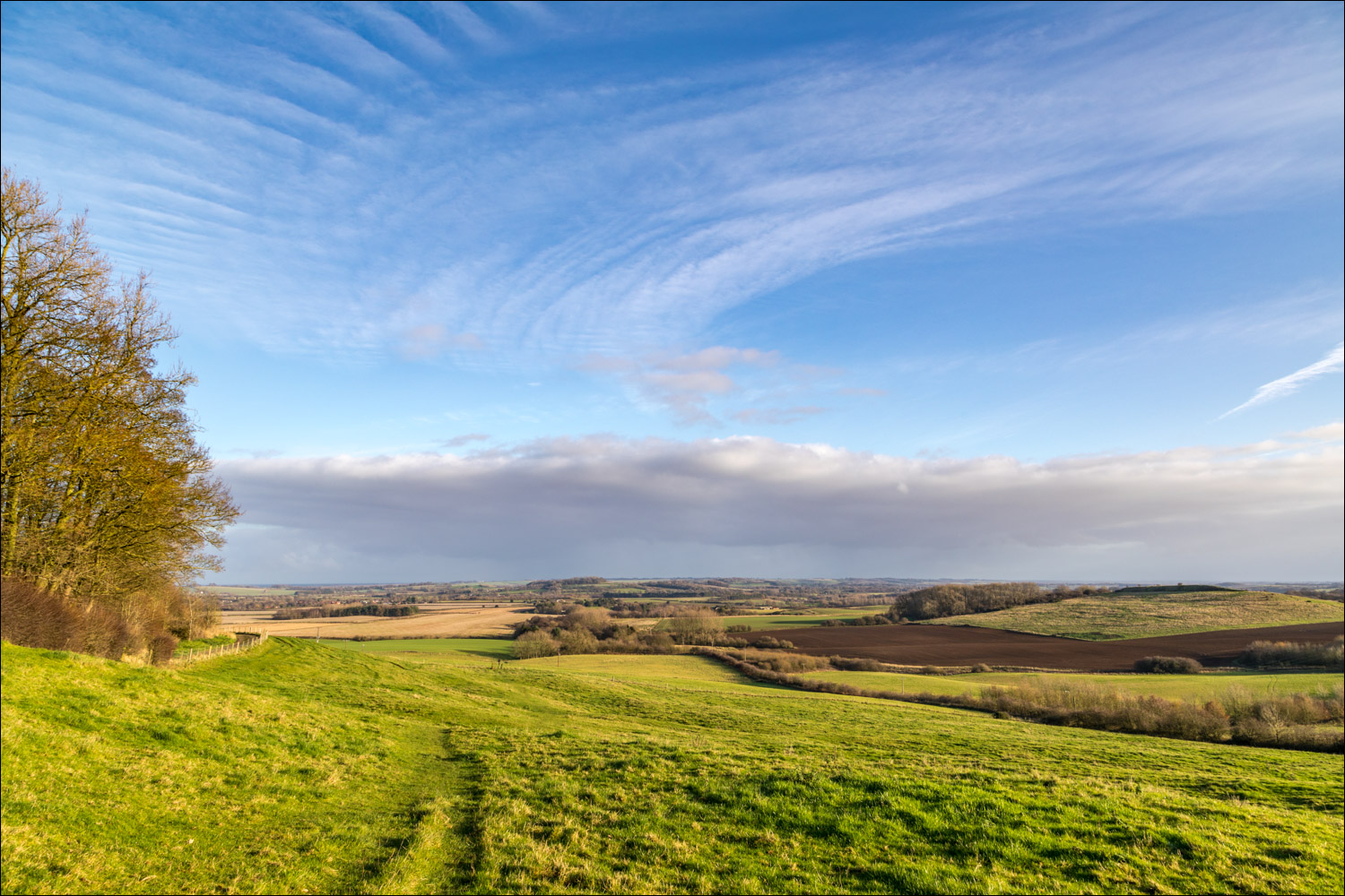
…and what a start – miles of open countryside stretch out before us

We head east across the fields in the direction of Salmonby

Salmonby Carr is on our right...


Looking back to Gorse Farm…


Approaching Salmonby

We pass by this attractive pond at the edge of the settlement

We leave Salmonby via a quiet lane

Our path will take us along the foot of the wolds beyond the fields

We follow a permissive path into Tetford

A small pond on the outskirts of Tetford where kingfishers may be seen (though not by us today)

We walk through Tetford, though our route misses much of the village

Beyond Tetford we join an old Roman salt road known as Platts Lane, which runs straight as an arrow…


Looking back to Glebe Farm, which has been abandoned…


Heading towards Belchford

A short road section along Lowfield Lane

We arrive in Belchford

We follow the road round to the right

St Peter and St Paul’s Church, Belchford

The Blue Bell Inn, where we leave the village and join the Viking Way

Looking across to Belchford

We continue along the Viking Way on the final leg back to Fulletby...


Fields at the edge of Fulletby

St Andrew's Church Fulletby

Back to the start and that view again, one of the best in the Lincolnshire Wolds
Follow the link for more walks in Lincolnshire (26)
