
Route: Dale Head, High Spy and Maiden Moor
Area: North Western Lake District
Date of walk: 17th May 2018
Walkers: Andrew
Distance: 8.8 miles
Ascent: 2,900 feet
Weather: Mostly sunny with a few cloudy intervals
I parked in the small car park by Chapel Bridge on the edge of Little Town – which is certainly little but is far from being a town, and consists of a few farm buildings. About 4 years ago I’d taken an unusual route up to Dale Head, as recommended by Wainwright, and I recall it as being a superb way to the top. Instead of ascending to Dalehead Tarn, which is the usual route, I turned off the main path beyond the end of the valley and diverted to the right in order to climb up via the old copper mine – ‘a mountaineering must’ according to the great man. The path is very sketchy and it’s clearly not used often – I don’t know why this is as it’s straightforward with no fears, though maybe just a small frisson as the path passes above Dalehead Crags which plummet into the valley below
Having reached the summit of Dale Head and savoured the wonderful views, I descended down the (initially) easy grassy flanks of the fell looking for a footpath which is clearly marked on the OS maps. The path only exists on paper. There was no sign of one at all, and I knew that I was on the correct course as I was heading down to Dalehead Tarn, clearly visible throughout the descent. Lower down the gradient became steeper and it was not a particularly pleasant way down. I was glad to arrive at the tarn. If I follow this route again, I’ll try the alternative path leading down to the tarn, shown on the OS map with a thin dotted black line. This at least did seem to exist on the ground
I then followed the ridge to the next fell on today’s round, High Spy. This involved about 500 feet of easy climbing, with some great views across to Hindscarth Crags to my left, and views of Borrowdale and Derwent Water to my right. It was now time to march on to the final fell, Maiden Moor. This was an easy tramp with more superb views along the way. My arrival at the summit of Maiden Moor signified that I’d clocked up 999 Wainwright ascents over the years. A decision is looming…..
I descended to Hause Gate, a depression between Maiden Moor and Catbells, and on reaching it I turned west to follow a path gently downhill and back into Newlands Valley. It had been a fantastic walk and apart from the minor hiccup on the descent to Dalehead Tarn, every step of the way was a pleasure
For other walks here, visit my Find Walks page and enter the name in the ‘Search site’ box
Click on the icon below for the route map (subscribers to OS Maps can view detailed maps of the route, visualise it in aerial 3D, and download the GPX file. Non-subscribers will see a base map)

Scroll down – or click on any photo to enlarge it and you can then view as a slideshow

On the day of the walk, I drove past Rannerdale to check on the bluebells

They are very unusual, growing on open fellside as opposed to their normal woodland habitat

Sadly the numbers have declined by 25% in the last 4 years thanks to thoughtless visitors leaving the paths and trampling on them

There were a few more signs and barriers around today - let's hope that these have the desired effect

A wonderful sight - and scent


A short while later, the start of the walk as I head up the valley, with Hindscarth and Robinson on the right

My first objective - Dale Head

I pass by a building shown as a climbing hut on the OS maps

Signs of the mining activity which once took place here - and beyond in the centre of the picture lies my path up to Dale Head

Looking back along the valley during the early part of the climb

Looking across to High Spy, where I'll be later

I pass by a ruined building, part of the old Dale Head Mine

Another view across to High Spy as the path takes me above Dalehead Crags

Great Gable (not 'the' Great Gable)

Bonnie contemplates the way ahead

Looking back along the valley as I start the final push for the summit of Dale Head

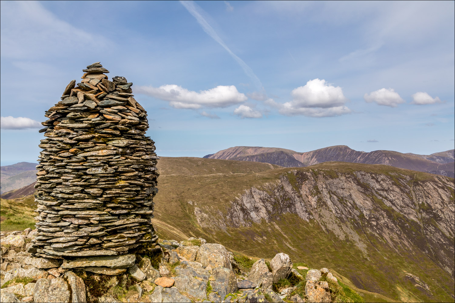
The well made cairn on Dale Head

Looking along Newlands Valley, which I'd walked along to get here, with Skiddaw and Blencathra in the background

Start of the pathless descent to Dalehead Tarn

I finally make it down to the tarn

The path to High Spy

Looking across to Dalehead Crags

I pass by another small tarn

Dale Head

...and again

Zooming in on the path I'd followed earlier, starting bottom right of the photo and then zigzagging after crossing Far Tongue Gill

Summit cairn on High Spy

Dale Head from High Spy

Views across the valley as I continue along the ridge

Heading for Maiden Moor

Derwent Water and Borrowdale come into view on my right

The rather featureless terrain over Maiden Moor

Hindscarth, and Robinson beyond it

Newlands Valley

A view back along the path

Hindscarth again

The big toe of Scope End in the foreground, Newlands Valley, and a host of North Western fells

Catbells, Keswick and Skiddaw

Catbells and Derwent Water - I'll be turning off the ridge at Hause Gate, bottom right of picture

Derwent Water

Start of the descent from Hause Gate back down into Newlands Valley

A stony section marked by a series of cairns, but it's all very easy going

The distinctive knobbly outline of Causey Pike

I join a wide path leading back to Little Town

Causey Pike again

Sweet Newlands Valley

The circuit is complete - the car park is just around the corner

Earlier in the week, spring flowers in the garden
