
Route: Crummock Water and Lanthwaite Green
Area: Western Lake District
Date of walk: 12th February 2015
Walkers: Andrew
Distance: 3.6 miles
Weather: Overcast with light drizzle
There was only time for a short local walk today, so I returned to one of my favourite places. Although I’ve trodden all these paths at different times as parts of other walks, the route I took was a new one for me. I made it up as I went along, and it was a success – one to be repeated in the future
I parked in the National Trust car park at Scale Bridge, from where two paths lead to the foot of Crummock Water – a wide track through Lanthwaite Wood, and a narrower one along the bank of the River Cocker. The latter path is sometimes flooded when the river is high but today it wasn’t, so I followed it to the outflow of the lake into the river
Having admired the wonderful view along Crummock Water, I walked along the path by the eastern shore, leaving the lakeside after about 15 minutes to walk up to the roadside
This marked the halfway point and I walked back over Lanthwaite Green, turning left just after Lanthwaite Gate to head into – what else could it be called? – Lanthwaite Wood
I then walked back through the wood back to the start. Despite the indifferent weather it was a lovely walk
For other walks here, visit my Find Walks page and enter the name in the ‘Search site’ box
Click on the icon below for the route map (subscribers to OS Maps can view detailed maps of the route, visualise it in aerial 3D, and download the GPX file. Non-subscribers will see a base map)

Scroll down – or click on any photo to enlarge it and you can then view as a slideshow

Red squirrel activity in the garden before I set off this morning……


On with the walk - at the car park, this is Mellbreak behind the River Cocker

The riverside path, held together by tree roots

Mellbreak again

That red squirrel is following me everywhere!

The River Cocker again

Snowdrops on the riverbank

The foot of Crummock Water, with Rannerdale Knotts beyond

Another view along Crummock Water

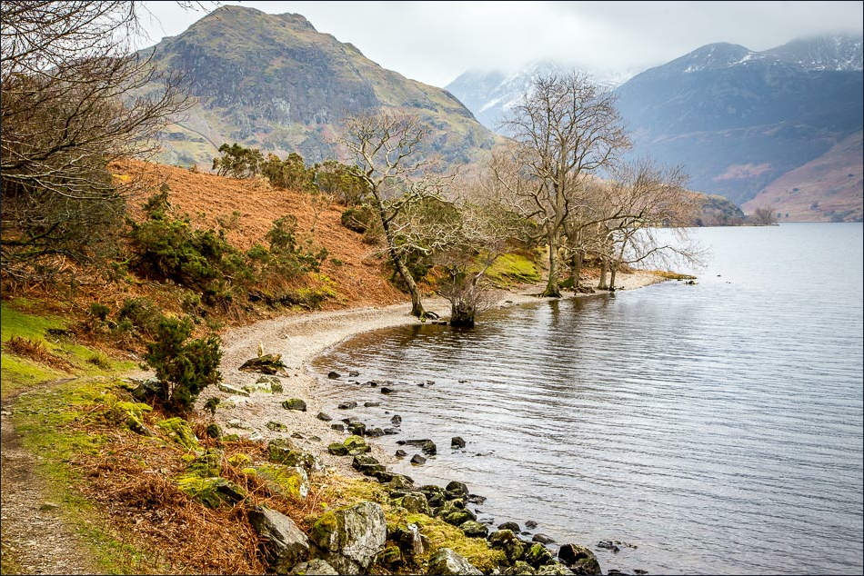
I follow the lakeside path

The boathouse. and Mellbreak in the background

The tops of the High Stile Range are in the clouds

Further along the lakeshore path……


The halfway point, and heading away from the lake in the direction of Grasmoor

Looking over to Rannderdale Knotts as I cross the road

Whin Ben on the right, leading up to Whiteside

The path beyond Lanthwaite Gate leading into Lanthwaite Wood

Mellbreak comes into view again

Entering Lanthwaite Wood

Walking through Lanthwaite Wood

I take the left fork here - the car park is just ahead

Back at home, a robin in the garden

Siskin in the rain, just siskin in the rain, what a glorious feeling……

Tree sparrow

And finally the red squirrel is back for tea
