
Route: Crummock Water
Area: Western Lake District
Date of walk: 23rd April 2015
Walkers: Andrew
Distance: 9.3 miles
Weather: Sun and blue skies – again
I parked in the National Trust car park at Scale Hill and followed the familiar track down to the foot of Crummock Water – the view from the shingly beach was as wonderful as ever
I decided to go round the lake anti-clockwise, for no other reason than it seems the natural way to go, as is the case with Buttermere (for me anyway)
The path hugs the shore of the lake for much of the way, heading inland slightly at a juicy section near Scale Knott. I then followed a recently improved path to the head of the lake and crossed Scale Bridge to walk into Buttermere village. At this point I had to decide whether to walk along the road (about 2 miles) or avoid this by climbing up to Low Bank and walking down Rannerdale – a longer and more strenuous alternative. In the end I opted for the road and this wasn’t an issue, there wasn’t much traffic and the surroundings were beautiful
At Cinderdale Common a path leads off the road down to the shore of the lake and I followed this back into Lanthwaite Wood. Instead of retracing my steps along the main track I followed the bank of the River Cocker back to the start of what had been a wonderful walk
For other walks here, visit my Find Walks page and enter the name in the ‘Search site’ box
Click on the icon below for the route map (subscribers to OS Maps can view detailed maps of the route, visualise it in aerial 3D, and download the GPX file. Non-subscribers will see a base map)

Scroll down – or click on any photo to enlarge it and you can then view as a slideshow

The River Cocker and Mellbreak at the start of the walk

The track leading to the foot of Crummock Water

Bonnie waits impatiently for me to catch up, she knows what lies ahead……


L to R - Rannerdale Knotts, the High Stile Range and Mellbreak

Grasmoor, from the point where Crummock Water flows into the River Cocker

Looking across to the boathouse - in 3 hours time I’ll be passing by it along the far shore

The footbridge over Park Beck

Park Beck

Grasmoor

Rannerdale Knotts left of picture and Great Gable in the distance

Mellbreak

Rannerdale Knotts

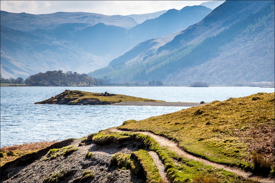
High Ling Crag……

…and Low Ling Crag

Low Ling Crag and Rannerdale Knotts

Whiteless Pike

Rannerdale Knotts again

The head of Crummock Water - and Fleetwith Pike

Fleetwith Pike

I cross Scale Bridge to head towards Buttermere village

Bonnie beside Buttermere Dubs

Heading into Buttermere

Herdy

Buttermere again

Walking out of the village

The road section of the walk


Woodhouse Islands


The end of the road section as I head back down to the shore of Crummock Water

Gorse - it seems to have been flowering for months

Stand well back - here comes The Shake

Further along the lakeshore path

The boathouse, looking across to where I’d been 3 hours ago

There just remains a lovely stroll back to the start along the bank of the River Cocker
