
Route: Circuit of Crummock Water
Area: Western Lake District
Date of walk: 26th October 2016
Walkers: Andrew and Gilly
Distance: 8.4 miles
Weather: Cloudy with some rain
A negative weather forecast, which proved to be accurate, persuaded us to stay low today so we decided to walk round Crummock Water – a beautiful circuit whatever the weather
We parked in the National Trust car park at Scale Hill and followed the track to the foot of the lake. We set off in an anti-clockwise direction as the views down the lake are more extensive in that direction
Before long it started raining and the rain persisted until we reached the head of the lake. From there we followed the juicy path to Scale Bridge, which we crossed, and then walked into Buttermere village. There were plenty of folk setting off on the Buttermere round and we were glad we’d chosed the longer and quieter Crummock Water circuit
After walking out of the village we followed the road for a mile or so, avoiding it at one point by taking the path over Hause Point, and on reaching Cinderdale Common we took a path which leads down to the lakeshore and through the woods back to the start
It was a lovely walk despite the indifferent weather
For other walks here, visit my Find Walks page and enter the name in the ‘Search site’ box
Click on the icon below for the route map (subscribers to OS Maps can view detailed maps of the route, visualise it in aerial 3D, and download the GPX file. Non-subscribers will see a base map)

Scroll down – or click on any photo to enlarge it and you can then view as a slideshow

Red squirrel in the garden the afternoon before the walk…


The start of the walk as we follow the track through Lanthwaite Wood

After a 5 minute stroll we arrive at the foot of Crummock Water

The lower slopes of Mellbreak

Rannerdale Knotts near the head of the lake

We cross the bridge over the River Cocker


Looking across to Lanthwaite Wood and the boat house with Grasmoor in the background

The path takes us below the foot of Mellbreak


The High Stile Range beyond the head of the lake


We follow the path around a small headland


Mellbreak and Green Wood

Looking back to the path over the headland

Beyond this gate, the path becomes very juicy at times


A view back to Low Fell

Haystacks ahead

It started raining here, and the camera had to be put away for a while

Looking across to Rannerdale


Another boggy section ahead


We approach the head of Crummock Water

Holme Island

We continue beyond the head of the lake for a while

Fleetwith Pike

We turn off the path here to cross Buttermere Dubs

We head towards Buttermere village at the half way point of the walk

Looking across the fields to Haystacks

We pass by Cragg House Farm on the edge of Buttermere

The walk along the Buttermere road can be avoided in part by taking a track through Great Wood to the right

Looking back to the head of the lake as we start the gentle climb over Hause Point…


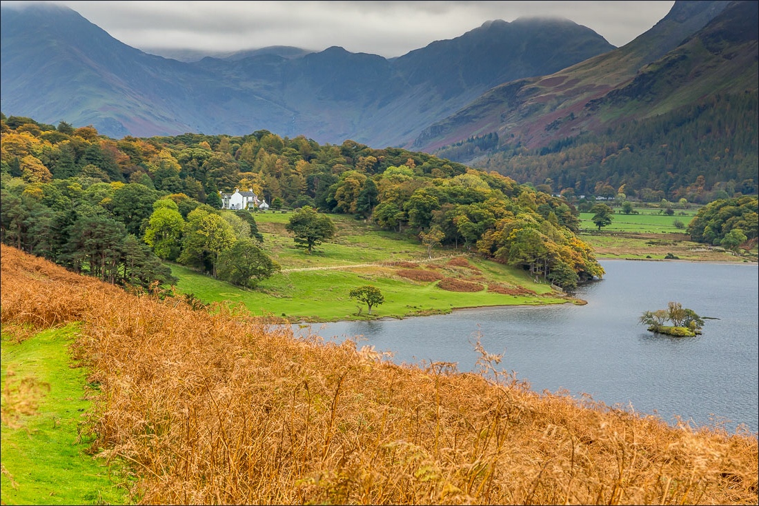
Wood House

Top of the hause

We descend to the road and follow it for a mile or so - this can be avoided by a detour into Rannerdale to the right

‘Tek care, lambs on’t road’

We leave the road here to head back down to the lakeshore…


We pass by the boat house


The circuit is complete as we arrive back at the foot of the lake, and from here it’s a short stroll back to the car park

Back home, a red squirrel enjoying a walnut
