
Route: Around Collias
Area: Gard, Southern France
Date of walk: 26th September 2018
Walkers: Andrew and Gilly
Distance: 8.6 miles
Ascent: 750 feet
Weather: sunny and hot
Yesterday’s walk had brought us from the old town of Uzès to the Hostellerie Le Castellas in Collias, and today we’d have the opportunity to explore the area around Collias, a small town on the banks of the Gardon river and a popular place for canoeing along the Gardon Gorges
We left the town via the spectacular bridge across the Gardon Gorges and turned left at the end to follow a track beside the river. Our walk almost came to a premature stop when we were halted by a couple of hunters with rifles who informed us that it would be ‘dangereux’ to continue. After a discussion in French we advised them of our route and were told that it was fine to continue, and we’d be unlikely to encounter a boar as their quarry lay in the other direction. Later that day, in a bar in Collias, we chatted to a local couple who informed us that wild boar are a pest at this time of the year, when they come down from the hills in search of food and can be a danger to traffic – and humans
Continuing the walk, we entered a deserted wooded valley and crossed an old packhorse bridge to visit a ruined Romanesque hermitage. After exploring the atmospheric ruins we climbed up some steep and narrow rocky steps to reach the Gardon plateau, a flat agricultural area where we made quick progress along deserted country lanes
We eventually reached the far point of the walk and started the return journey along the old mule track of La Torte. Although we were walking along the ridge of the gorge, with steep drops to both sides, there was no visible indication of this and the views were limited by the ‘garrigue’, a combination of mostly evergreen shrubs and trees. As we approached Collias the views began to open up and we had a good view over the town as we made the gentle ascent down the rocky track. On reaching Collias we crossed over the bridge again and retraced our steps back to the start
Click on the icon below for the route map
![]()
Scroll down – or click on any photo to enlarge it and you can then view as a slideshow

The start of today's round as we leave our hotel and walk through the streets of Collias...


We arrive at the arched bridge over the River Gardon and climb up to cross it

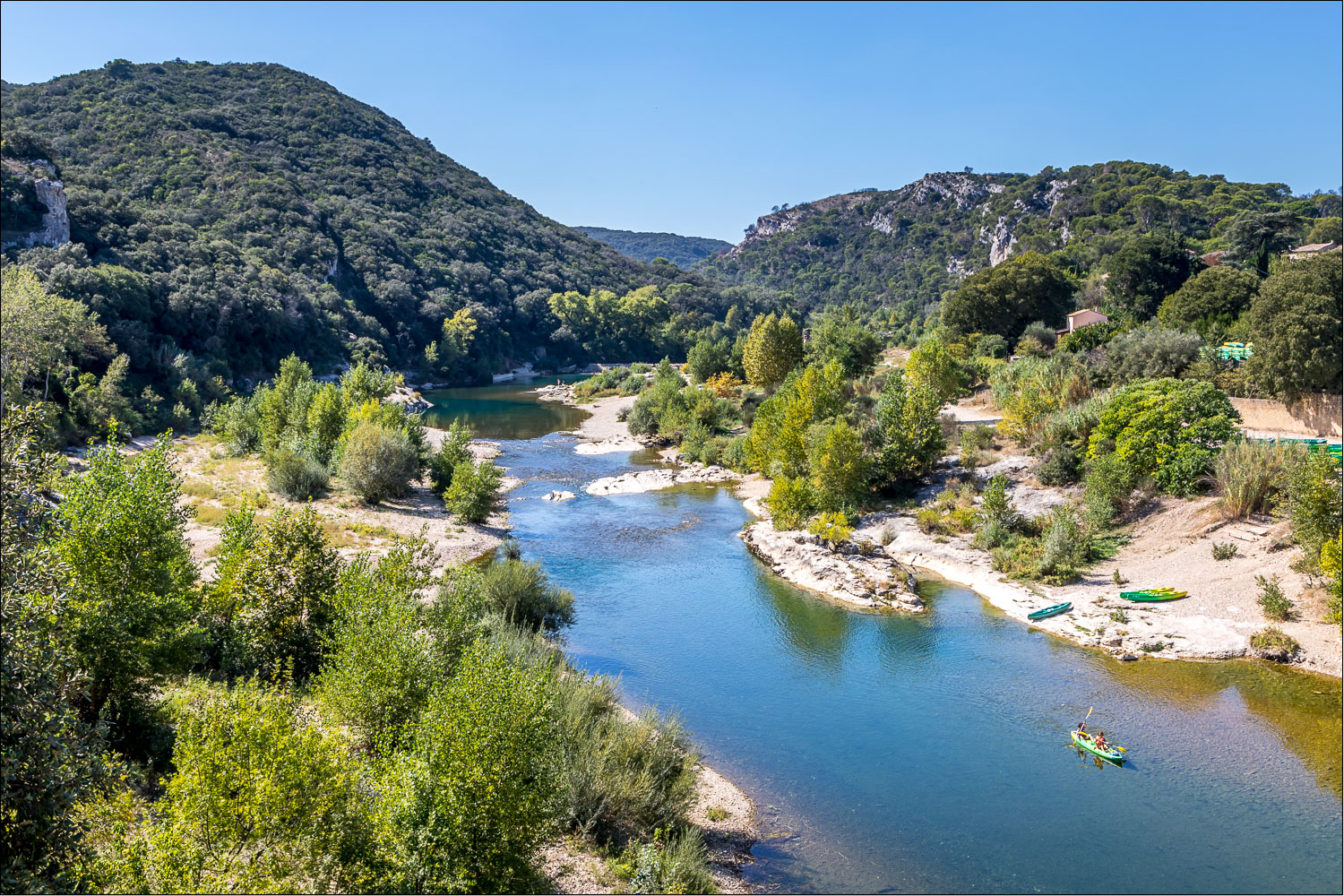
From the bridge, looking downstream along the Gardon Gorge - canoes may be hired from here for the 5 mile run to Pont du Gard

Looking upstream from the bridge - we'd arrived in Collias yesterday via the ridge on the right of the picture

Looking back to the small church in Collias

As we walked along the riverbank we were stopped by two men hunting for wild boar but after a friendly conversation we were waved on

We pass by a stone cross

The path now leaves the river and we head into a wooded valley


The rocky side of a small gorge in the valley


The path is known as Chemin de l'Ermitage, for reasons which soon become clear


We cross this bridge over a dry stream

We arrive at an old church, built on the site of an earlier Roman temple

The hermitage, which is in essence a cave, lies next to the church

Looking across the valley from the church...


We climb out of the gorge via a steep and narrow rocky path

At the top of the gorge the route could be shortened here by turning right to return to Collias. We opt to turn left along a track through typical Mediterranean scrub

The track passes by the lovely old farmhouse of Mas de Laval

We head out into open countryside...


A short woodland section (which takes us briefly off the edge of our map)

Start of the return section, which is fairly featureless in the early stages

A swallowtail butterfly - we had several sightings of these beautiful creatures

We follow the old mule track of La Torte...


Much of the scenery has been concealed by the shrubbery ('garrigue') but views now start to open up, and we realise that we're walking along a ridge, where the path has stone supports in places...


Collias below...

More views of our destination as we follow the zigzag path downhill...


We arrive back at the arched bridge in Collias and cross over the River Gardon again...


A canoe below, no doubt heading for the Pont du Garde

We walk through the old streets of the village


After a long walk in the scorching heat, we enjoy a cold beer in the local bar - a great end to the day
Follow the link for more walks in France (11)
