
Route: Circuit of Loweswater
Area: Western Lake District
Date of walk: 15th May 2025
Walkers: Andrew and Gilly
Distance: 4.2 miles
Ascent: 300 feet
Weather: Sunny
Loweswater is unique in the Lake District, as it is the only lake that drains towards the centre of Lakeland, into Crummock Water to which it was once joined
We parked at Waterend where there are several roadside parking spaces along the Loweswater road. We followed a path across the head of Loweswater which brought us to the lane leading to Hudson Place. We turned left beyond Hudson Place to descend towards the lake and passed through a gate leading into Holme Wood, managed by the National Trust, and having many inviting paths and some superb mature trees – alder, oak, lime, chestnut, ash, sycamore and others. Sadly the larch trees in the wood have been affected by Phytophtora Ramorum, and all of them have recently been felled by the National Trust in order to reduce the chance of the disease spreading.
There’s a choice of paths running through the the wood – a wide track is the most direct route, but I preferred to follow an alternative path which follows the lakeshore and passes by Holme Wood Bothy. We continued through Holme Wood and then joined the track leading to the Loweswater road. Points must be deducted from an otherwise perfect walk, as the return section follows the road for about 15 minutes. However it’s a fairly quiet road and can be avoided for much of the way by taking a narrow footpath which runs close to the lakeshore and parallel with the road. This can be found opposite an ancient pinfold which has an information board about its interesting origins
The lakeside path eventually ended and a further 5 minute road section brought us back to the start of the circuit o
For other walks here, visit my Find Walks page and enter the name in the ‘Search site’ box
Click on the icon below for the route map (subscribers to OS Maps can view detailed maps of the route, visualise it in aerial 3D, and download the GPX file. Non-subscribers will see a base map)

Scroll down – or click on any photo to enlarge it and you can then view as a slideshow

The start of the walk from the roadside parking spaces as we follow the sign to Hudson Place

A glimpse of Loweswater below Carling Knott and Holme Wood

We cross the newly built bridge over Dubs Beck

Dubs Beck, which was 'rewiggled' by West Cumbria Rivers Trust three years ago. Once a straight channel, this will now reduce flooding risk and improve wildlife diversity

Mellbreak looming over Loweswater

We walk up the lane to Hudson Place

Looking back

Herdwicks resting in the shade

We pass by Hudson Place, where there are some quirky landscape features

We follow the path down to the head of Loweswater

Holme Wood and Loweswater

Darling Fell on the far side of Loweswater

Path beside Loweswater...


We enter Holme Wood

At this junction we turn left in order to keep closer to the lake. The two paths merge later on

Looking across Loweswater to Askill Knott

We cross the footbridge ove Holme Beck

We pass by Holme Wood bothy

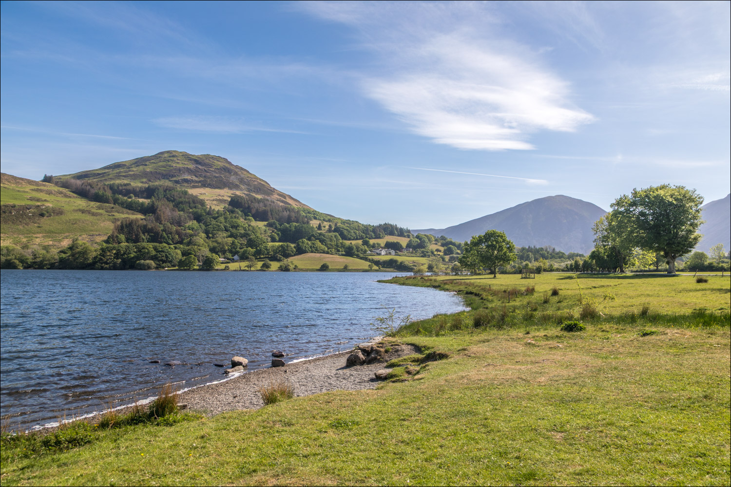
View from the stony beach bedside the bothy

Darling Fell on the far side of the lake

Low Fell as we emerge from Holme Wood

We follow the track from Watergate Farm

Mellbreak

Hen Comb on our right

Having passed through the small car park at Maggie's Bridge (an alternative starting point), we walk up the lane to the Loweswater road

Mellbreak erupting

Mellbreak, Hen Comb and Gavel Fell seen from the Loweswater road

There are several ancient houses around Loweswater, this is Thrushbank, dating back to 1697...


Looking across Loweswater to Carling Knott and Holme Wood

Gavel Fell

We arrive at the pinfold and leave the road here to join a narrow path beside Loweswater

Beware the Pinder

Loweswater from one of he clearings along the way

Looking back to Loweswater as we arrive back at the start of the walk
