
Route: Castlehead
Area: North Western Lake District
Date of walk: 28th March 2018
Walkers: Andrew
Distance: 3.4 miles
Ascent: 400 feet
Weather: Cloudy with showers, improving later
This is an ideal short walk for families or for anyone who is staying in Keswick and has an hour or two to spare. Castlehead is a small wooded hill just outside the town, only about 500 feet high, but which commands a good panorama over Derwent Water and the surrounding mountains
I parked in Booths car park in the town centre and walked past Moot Hall in Market Square, following St John’s Street past the church, and then turning right into Springs Road. A little way along the road a sign points the way along a public footpath leading to Castlehead. I walked through the woodland, climbing easily at first before reaching a short rocky section which brought me to the top
The weather wasn’t particularly inspiring, being rather drizzly and overcast but the view was superb nevertheless, and I’d like to return here in better conditions. A metal dial here describes the 30 or so fells which may be seen from the top
I retraced my steps for a short distance before heading west out of Castlehead Wood to reach the Borrowdale Road. I crossed the road to join the path on the other side which leads round Strandshag Bay and Friar’s Crag. My arrival here coincided with an improvement in the weather and there were some good views across to Cat Bells and the north west fells. I walked along the shoreline, passing by the landing stages and the Theatre by the Lake, and then into Crow Park. After a short walk in the park I headed back to the start of a very pleasant amble
Click on the icon below for the route map (subscribers to OS Maps can view detailed maps of the route, visualise it in aerial 3D, and download the GPX file. Non-subscribers will see a base map)

Scroll down – or click on any photo to enlarge it and you can then view as a slideshow

The start of the walk - Moot Hall in Market Square Keswick

St John's Church - its elegant spire features in some of the views later on

Springs Road - the path out of town is further along to the right and would be hard to miss...


Looking across to St John's Church

I follow the path into Castlehead Wood

After a short climb in rather miserable weather I arrive at the top

Cat Bells and Maiden Moor are well seen from here

Fresh snow on Causey Pike

Cat Bells

Bassenthwaite Lake in the distance

Looking across Keswick

After taking in the views I descend through the wood

Plaque commemorating the generous gift of this land to the National Trust

I leave Castlehead Wood and cross the Borrowdale Road

I follow the path towards Cockshot Wood

Looking back to Castlehead

And a view to my right to St John's Church and Skiddaw

Path to Strandshag Bay

Strandshag Bay

Walla Crag

I follow the shoreline path to Friar's Crag

Rampsholme Island

The John Ruskin Memorial at Friar's Crag

Cat Bells and Maiden Moor from Friar's Crag

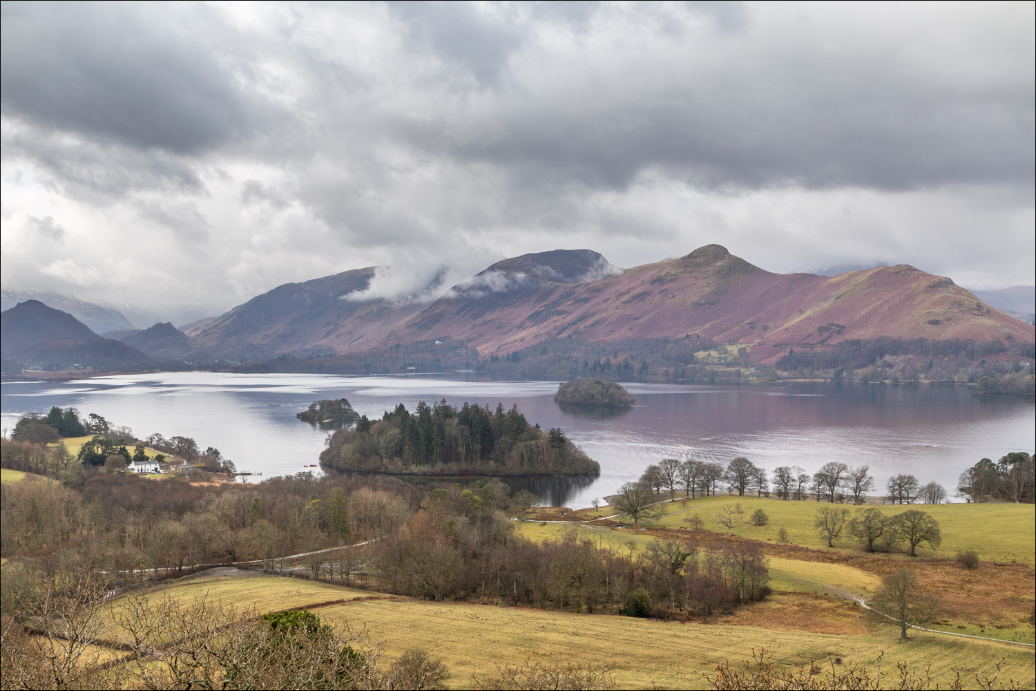
Looking across Derwent Isle to Swinside

Head of Derwent Water

Zooming in on a misty Maiden Moor...

...and to the head of Derwent Water

I leave Friar's Crag to follow the shoreline path

Cat Bells, such an inviting summit

Boat houses on Derwent Isle

I arrive at the landing stages

Lakeland Mist, one of the Keswick Launches

Feeding the ducks and geese

I enter Crow Park, where visitors are admiring the recently unveiled plaque marking the status of the Lake District as a World Heritage Site - see my previous walk for more details of the ceremony

St John's Church, and Blease Fell leading up to Blencathra

A view from Crow Park to Derwent Isle and Cat Bells beyond

Zooming in on Cat Bells

Herdwick sheep in Crow Park - and from here it's a short stroll back into Keswick and the end of a great little walk
