
Route: Castle Crag
Area: North Western Lake District
Date of walk: 1st September 2016
Walkers: Andrew and Gilly
Distance: 4.7 miles
Ascent: 900 feet
Weather: Cloudy with bright spells
The small but dramatic fells of King’s How and Castle Crag together form what are known as the ‘Jaws of Borrowdale’. Having climbed King’s How yesterday and enjoyed some superlative views of Borrowdale we felt inspired to revisit the area and climb the other jaw – Castle Crag. Standing at 985 feet, this is the only fell below 1,000 feet to be awarded the full treatment in Alfred Wainwright’s classic Guide to the Lakeland Fells – ‘a distinction well earned’ according the the great man
We parked at the National Trust car park in Rosthwaite and followed the path to the River Derwent. After walking along its bank for a few minutes we turned off just beyond New Bridge to climb up Lingy Bank and join a wider track which brought us to the foot of Castle Crag and the start of a steep but short climb to its summit. The views over Borrowdale in one direction and Derwent Water in the other were wonderful
We retraced our steps for a short distance and then rejoined the track beside Broadslack Gill. On reaching the River Derwent we turned off and walked along the Cumbria Way through Low and High Hows Woods – a delightful section which brought us back to New Bridge and from there we retraced our steps back to the start
Borrowdale is one of the most beautiful areas in the country and it was a privilege to visit for the second day running
For other walks here, visit my Find Walks page and enter the name in the ‘Search site’ box
Click on the icon below for the route map (subscribers to OS Maps can view detailed maps of the route, visualise it in aerial 3D, and download the GPX file. Non-subscribers will see a base map)

Scroll down – or click on any photo to enlarge it and you can then view as a slideshow

At the start of the walk in Rosthwaite we bump into an old friend - great to see you again Trevor!

Walking out of the village

We follow the path towards the River Derwent

The Jaws of Borrowdale - Castle Crag left and King’s How right

We need to cross the river, and decide to take the risk free option of the bridge further along the path

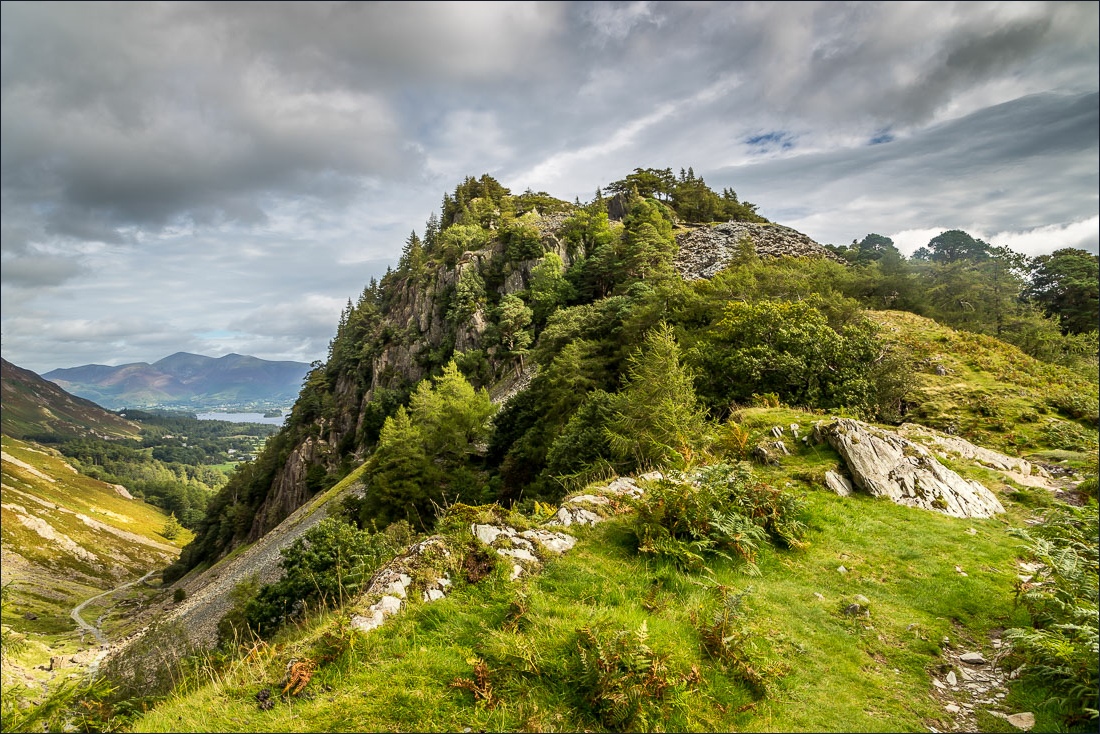
Castle Crag


New Bridge, which was new 200 years ago. It was damaged in the 2015 floods and is being repaired - this is the only angle I could get which avoided scaffolding and building equipment

We climb up Lingy Bank…


Wonderful retrospective views over Borrowdale near the top of the bank…


Rosthwaite

View from the top of the bank

We pass through a gate and join a wider track which will take us to the foot of Castle Crag


The view south towards Base Brown

Castle Crag, with Derwent Water through the gap - we turn off the path here to start the climb to the top

Looking back down to the path


Skiddaw in the background


Base Brown

We follow the zigzag path through the stones

Borrowdale, with Eagle Crag at the head of the valley

The old quarry just below the summit

High Doat and Johnny Wood

Derwent Water from the summit of Castle Crag

Rosthwaite and Borrowdale

…and that lovely view south again

We descend and turn right along the path below


The path descends gently to the River Derwent

We then follow the Cumbria Way through Low and High Hows Woods with the river on our left


We emerge from the woodland


Looking across the river to Eagle Crag

Having crossed New Bridge again we retrace our steps to the start

Rosthwaite - and the end of another wonderful walk in Borrowdale

Later that day, a red squirrel in the garden

