
Route: Castle Crag and Borrowdale
Area: North Western Lake District
Date of walk: 15th May 2015
Walkers: Andrew
Distance: 7.0 miles
Weather: Sunny at first, clouded over later
I made an early start as the forecast was for sun and blue skies early morning, but gradually clouding over, and this proved to be the case.
It was a beautiful morning as I arrived in Grange and parked near the bridge. I walked out of the village along a quiet lane which joins the path beside the River Derwent. The river was to be my constant companion for the outward leg of the walk until just beyond Rosthwaite, when I turned away from its course to head up into Johnny Wood
There followed a short climb uphill to reach the Cumbria Way and the delightful terraced path took me to the foot of Castle Crag. The fell has the distinction of being the only fell in Wainwright’s Guides with an altitude below 1,000 feet – it stands at 985 feet – but such is its rugged character that Wainwright made an exception and gave it what he termed ‘the full treatment’
It was a short but steep climb to the top. The normally superlative views were not shown at their best thanks to some indifferent weather which had been moving in from the south – but they were lovely all the same
I descended the way I’d come, then carried on along the Cumbria Way and retraced my steps back into Grange
For other walks here, visit my Find Walks page and enter the name in the ‘Search site’ box
Click on the icon below for the route map (subscribers to OS Maps can view detailed maps of the route, visualise it in aerial 3D, and download the GPX file. Non-subscribers will see a base map)

Scroll down – or click on any photo to enlarge it and you can then view as a slideshow

Bridge over the River Derwent at Grange

Down by the river

Walking through Grange…


I follow a quiet lane out of the village


Early morning sunlight on the Derwent


Low How Wood


Bonnie - half dog half fish

The Shake


I pass by a disused quarry

Looking across to Grange Fell

Borrowdale Fells

Looking back along the Derwent

I cross New Bridge - one of those names that was a good idea at the time

Path to Rosthwaite

I cross back to the other side of the Derwent via the stepping stones

Longthwaite, the start of the return leg

I admire, but don’t cross, the bridge to Rosthwaite

Walking along the edge of Johnny Wood

The ‘Jaws of Borrowdale’ - Castle Crag and Kings How - seen from the edge of the wood

Mossy banks in Johnny Wood

I emerge from the wood onto the flanks of High Scawdell

Looking back over an old sheepfold to Rosthwaite

Now on the Cumbria Way and approaching Castle Crag

Looking back along the path

I take the narrow path on the right - there’s an alternative one a little further down

Castle Crag


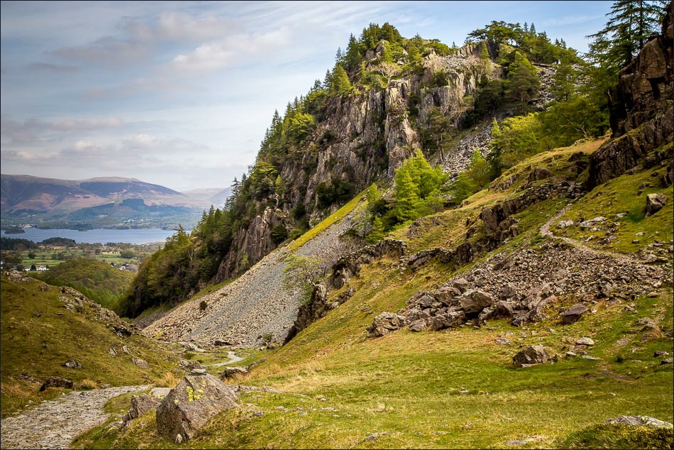
The zig zag path up through the spoil heap of slate

Borrowdale from one of the cairns near the top of the fell

The curious area of standing stones, a bit like a graveyard

Derwent Water from the small summit of Castle Crag - I paid heed to Wainwright’s advice that ‘photographers (who have a habit of taking backward steps when composing their pictures) should take care lest they suddenly vanish’

Having retraced my steps back down, it’s a short walk back to the start

Back in Grange

Looking back to Castle Crag from the bridge at Grange
