
Route: Buttermere to Wasdale
Area: Western Lake District
Date of walk: 25th May 2017
Walkers: Andrew
Distance: 7.8 miles
Ascent: 2,200 feet
Weather: Sunny and very hot
Some may think that a half day walk from Buttermere to Wasdale is out of the question, given that it takes nearly an hour to drive from one to the other. A way does exist however, and it takes advantage of two of Lakeland’s iconic mountain passes – Scarth Gap and Black Sail. This being a linear walk it’s necessary to arrange transport back and to solve this issue Gilly and I came up with a plan.
We parked in the National Trust car park just outside Buttermere village. We then followed the delightful lakeshore path and on reaching the head of the lake I turned off to take the path to Scarth Gap, while Gilly and Bonnie carried on to complete a circuit of Buttermere. If all went to plan Gilly would drive over to Wasdale Head and pick me up later on.
I’ve walked the path to Scarth Gap many times on the way to Haystacks, but today I ignored the turn off to Haystacks and continued down the pass into lonely Ennerdale, passing by the famous Black Sail Hut. Shortly after this I started the second climb of the day up to Black Sail Pass. By now it was midday and swelteringly hot (approaching 30c as I discovered later), with not a breath of wind and, although it’s a straightforward climb, there was a lot of huffing and puffing on my part
It was a relief to finally make it to the top of the pass and to start the long descent into Wasdale. After what seemed like an age I finally arrived at my destination, the famous Wasdale Head Inn, birthplace of climbing. I’d just started rehydrating with a refreshing pint when Gilly arrived – perfect timing. It had been a superb walk, though quite a tough one on account of the intense heat
For other walks here, visit my Find Walks page and enter the name in the ‘Search site’ box
Click on the icon below for the route map (subscribers to OS Maps can view detailed maps of the route, visualise it in aerial 3D, and download the GPX file. Non-subscribers will see a base map)

Scroll down – or click on any photo to enlarge it and you can then view as a slideshow

A dawn visit to Crummock Water before the walk - Canada geese...

...with 12 gosling

Early morning mist on the lake


Crag Wood Hassness

Back home, a red squirrel in the garden

A hour or so later, the start of the walk as we pass by Cragg House Farm

The Fish Inn

Haystacks at the head of the valley

The path to the lake

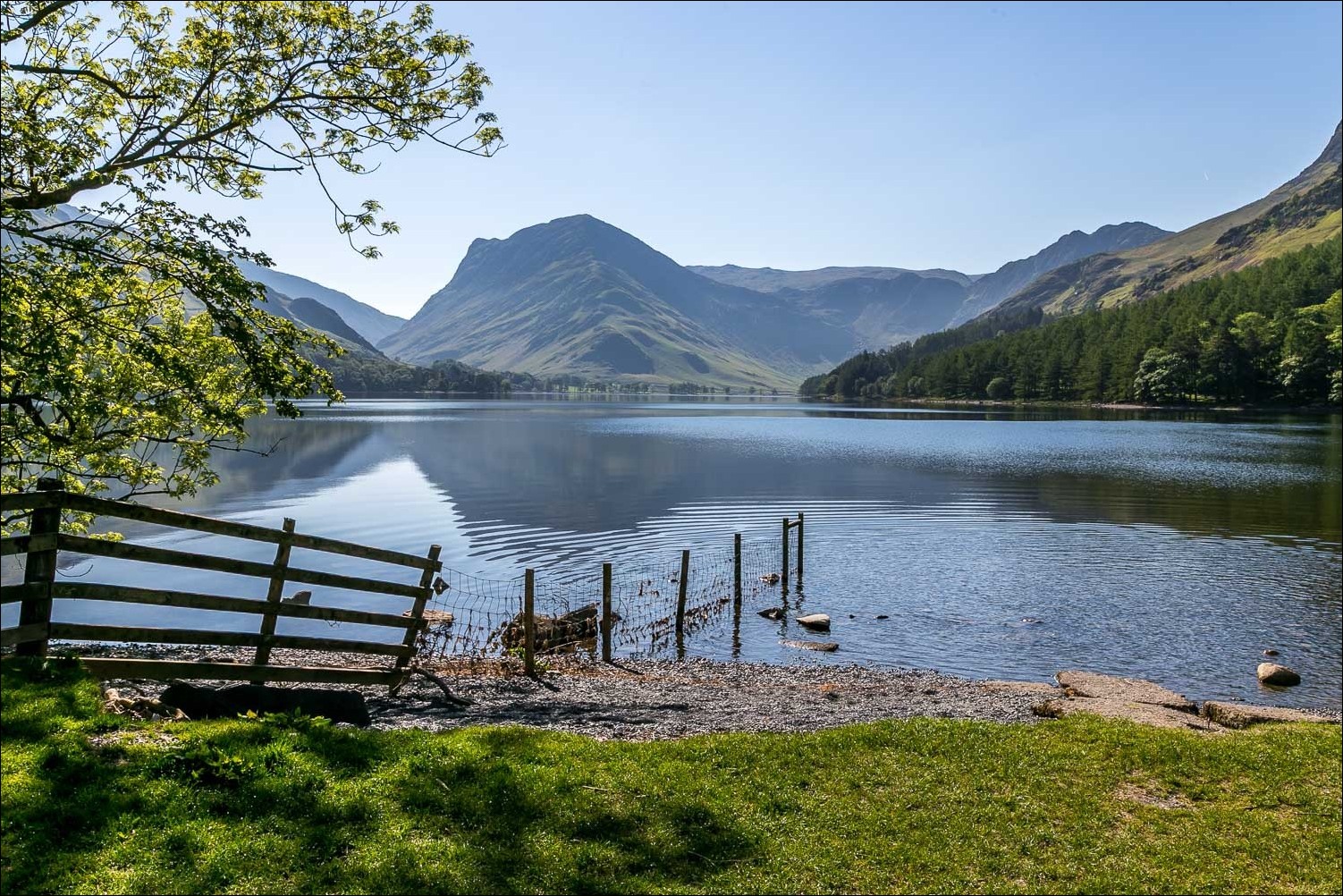
Foot of Buttermere and Fleetwith Pike

We cross Buttermere Dubs

The wonderful lakeshore path...


The bothy at the head of Buttermere

Having said our goodbyes, Gilly and Bonnie continue around the lake, and I fork off to the right - see you later

Looking down to the path across the head of Buttermere

It's been an amazing year for bluebells

Scarth Gap ahead, with Haystacks on the left

Looking across to Fleetwith Pike

I arrive at the top of the pass

Descending into Ennerdale

Pillar

Ennerdale again

I follow the fence down to the valley floor

Looking across to Ennerdale (the lake) in the distance

Great Gable dominates the scene as I walk further up the valley...


Black Sail Hut ahead

I pass by the front of the hut, where the rooms bear the names of surrounding fells

I cross the River Liza here and start the climb up to Black Sail Pass

Looking along the River Liza from the footbridge

Looking back to Black Sail Hut right of picture and to the path I'd followed down from Scarth Gap

I follow a path beside Sail Beck

I arrive at the top of Black Sail Pass and it's all downhill from here

The path snakes its way down the valley below Yewbarrow and Red Pike

Wasdale comes into view

Almost down to the valley floor

A dry stone wall leading across Mosedale almost to the summit of Red Pike

Scafell

A couple of inquisitive Herdies

Wasdale Head below

Lingmell and Scafell Pike

A glimpse of Wastwater in the distance

I pass by the old packhorse bridge over Mosedale Beck

I arrive at my destination, the Wasdale Head Inn

Cheers!
