
Route: Bowfell
Area: Southern Lake District
Date of walk: 5th October 2017
Walkers: Andrew
Distance: 8.9 miles
Ascent: 2,900 feet
Weather: Mixed cloud and sun, very windy on tops
Bowfell is a noble mountain, the sixth highest of the lakeland fells standing at 2,960 feet, and set in a wonderful position at the head of the Langdale valley. Looking forward to a grand day out on the fells, I parked in the National Trust car park at the Old Dungeon Ghyll Hotel and after crossing the bridge over Great Langdale Beck I headed along the track to Stool End at the foot of The Band, a long ascending ridge which leads directly to the top of Bowfell
Eventually I reached the upper section of The Band where the going becomes much rockier, though there are never any difficulties, and after clambering up through a boulder field I was on the summit enjoying some spectacular views in all directions. A very strong wind brought with it a significant wind chill factor so I didn’t linger there and picked my way down through the boulders, with route finding being assisted by a line of cairns as I headed towards Ore Gap. At this point Esk Pike was temptingly close but I still had a long way to go, so at the gap I turned right to follow a stony path down to Angle Tarn
Just beyond the tarn the lies the direct route down Rossett Gill which can only be recommended to walkers of a masochistic disposition. Luckily it can be avoided by a more circuitous path known as the old pony route, and this is way I went today. The gradient is relatively easy, though I can’t see how a pony could possibly use this path as there are some very rocky sections. The path has superb views along Mickleden, and eventually meets up with Rossett Gill lower down
On reaching Mickleden, the path merges into the Cumbria Way and from here it’s an easy descent to the valley floor and along the valley back to the start of a wonderful walk – one of the very best
For other walks here, visit my Find Walks page and enter the name in the ‘Search site’ box
Click on the icon below for the route map (subscribers to OS Maps can view detailed maps of the route, visualise it in aerial 3D, and download the GPX file. Non-subscribers will see a base map)

Scroll down – or click on any photo to enlarge it and you can then view as a slideshow

Red squirrels in yesterday's rain

Next day, a fine start as I leave the Old Dungeon Ghyll car park

I cross the bridge over Great Langdale Beck

The head of Great Langdale

The Band, my route to Bowfell, is to the right of the picture, partly in shadow

Looking back along the valley

Micklenden - I'll be returning that way later

I cross Oxendale Beck near Stool End

Beyond Stool End the path splits and I head right to start the climb up The Band

Crinkle Crags

Memorial bench to S H Hamer, secretary of the National Trust 1911-1934. In the background is Pike o' Stickle

A view back along Great Langdale

The path has received the attentions of Fix the Fells, who have done a sterling job here

Looking back down The Band to Stool End

Pike o' Stickle again

Great Langdale

The summit of Bowfell comes into view

Looking across to Crinkle Crags

A view back along The Band

The going gets rockier as I reach the upper section of the path

Looking back to Three Tarns

The pointed outline of Pike o' Blisco

The Great Slab of Flat Crags

Not far to the summit now

The Great Slab again...


Looking back along the path

After clambering up some boulders, I arrive at the summit of Bow Fell, here looking into Eskdale

Scafell and Scafell Pike

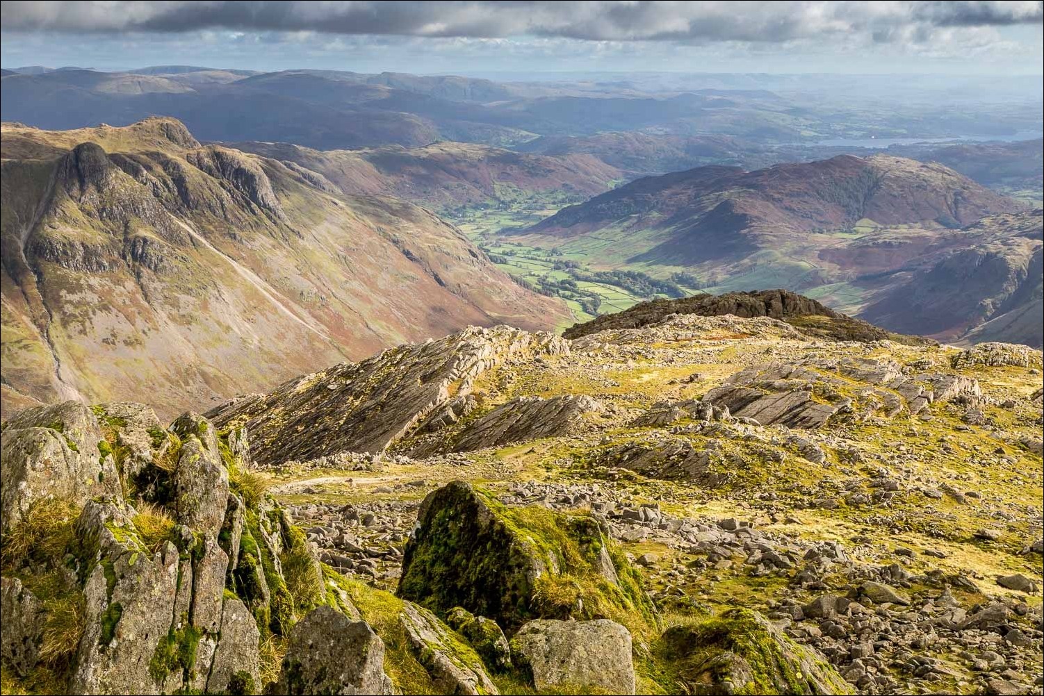
Looking towards Langdale, with Windermere on the right

A view north, with Skiddaw top left

Langdale, and the Langdale Pikes on the left

I descend past Bowfell Buttress

I follow the path towards Ore Gap

The Scafells

Looking back to Bowfell

At Ore Gap I set my sights on Angle Tarn below, here looking towards Langstrath

Pike o' Stickle and Loft Crag

Angle Tarn - my path will cross its outflow, and then rise beyond it...


Descending to Micklenden

I follow the old pony route, which avoids the horrors of the direct 'path' down Rossett Gill

Back down to valley level

The path follows the course of Mickleden Beck

Looking across to the start of The Band, where I'd been earlier

The Cumbria Way

Middle Fell Farm - the Old Dungeon Ghyll is next door

Back to the start, a final look back to Bowfell beyond Middle Fell Farm

...and back home, more red squirrel activity

Later that night, a hedgehog
