
Route: Binsey
Area: Northern Lake District
Date of walk: 25th March 2018
Walkers: Andrew
Distance: 4.4 miles
Ascent: 970 feet
Weather: Patchy sunshine
Binsey is an isolated fell in the far north western corner of the Lake District. Its slopes are gentle and grassy and it would be difficult to get lost here. The remote position of Binsey means that it is unfrequented, and so makes it an ideal choice for a quiet Sunday afternoon fell walk
There is access to the fell through a gate at the side of the A591 road, just beyond the small hamlet of Bewaldeth. I parked on a small lane on the other side of the A591 and after crossing the road started the easy climb, which is initially up a green lane flanked by trees. After passing through a gate the going becomes slightly steeper but it’s an easy climb. Before long I was on the lovely summit of the fell, marked by a cairn, a heap of stones and a couple of stone shelters
After admiring the views into lakeland looking one way, and to the Solway Firth and Scotland looking the other, I started to descend in the direction of Overwater. The descent was as easy as the ascent had been, and there were some good views to admire on the way down
When I reached the foot of the fell, near Binsey Lodge, I joined the quiet lane which leads back into Bewaldeth, skirting around the foot of Binsey as it does so. Although this was a lengthy section there was no traffic at all and it was an enjoyable stroll through unspoilt countryside with more good views along the way. After passing through Bewaldeth I walked along the wide verge of the A591 back to the start. This is the only black mark against an otherwise perfect walk. However this road section was only for a few hundred yards and was over in less than 5 minutes – a small price to pay for all the pleasure that had preceded it
For other walks here, visit my Find Walks page and enter the name in the ‘Search site’ box
Click on the icon below for the route map (subscribers to OS Maps can view detailed maps of the route, visualise it in aerial 3D, and download the GPX file. Non-subscribers will see a base map)

Scroll down – or click on any photo to enlarge it and you can then view as a slideshow

A record shot to show the parking space, which is to the left of this sign by the A591

Just across the road, the start of the walk looking towards Binsey

Further along the tree lined green lane

Looking back across the fields...

....and back along the lane

Binsey ahead

On reaching the gate I arrive onto open fellside and follow the clear path to the left

Another view back

The gradient steepens from very easy to quite easy

Big views looking north west

The Solway Firth and Scotland can just be seen in the far distance

Nearing the summit of Binsey...

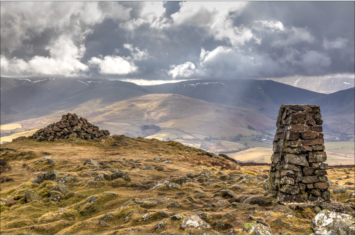
Summit cairn on Binsey

Overwater

The Solway Firth and Criffel in Scotland

I follow the easy path downhill in the direction of Overwater

Blencathra in the background

Further down these gentle slopes

Overwater again

A view into lakeland beyond Bassenthwaite Lake...

...and again

Overwater

The dry stone wall below marks the end of the descent, and I turn left here to follow the lane

Looking to my left from the lower flanks of Binsey

I join the quiet and delightful lane leading to Bewaldeth

Bassenthwaite Lake

Looking across the fields towards the Skiddaw Fells


Bassenthwaite again

Traffic at Fell End Farm

I follow the road past the barn on the right of the picture

Looking back to Binsey from the barn

Bewaldeth, and from here it's a short walk back to the start of a great little fell walk

Earlier this week, hellebore in the garden, signifying that spring is properly underway
