
Route: Barranco de Benchijigua
Area: La Gomera
Date of walk: 3rd February 2016
Walkers: Andrew and Gilly
Distance: 9.9 miles
Ascent: 2,600 feet
Weather: sunny and very hot
The island of La Gomera is the second smallest of the Canary Islands and its unique geology makes it a paradise for walkers. From its central peak, the Garajonay, there are numerous deep ravines (‘barrancos’) which are ideal for walkers but a nightmare for roadbuilers and so a network of paths has built up over the years enabling the locals to travel from one area to another
On our first day here we decided to explore one of these ravines, the Barranco de Benchijigua. We parked our hired car near the hamlet of Taco and after walking along the road for a short distance turned right to follow a rough path uphill. The next couple of hours were hard going in the heat, and the climb seemed to go on forever, but eventually we reached the far end of the ravine at Benchijigua and started out on the return leg
The views along the valley were superb all the way and we arrived back at the start hot but happy after a fantastic walk which was full of interest. We’d learned a valuable lesson though – we’d taken water supplies with us, but not nearly enough, and we were completely parched for most of the return section. We resolved to take as much water as we could carry on our future walks
It had been a great introduction to what is a new walking area for us, and we were full of anticipation as to what might lie ahead
Click on the icon below for the route map
![]()
Scroll down – or click on any photo to enlarge it and you can then view as a slideshow

There are no direct flights to La Gomera, and so the day before the walk we’d flown to Tenerife, caught a taxi to Los Cristianos, and from there taken a ferry to the island

As we awaited the ferry, a local fishing boat brought in a catch of tuna

The ferry arrives, and from here it’s a 40 minute trip to La Gomera

Sunset as we leave Los Cristianos, bound for the island of La Gomera

Dawn next day and for the first time we see the view from our room at the Hotel Jardin Tecina (which we can highly recommend)


After breakfast we collected our hire car and drove to nearby Taco, where we found some roadside parking

We walk along a quiet road through the hamlet of Taco

Taco is set in the middle of a huge ravine - the Barranco de Benchijigua - which we will ascend during our walk

Further along the initial road section (an encounter with traffic is highly unlikely)

Looking across the valley…


We leave the road here to join a rocky path signposted for Benchijigua

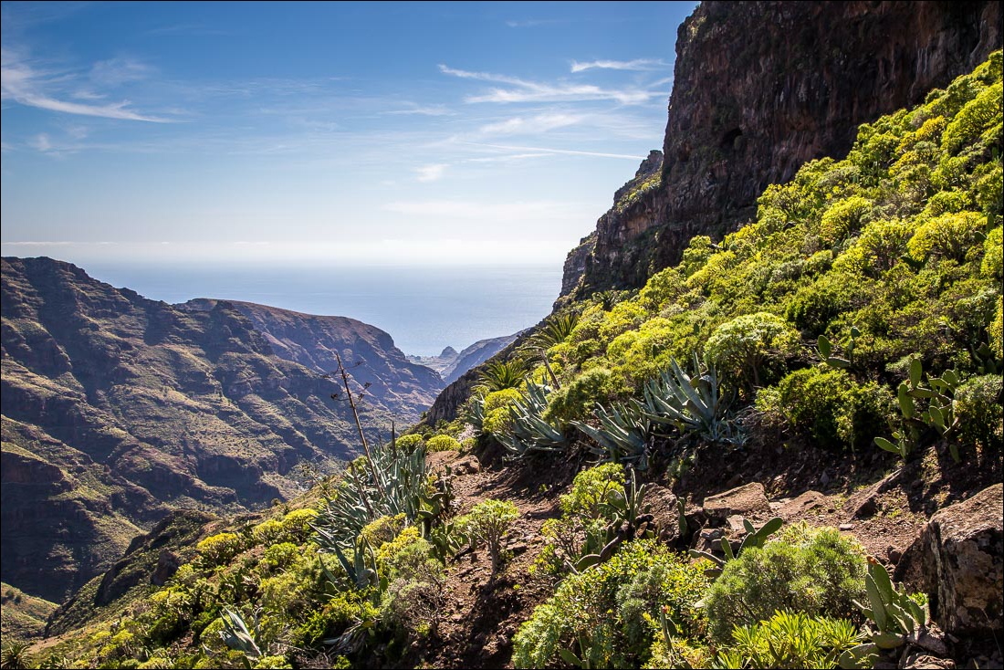
We’d expected the landscape to be quite barren and it was a pleasant surprise to see the lush vegetation along the way


Looking back along our path as we ascend higher up the valley


Another view back as the sea comes into view

The distinctive outline of Roque Agando at the head of the valley. We’re aiming for Benchijigua, a short distance below the rock, and will then return along the far side

Roque Agando again

We follow the inviting path around the mountain side

Looking back down the path to the start of our walk, somewhere along the road below

Roque Agando dominates the scene as we progress up the valley

Looking back

Blossom - possibly an almond tree


We pass by a ruined building and an old bread oven

The gradient eases as we approach Benchijigua

The furthest point of the walk is ahead - Benchijigua below Roque Agando

One of several atmospheric ruined buildings in Benchijigua

We round the head of the valley towards our return route along the other side

Downtown Benchijigua

Start of the return leg


Another ruined building beyond Benchijigua

The early stages of a long descent back down the valley

A houseleek clinging to the rock

We can see our path ahead carved out of the mountain side, looking rather intimidating seen from here…

…and from here, but it’s not nearly as bad as it looks in the photos and it’s perfectly safe

One of many small lizards we saw scuttling across the rocks

Further down the valley


Our water supplies had run out and we were quite dehydrated by now, so this sign attracted our undivided attention

The restaurant was closed but a can of lager by the roadside seemed like a luxury

Suitably refreshed we carry on down the road back to the start, passing by El Cabezo perched at the foot of Lomo de Azadoe

A pity that the walk ended with a tarmac section, but this small blemish didn’t spoil what had been a fantastic walk
Follow the link for more walks in La Gomera (8)
