
Route: Barnard Castle
Area: County Durham
Date of walk: 29th August 2019
Walkers: Andrew and Gilly
Distance: 5.4 miles
Ascent: 400 feet
Weather: Mostly sunny, clouding over later
Barnard Castle is a market town in Teesdale, County Durham. It is also the name of the castle around which the town is built. We’ve passed through the town on previous occasions but until today haven’t had the opportunity for a proper exploration. There are plenty of parking places in the town, and we parked in a residential street near the castle, making it our first port of call before setting off on today’s walk
Barnard Castle is owned by English Heritage (an entry fee is payable by non-members). It is set on a high rock above the River Tees and takes its name from its 12th century founder, Bernard de Balliol. It was later developed by the Beauchamp family and then passed into the hands of Richard III. We wandered around the well preserved ruins and admired the views over the Tees Gorge, but after an hour or so it was time to be on with the walk. We left the castle grounds and followed the road past Castle Bridge, which dates back to the 14th century. Shortly after this we joined a path through a field on the outskirts of the town, part of the Teesdale Way
The path hugged the north bank of the River Tees, and we followed it through unspoilt countryside as far as Abbey Bridge. We crossed the old road bridge and then walked along a lane to the remains of Egglestone Abbey, also owned by English Heritage. The abbey of St Mary and St John the Baptist, to give it its full name, was founded at Egglestone between 1195 and 1198 for Premonstratensian canons. Entry is free and it’s well worth making the very short diversion to visit this atmospheric place
We returned to the lane and then joined a footpath on the south bank of the River Tees. We took the higher of two possible paths back into Barnard Castle and after a short wander around the old streets we headed back to the car, just as it started to rain. It was a great little walk linking two ancient buildings steeped in history
Click on the icon below for the route map (subscribers to OS Maps can view detailed maps of the route, visualise it in aerial 3D, and download the GPX file. Non-subscribers will see a base map)

Scroll down – or click on any photo to enlarge it and you can then view as a slideshow

Entrance to Barnard Castle looking across the River Tees, unseen from here

Having entered into the castle grounds, the Mortham Tower and the Round Tower...


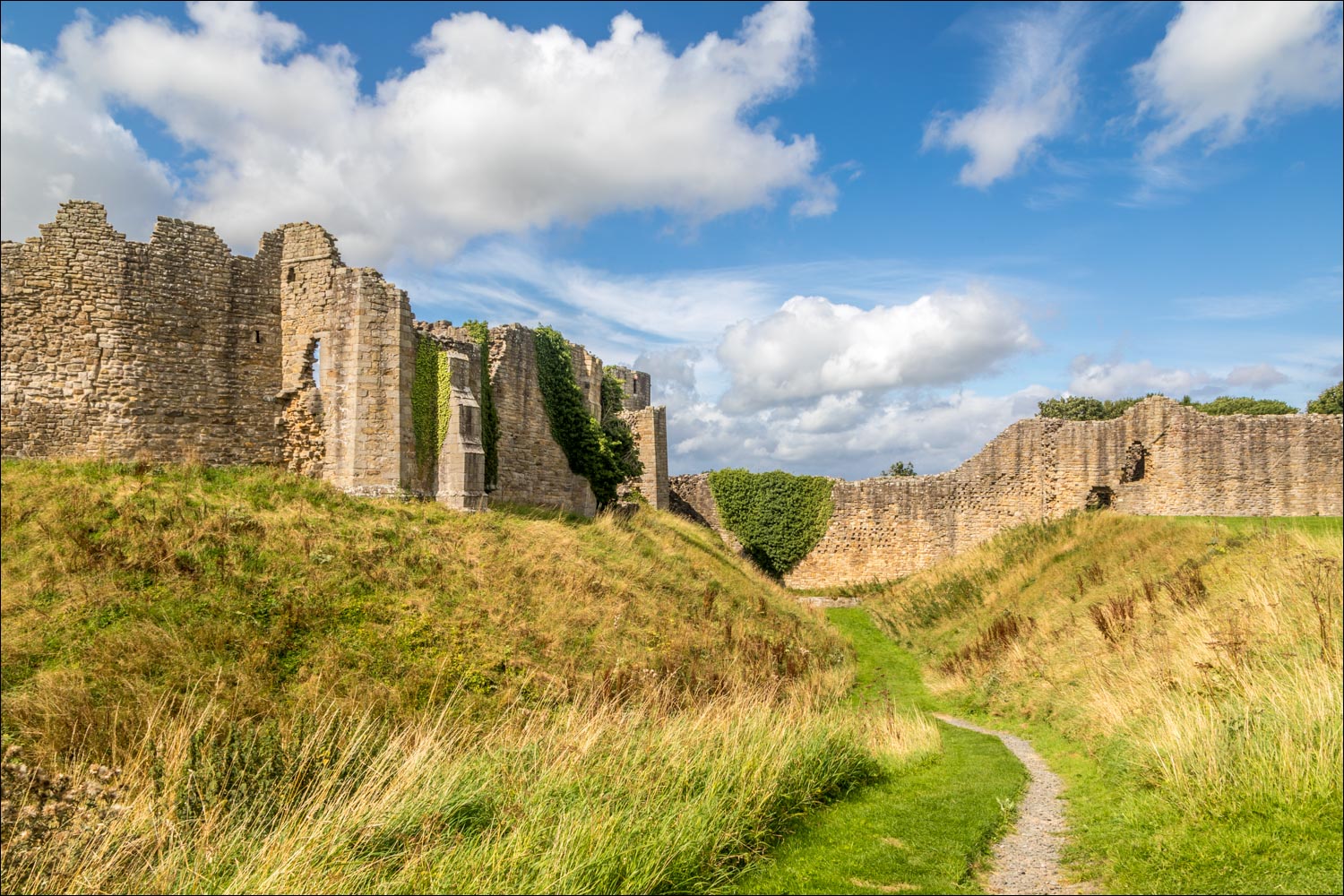
The castle moat, known as the Great Ditch

View towards the Methodist Church

The River Tees seen from the ramparts

The Mortham Tower

Views from the windows...


Mortham Tower and the Round Tower again

Looking along the Great Ditch

The end of a fascinating visit and the start of the walk as we pass by the castle and head south towards the River Tees


Looking along the Tees, with the castle on the right

We pass by Castle Bridge

Looking across to St Mary's Church

We follow this lane between the houses at the edge of the town

We join the Teesdale Way...


We pass through Demesnes Mill Farm

Looking back along the Tees

We emerge into open countryside...


Another view back along the Tees


A glimpse of Egglestone Abbey on the far bank of the Tees

We cross Abbey Bridge

Looking along the River Tees from Abbey Bridge

Approaching Egglestone Abbey...


A short but very worthwhile detour...


The tomb of Sir Ralph Bowes of Streatlam...


We return to the lane and pass by the Abbey

Our path takes us through fields, with the Tees below on our right

We arrive back at Barnard Castle

Looking along the Tees as we cross the footbridge back into the town

We walk back through the old town

The octagonal Market Cross, known locally as the 'Butter Mart'...

The end of a walk through time
