
Route: Lizard Point
Area: Cornwall
Date of walk: 13th October 2025
Walkers: Andrew and Gilly
Distance: 9.9 miles
Ascent: 1,400 feet
Weather: Bright at first but soon clouded over, with some light drizzle
We’d followed a section of the long distance South West Coast Path on yesterday’s walk to St Anthony Head and decided to follow another section today, the most southerly on the route. We started from the public car park at the edge of the small fishing village of Cadgwith. The walk could also be started from Lizard Point or Kynance Cove but we preferred to leave the easy inland section until the end. We joined the South West Coast Path, which took us along the cliffs and past the Devil’s Frying Pan and its rock arch. The path was narrow, with countless ups and downs, and hugged the coastline as it weaved back and forth around coves and gullies
We descended to Church Cove and watched the rough seas for a while before climbing up again to pass by the coastguard’s lookout station at Bass Point. Beyond Bass Point, Lizard Point came into view. The Lizard is the most southerly place on mainland Britain and is infamous as a site of shipwrecks in the past. It overlooks one of the busiest shipping lanes in the world
At the end of the Lizard Peninsular we headed along an easy grassy path towards the final destination of the coastal section of the walk, Kynance Cove. The cove is flanked by spectacular rock stacks and the approach to it was one of the highlights of the walk. We descended to the small sandy beach and walked past the Kynance Cove Cafe – at high tide it’s necessary to take a higher path. We reluctantly turned inland here, following a path through Lizard Downs Reserve. The downs are best visited in the summer months. At this time of year, especially under grey skies, it’s a rather featureles place. It was easy walking though and, at the end of the heath, we followed country lanes and paths back to the start. Despite the indifferent weather it had been a wonderful walk
Click on the icon below for the route map (subscribers to OS Maps can view detailed maps of the route, visualise it in aerial 3D, and download the GPX file. Non-subscribers will see a base map)

Scroll down – or click on any photo to enlarge it and you can then view as a slideshow

The start of today's walk from the small fishing village of Cadgwith. The blue skies will soon give way to grey

Cadgwith Cove

We join the South West Coast Path, indicated by one of the waymarker posts which are dotted along the route

Views back to Cadgwith as we gain height...


We pass above the Devil's Frying Pan

Looking back along the cliffs

Polgwidden below


Looking down to a natural rock arch at Polbarrow headland

A view back along the path

We descend to Church Cove

Church Cove...


After climbing up to the cliff top again we pass above the Lifeboat Station. There's a poignant memorial here to the 12 crewmen of the Ardgarry who were lost in a storm in 1962. The RNLI spent 14 hours searching for survivors but none were found

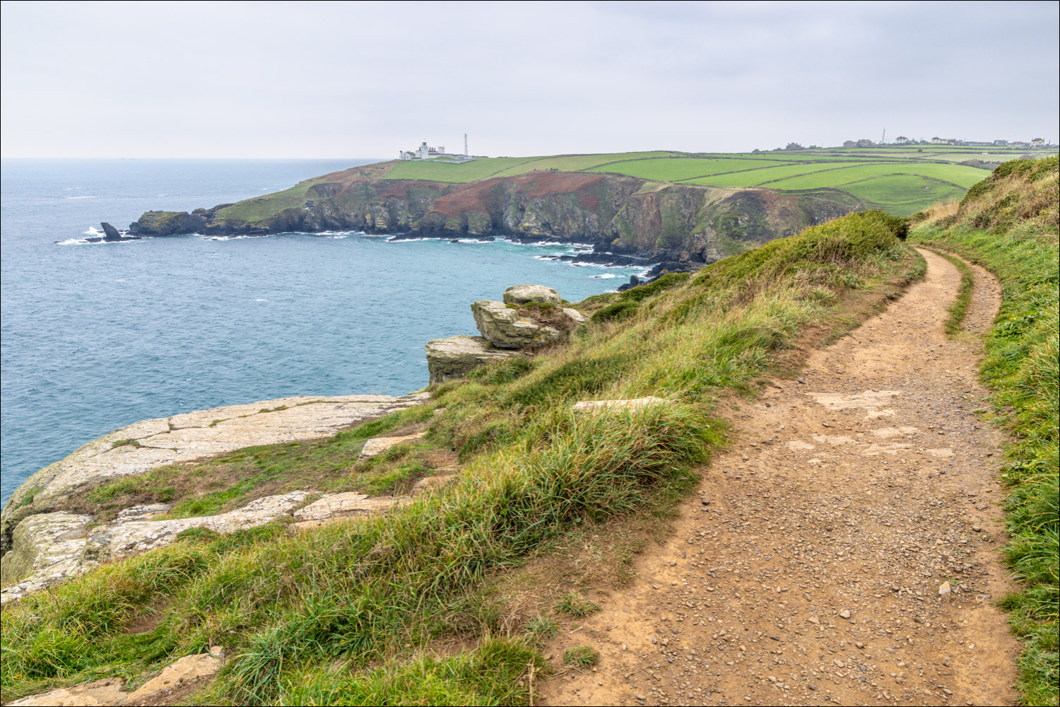
Bass Point ahead...


On reaching Bass Point, another milestone appears in the distance - Lizard Lighthouse

We pass by Lloyd's Signal Station, built in 1872 as a safety beacon for passing ships. It is now the most southerly holiday home in the country

Housel Bay. We will follow the path at the top of the cliffs (which is perfectly safe)

Lizard Point. The sea stack on the left is Bumble Rock

Housel Cove below and our path above

Lizard Lighthouse ahead

The lighthouse was built in 1752 and marks the most southerly point of mainland Britain


We pass above the Polpeor Cove Lifeboat Station, now closed

We continue around Lizard Point

The end of the coastal section in the distance - Kynance Cove

Last of the cliffs on Lizard Point as we round the headland and aim north

Kynance Cove ahead

Wonderful rocky scenery as we follow the undulating path on the right

Crane Ledges

We walk above Pentreath Beach

Lion Rock and Gull Rock guarding the waters of Kynance Cove

Looking back along our path

Lion Rock and Gull Rock again

We descend to Kynance Cove

The waters of Kynance Cove are aquamarine, despite the overcast conditions

We approach Kynance Cove via the lower path. At high tide it's necessary to take a higher path

We descend to the small beach below

The Bishop left of picture, then Gull Rock and Asparagus Island

We cross the stony beach

Lizard Point in the distance

The Bishop again

A final gaze out to sea as we reluctantly turn away to set out on the inland return section of the walk

Looking back along a track which takes us to the downs

Lizard Downs, which would be a wonderful sight when the heather is in bloom. The terrain is quite featureless but it makes for an easy return leg after the tortuous coastal path

At the edge of the downs we walk through a hedge tunnel

After a section through the fields and along a quiet lane, we pass by the church of St Grada of the Holy Cross, or St Grade's Church

The end of a fabulous walk as we follow the lane back to the car park at Cadgwith
