
Route: St Anthony Head
Area: Cornwall
Date of walk: 12th October 2025
Walkers: Andrew, Gilly, Denise and Phil
Distance: 4.1 miles
Ascent: 450 feet
Weather: Mostly cloudy, brighter later on
On the first day of a short walking holiday in Cornwall we decided to visit one of the best sections of the long distance South West Coast Path. We were based in the village of Flushing and, although we could have driven to the start, this would have necessitated a long detour around the estuary of the River Fal. It would be just as convenient, and a lot more interesting, to make use of the local ferries. Three separate trips were involved – from Flushing to Falmouth, Falmouth to St Mawes and finally St Mawes to Place Creek on the Roseland Peninsula. Our walk started at Place Creek, but anyone not based in Flushing can follow the walk by driving to St Anthony Head and starting from there
After disembarking from the ferry at Place Creek we followed a waymarked path past Place House, home to the Spry family since 1649. Just beyond the house the path took us past the abandoned but well preserved church of St Anthony-in-Roseland described by Pevsner as ‘the best example in the county of what a parish church was like in the twelfth and thirteenth centuries’
After a brief visit we continued along the undulating South West Coast Path and on reaching Carricknath Point we headed south towards the lighthouse at St Anthony Head, built by Trinity House in 1835 in order to guide vessels clear of the treacherous Manacles. Beyond the lighthouse we walked around Zone Point and followed a lovely path above the cliffs towards Porthbeor Beach. A longer version of this walk continues beyond the beach but we turned inland at this point to walk along a quiet lane into the small village of Bohortha. At the end of the village the road turned into a track which we followed back to Place Creek. Three more ferry trips later we arrived back in Flushing to end a wonderful walk, a perfect start to our walking holiday in Cornwall
Click on the icon below for the route map (subscribers to OS Maps can view detailed maps of the route, visualise it in aerial 3D, and download the GPX file. Non-subscribers will see a base map)

Scroll down – or click on any photo to enlarge it and you can then view as a slideshow

From our base in Flushing we caught the small ferry to Falmouth on the far side of Penryn River

The St Mawes Ferry then took us across Carrick Roads to St Mawes

From St Mawes we caught our third ferry, the Place Ferry which operates as a shuttle service

We disembark at Place Creek and cross a wobbly pontoon to start the walk. As mentioned in the introduction, the walk may be started from St Anthony Head if arriving here by car

We pass by Place House at the head of Place Creek

We enter the grounds of the Church of St Anthony-in-Roseland

The church dates back to the 12th century and is managed by the Churches Conservation Trust, as it is no longer an active parish church

A major restoration was undertaken in the 19th century by the Spry family of Place House, who commissioned the rebuilding of the chancel, wooden roofs, floor tiles, and stained glass.

We are now on the long distance South West Coast Path

We pass above a small beach looking across to St Mawes

Castle Point and St Mawes Castle on the right

St Mawes

A stonechat, one of several

We pass around Carricknath Point

The lighthouse at St Anthony Head comes into view in the distance...


With the aid of a fixed rope we make a short diversion to Great Molunan Beach

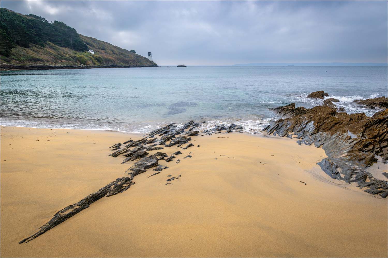
St Anthony Lighthouse from Great Molunan Beach

We climb back up to the path

Looking back along our path

A wall butterfly resting on a wall

Looking back to St Mawes

St Anthony Head

We continue around the headland

Shafts of light illuminating the sea

Zone Point

Zone Point is the southernmost extremity of the Roseland Peninsula

We follow a path across Drake's Downs

Porthmellin Head in the distance

Further along Drake's Downs

We descend towards Porthbeor Beach...


Porthbeor Beach below

Looking back along our path

We leave the coast at this sign and turn sharp left to head inland. The walk can be extended here by continuing along the coastal path and taking an inland route beside Porth Creek

We pass through the hamlet of Bohortha

We follow a track back across the Roseland Peninsula

Cellars Beach on the left and St Mawes in the distance

Place House comes back into view as we follow a lovely path down the fields towards Cellars Beach and Place Creek...


We rejoin our earlier path and retrace our steps back to the landing stage at Place Creek

Looking across to St Mawes as we await the Place Ferry

Here it comes....

Back to St Mawes...


A short stroll in St Mawes as we await the ferry back to Falmouth

Looking back to St Anthony Head as we head back to the ferry - thanks to Phil and Denise for recommending this wonderful walk
