
Route: Spurn Point
Area: East Yorkshire
Date of walk: 13th January 2016
Walkers: Andrew
Distance: 9.4 miles
Ascent: 400 feet
Weather: Sunny and cold
Spurn Point is a unique place – a spit of land 3.5 miles long and only 50 metres wide in places. It’s also a National Nature Reserve and a birdwatcher’s paradise. I was last here in 2013 and since then there has been a tidal surge which removed part of the road leaving a ‘wash over section’ which is now submerged at high tide, leaving the far end of Spurn Point an island at those times
There is no vehicular access to the Point – access is solely on foot, bike, or on a specially equipped vehicle operated by Yorkshire Wildlife Trust, which manages this place. Note that dogs are not allowed on Spurn in order to protect the sensitive wildlife and habitats
Having checked the tide times (which it is essential to do if undertaking this walk – check this link) I parked at the Bluebell Cafe car park and set off down the road, calling in at the information centre a little further along
Navigation couldn’t be easier and a map isn’t really necessary. I followed the road for a while and at the wash out section I walked along the beach, then crossed over to the estuary side nearer to Spurn Point. Having walked to the far end of the Point I retraced my steps back to the start – a circular walk is not possible, as is obvious when looking at the map
An amazing walk!
For other walks here, visit my Find Walks page and enter the name in the ‘Search site’ box
Click on the icon below for the route map (subscribers to OS Maps can view detailed maps of the route, visualise it in aerial 3D, and download the GPX file. Non-subscribers will see a base map)

Scroll down – or click on any photo to enlarge it and you can then view as a slideshow

Start of the walk from the car park behind the Blue Bell cafe

Part of a large flock of knots


I then crossed over and walked along the beach for a while, admiring the old sea groynes…


Walking down the road to the Nature Reserve

One of the Chalk Bank hides

Looking along the beach to the High Lighthouse (which is under wraps and being refurbished) and the Low Lighthouse

The Low Lighthouse and the jetty

The jetty, not open to the public

Zooming in on Bull Sand Fort about 1.75 miles away

Humber Lifeboat


Land’s end - Spurn Point, looking across the estuary to the fort


This is one of 2 forts built in WW1 and reactivated in WW2 to protect the estuary, with room for 200 soldiers - it’s now a Grade II listed building

I start the return journey and pass by the High Lighthouse again


High Tide Shelter, for those who have ignored the numerous warning signs

The ‘wash over’ section, where the road has disappeared

Curlew

Back on the road to the Bluebell cafe, where today’s walk will end

The information centre - plans are in hand for a much needed new visitor centre

A reminder on the cafe wall as to how fragile this place is

On the way home now, some roe deer in a nearby field

Seawatching hide near the information centre

Looking one way out to the North Sea….

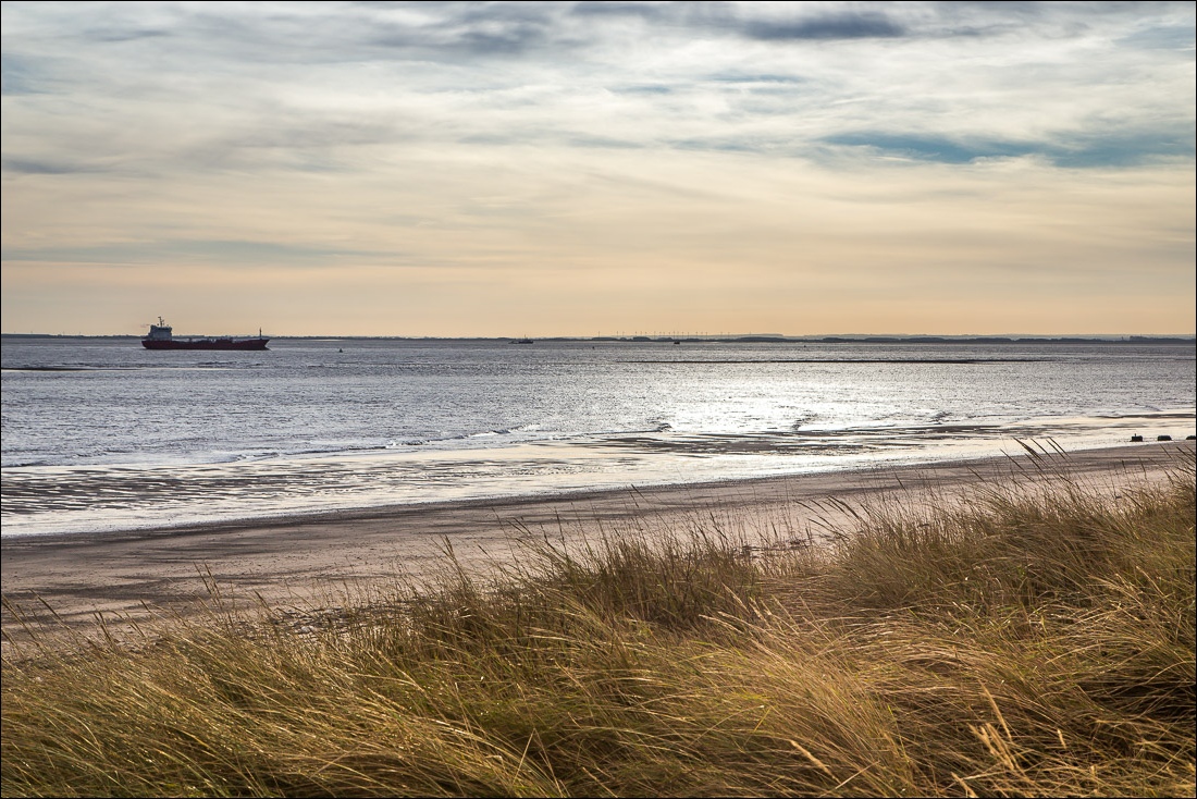
.and looking the other way over the Humber Estuary

There are several reminders of the dangers here - and remember to leave time for the return journey too

Looking out over the Estuary - this is Kilnsea Clays
