
Route: Hambleton Peninsula, Rutland Water
Area: Rutland
Date of walk: 10th April 2018
Walkers: Andrew and Gilly
Distance: 5.4 miles
Ascent: 500 feet
Weather: Very misty and damp
As a special birthday treat for Mrs Andrewswalks we were staying at Hambleton Hall, a wonderful hotel located on the Hambleton Peninsula. The obvious walk from here is the circuit of the peninsula – anyone not staying at the hotel could start from the village of Hambleton
Rutland Water is one of the largest artificial lakes in Europe, and by surface water area is the largest reservoir in England. It is also an internationally famous nature reserve managed by the Leicestershire & Rutland Wildlife Trust in partnership with Anglian Water, and provides one of the most important wildfowl sanctuaries in Great Britain, regularly holding in excess of 25,000 waterfowl
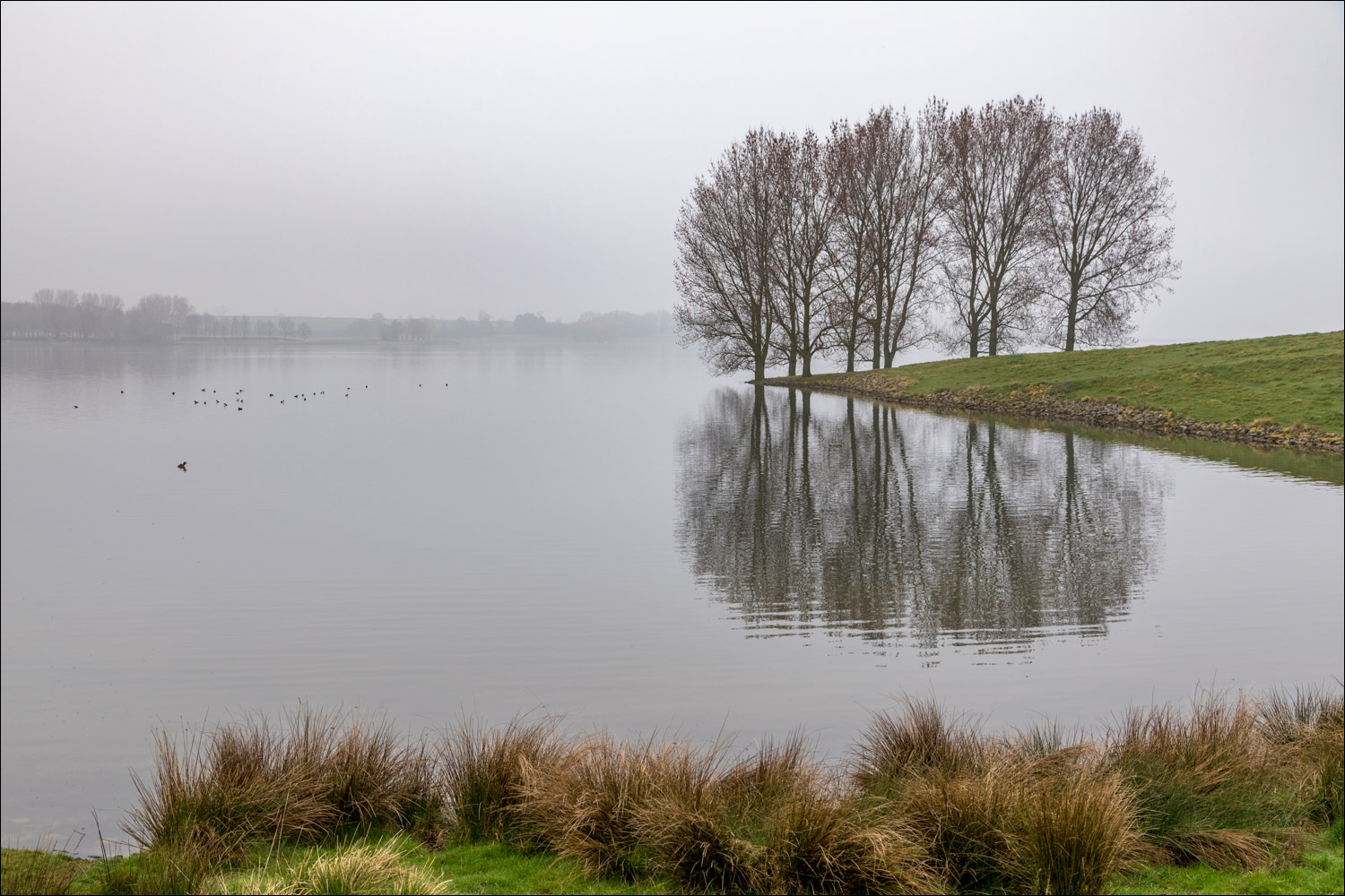
Sadly our arrival coincided with some truly miserable weather – thick fog shrouded the whole area and visibility was very poor, resulting in very few landscape photos in today’s offering – there was hardly any landscape to be seen. At least it wasn’t raining and, having come all this way, we decided to carry on with the planned walk. We left the hotel and walked through pretty Hambleton village, passing through the grounds of St Andrew’s Church to follow a path which took us down to the southern shore of the reservoir. At this point we joined the main path which loops around the peninsula – it’s wide and well signposted and it would be hard to go astray
As we ambled along we kept a sharp lookout for wildlife. There was plenty to be seen, but mostly in the misty distance. The path took us through Hambleton Wood (which will soon be covered by a sea of bluebells) to the tip of the peninsula and from here we made the return journey along the northern shoreline, leaving the main track to follow a muddy path back up the the hotel. Despite the miserable conditions we’d enjoyed the walk
We could have extended our route by continuing further along the shore, but we wanted to leave sufficient time to visit the Birdwatching Centre at Egleton, a short drive away, in the hope of spotting the iconic bird of Rutland Water – the osprey. The helpful staff directed us to the nearby Lyndon Visitor Centre, having advised us that there was a ‘100% chance’ of sighting an osprey. I’m not a betting man, but with odds like that we took the bet and drove to Lyndon, located at the edge of Manton Bay. I’ll let the final pictures tell the story as to whether we won our prize
Click on the icon below for the route map (subscribers to OS Maps can view detailed maps of the route, visualise it in aerial 3D, and download the GPX file. Non-subscribers will see a base map)

Scroll down – or click on any photo to enlarge it and you can then view as a slideshow

Hambleton Hall...

...and its gardens


We leave the hotel and walk into Hambleton village

A couple of the lovely cottages in Hambleton...


St Andrew's Church

We walk past the graveyard and leave via a path at the back of the church

What a shame - we can hardly see the other side of Rutland Water. We follow the path down to the shore...


On the main path now, and looking towards Old Hall in a remarkable location at the tip of a peninsula on another peninsula

A splendid pair of greylag geese


New born lamb

Heading towards Hambleton Wood

We follow the path through the wood

Tufted duck on the edge of Rutland Water...


Coppiced woodland in Hambleton Wood, and a woodland floor which will be blue next month

A good example of the art of hedge laying

Looking back along the shoreline

Another new born lamb

We continue along the shoreline path


Beyond Armley Wood we leave the main track to return to Hambleton Hall

Back in Hambleton, and the end of a walk which, in better weather, would be a superb choice for anyone visiting the area

A short while later, cormorants seen from the Egleton Birdwatching Centre. There's enough interest here for a full day's visit, but we were short of time and wanted to see the ospreys

Webcam trained on the osprey nest - this is the female 'Maya' sitting on 3 eggs

We then drove over to the nearby Lyndon Visitor Centre - this is the view of the nest from the Waderscrape Hide. There are 2 telescopes and informative volunteers here

When we arrived, the male osprey 'Number 33' was perching in a poplar tree some distance away

Zooming in on the nest as Number 33 flies down to visit Maya - the webcam is clearly visible

A conversation ensues, which I interpret as Maya telling Number 33 to bring back a fish

He dutifully complies...

These photos are for the record and will never be prize winners - the birds were a considerable distance away

For anyone interested in such matters, these photos were taken (in poor light) with a Canon 7D, 100-400 lens at 400mm, plus a 1.4 extender. That amounts to a massive 896mm focal range. The images have then been cropped


Last but not least, a moorhen gathering nesting material...

...and a pair of cormorants
