
Route: High Rigg
Area: Central Lake District
Date of walk: 31st December 2017
Walkers: Andrew and Gilly
Distance: 5.7 miles
Ascent: 1,300 feet
Weather: Cloudy, several showers, very windy on the tops
High Rigg is a wonderful little fell which punches well above its height on account of its rough and craggy nature, and being surrounded by higher fells it offers dramatic views in all directions
We parked in the car park at Legburthwaite and walked to the verge of the A591. From here there’s a thankfully very short 50 yard walk beside the busy road before a stile is reached, which leads into the woodland below the fell. The climb starts immediately, initially through some attractive old pine trees, until the ridge is reached. There are good views of Blencathra ahead and Thirlmere looking back, and I reflected on the pending planning application to install 8 zip wires across Thirlmere. Hopefully it will be refused, and I will be able to enjoy further walks in this area in the years to come, without the unwelcome sight and sound of zip wires – in a National Park and World Heritage Site of all places
We continued our walk along the knobbly spine of the fell, with innumerable ups and downs until the summit was finally attained near the end of the ridge. We didn’t linger there as our arrival coincided with a heavy shower and without ado we descended to St John’s Church and followed the higher of the two paths along St John’s in the Vale. The alternative lower path along the floor of the valley is equally attractive and a case could be made for either route back. The higher route is the shorter of the two
The weather today wasn’t on our side today, being mostly cloudy and with several showers but the beauty of the surroundings overcame this deficiency and we were glad we’d chosen to return to this special place
For other walks here, visit my Find Walks page and enter the name in the ‘Search site’ box
Click on the icon below for the route map (subscribers to OS Maps can view detailed maps of the route, visualise it in aerial 3D, and download the GPX file. Non-subscribers will see a base map)

Scroll down – or click on any photo to enlarge it and you can then view as a slideshow

Red squirrel before we set off this morning

After leaving the car park at Legburthwaite we walk to the foot of High Rigg and fork off to the left here. Our return path is the one on the right

We climb up towards Wren Crag

Looking back to Castle Rock...

...and to the car park below

Thirlmere - surely not a suitable site for a zip wire attraction?

Looking along the High Rigg ridge towards Skiddaw

Castle Rock again, behind some of the old pine trees which adorn the lower slopes of the fell

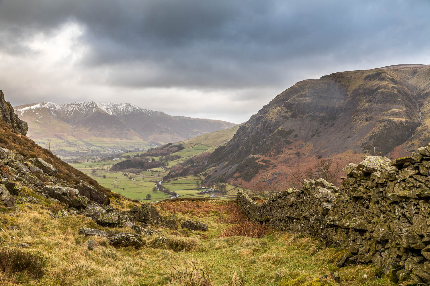
St John's in the Vale, with Blencathra beyond

Blencathra, with Clough Head on the right

Skiddaw in the distance

Another view of Blencathra

Looking across the valley to the flanks of Clough Head

Thirlmere

Helvellyn

Thirlmere again, much in my thoughts at the moment

Bonnie

A view back along our path

A lone tree, with Blencathra in the background

As we continue along the knobbly ridge, the summit of High Rigg comes into view

Summit cairn of High Rigg - it was raining quite heavily here, so we carried on without stopping

Start of the descent to the Youth Centre below

Blencathra again, well seen from here

We arrive at the col between High Rigg and Low Rigg

At the foot of the col we pass by tiny St John's Church

We walk along the quiet lane for 50 yards or so and leave it here to traverse the northern flank of High Rigg

Blencathra above Bridge House and St John's Beck

Start of the return leg along St John's in the Vale...


Blencathra again

We pass by the ruins of an old barn

The path snakes around the lower slopes of High Rigg

Looking back along the path to Lonscale Fell

Another shower as we continue along the valley path...


A view back along the valley

Low Bridge End Farm - a good place to stop for refreshments

Clough Head

Beyond the farm the path rises steeply above St John's Beck

We round the foot of High Rigg and complete the circuit just beyond this point

We follow the track back to the start of our last walk in 2017 - here's looking forward to more adventures next year
