
Route: Circuit of Rydal Water
Area: Central Lake District
Date of walk: 29th October 2015
Walkers: Andrew
Distance: 5.4 miles
Ascent: 800 feet
Weather: some weak sun
It had been raining heavily all morning but at last the clouds lifted and there was time for a low level walk. I drove over to Rydal and parked along the lane by St Mary’s Church. After walking through the grounds of the church I crossed the Grasmere road and followed a path down to the shore of Rydal Water
The path hugs the shoreline for much of the way, then rises gently. Beyond the end of the lake I carried on uphill to join the beautiful elevated path known as Loughrigg Terrace – the views over Grasmere are spectacular from here
At the end of the terrace I descended to the shore of Grasmere, crossed the footbridge just beyond the weir, and walked through part of White Moss Common. This led me to the Grasmere road which I crossed, and then followed a path uphill to join the old Coffin Road, so called as it was used to take the dead of Rydal for burial in Grasmere
The Coffin Road took me back into Rydal to complete the circuit of the lake
For other walks here, visit my Find Walks page and enter the name in the ‘Search site’ box
Click on the icon below for the route map (subscribers to OS Maps can view detailed maps of the route, visualise it in aerial 3D, and download the GPX file. Non-subscribers will see a base map)

Scroll down – or click on any photo to enlarge it and you can then view as a slideshow

The day before the walk - Crummock Water at dawn…

…and nearby Lorton Vale at dusk - in between those times it rained all day

Next day, more rain and a red squirrel using its tail as an umbrella


Later on, the rain stopped at last, and at the start of today’s walk I pass through the grounds of St Mary’s Church Rydal

Dora’s Field - when Wordsworth’s daughter Dora died he planted hundreds of daffodils here in her memory

I cross the footbridge over the River Rothay

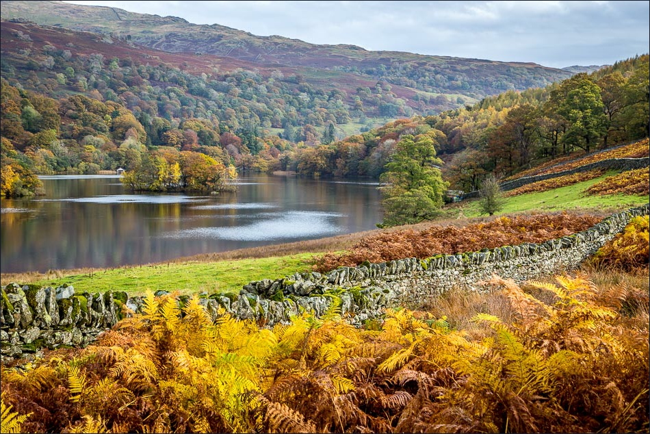
Rydal Water


The boathouse

Further along the lakeshore path


Looking back to the boathouse

…and again

The path climbs gently uphill


Looking back


There is another path below, but I prefer to climb up to Loughrigg Terrace


Grasmere from Loughrigg Terrace

There are several benches along the terrace from which to enjoy the wonderful view…


Redbank Wood


I turn sharp right here to descend to the shore of Grasmere


Autumn colours on Grasmere

The weir at the foot of Grasmere

Just beyond the weir, I cross this footbridge over the River Rothay, which supplies Rydal Water from one end and drains it from this end

I follow the path by the riverbank

Looking along the Rothay

Having left the riverbank path and crossed the Grasmere road, I pass by this waterfall in White Moss Common

A short climb uphill brings me to the old Coffin Road back to Rydal

Rydal Water from the elevated path


I passed by Rydal Hall and made a short detour to visit the magnificent gardens, landscaped by Thomas Mawson in Edwardian times


View from the window of The Grot, Grade II listed, and built in 1668 to provide a view of the waterfall

Rydal Hall

I leave the lovely grounds via this gate…

…and one minute later I’m back to the start at St Mary’s Church - what a wonderful walk
