
Route: Hopegill Head and Whiteside
Area: Western Lake District
Date of walk: 8th April 2017
Walkers: Andrew and Gilly
Distance: 5.0 miles
Weather: Sunny, no wind, rather hazy
On a glorious spring morning, with not a cloud in the sky, we parked in the small roadside space on the gated road to High Swinside. We walked along the road and at the top of the drive to High Swinside Holiday Cottages we started the climb up the grassy slopes of Swinside. This was very steep in places and we emerged huffing and puffing on the ridge leading to Ladyside Pike
As we followed the easy path along the ridge we could see the whole walk laid out in front of us – the summit of Hopegill Head, the ridge to Whiteside, and our line of descent down to Dodd
The crags below Hopegill Head are a fearsome sight, and if we’d not walked this way on several occasions we’d have been in doubt about the viability of the route. This involved a mild scramble but we were soon on the summit of Hopegill Head, propelled there by a dose of adrenalin
There then followed the highlight of the walk – the wonderful ridge leading to Whiteside, which is narrow enough to be exciting but not so narrow as to cause palpitations. This is one of my favourite miles in lakeland, and it was with reluctance that we turned the path on reaching the east top of Whiteside. We didn’t have time for the short ‘there and back’ diversion to the west top, but I’d recommend this as the views from there are superior
We followed the easy path down the slopes leading to Dodd and on reaching the col we descended to Hope Beck (pathless in parts). There’s no bridge over the beck, but unless it’s in full spate it’s easily forded in various places. Having crossed the beck it was a short stroll back to the start of a wonderful walk
For other walks here, visit my Find Walks page and enter the name in the ‘Search site’ box
Click on the icon below for the route map (subscribers to OS Maps can view detailed maps of the route, visualise it in aerial 3D, and download the GPX file. Non-subscribers will see a base map)

Scroll down – or click on any photo to enlarge it and you can then view as a slideshow

Rhododendron in the garden the day before the walk...


Red squirrel before the start of the walk

A short while later, looking towards Lorton Dodd from the parking space on the gated road

We set off in the direction of High Swinside

We leave the road here to follow a faint path up the flanks of Swinside

Looking along Lorton Vale at the start of the climb

Lorton beyond High Swinside Holiday Cottages - Scotland and the Solway Firth can be seen from here, but it was too hazy today

We toil up the steep grassy slope

Sweet Lorton Vale...


We follow the ridge towards Ladyside Pike

Looking across the valley to our eventual descent route - down the small cleft towards the right of the photo

Summit of Ladyside Pike, with the rather intimidating view of Hopegill Head

Grisedale Pike, and Blencathra in the distance

We continue along the Ladyside Pike ridge, following the line of a collapsed dry stone wall

Bonnie contemplates the final steep section up to Hopegill Head

Looking back along our route

After a scrambly final section we reach the small summit of Hopegill Head

Grisedale Pike from the summit

We set off along the wonderful ridge leading to Whiteside...


Gasgale Gill and the head of Crummock Water

Looking back to Hopegill Head

Bonnie below the summit of Whiteside

Coledale Hause and Gasgale Gill

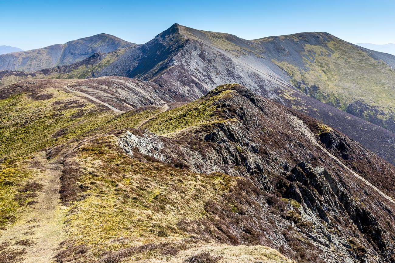
Another view back along the ridge

Dove Crags below Grasmoor

The west top of Whiteside seen from the east top - we turn right here to start our descent

Heading down towards Lorton Dodd

At the foot of Dodd we follow the path through an old quarry

Looking back up the valley to Hopegill Head

We take a pathless route towards Hope Beck

Hope Beck below

Looking up the beck to Hopegill Head

A view across Lorton Vale to Low Fell

The local farmer Christine has erected a small barrier on the path to keep the tadpoles safe

We arrive back at the start
