
Route: Beda Fell
Area: Far Eastern Lake District
Date of walk: 30th September 2016
Walkers: Andrew
Distance: 4.9 miles
Ascent: 1,300 feet
Weather: Sunshine and showers
Beda Fell bisects two beautiful valleys in the far east of the district – Howe Grain and Boardale – and thanks to its remoteness it’s a good place to get away from the madding crowds. At the risk of sounding anti-social, the Martindale area in which the fell is located is one of my favourite areas in the lakes
I parked in one of the few roadside spaces by Christy Bridge and after crossing the bridge I climbed up a path which leads to the start of the north ridge of the fell. Having gained the ridge I made my way up to Beda Head (the summit of the fell) via Winter Crag. It was fairly easy going though some heavy rain showers didn’t help progress
Having reached the top I carried on along the ridge across squelchy terrain for some distance until I arrived at Bedafell Knott, where I turned sharp left to begin the gentle descent back into the valley. As I did so I kept a look out for red deer, which I’ve often seen in this area, and sure enough I had a good sighting of a herd of 20 or more
The path took me down to Dale Head and from here it was a stroll along the narrow valley lane back to the start
For other walks here, visit my Find Walks page and enter the name in the ‘Search site’ box
Click on the icon below for the route map (subscribers to OS Maps can view detailed maps of the route, visualise it in aerial 3D, and download the GPX file. Non-subscribers will see a base map)

Scroll down – or click on any photo to enlarge it and you can then view as a slideshow

One of the Ullswater Steamers at Howtown seen on the way to Martindale

A few minutes later, St Martin’s Church at the start today’s walk - known as the ‘Old Church’ to avoid confusion with nearby St Peter’s

Looking the other way, to Christy Bridge

Howegrain Beck and Howe Grain from the bridge


Looking back to Howe Grain

The Coombs at the foot of Hallin Fell, seen from Howsteadbrow

Howe Grain again

A view of Ullswater as I gain the ridge leading up to Beda Fell

The northern end of Ullswater, the middle section being hidden behind Hallin Fell

A poor photo, but the only one I could manage of the route ahead, as the wind was driving rain into the camera lens

Retrospective views of Ullswater as I gain height…


Path leading up to Boredale Hause

Cairn below Beda Head

A small shelter near the summit

Looking down into Boredale

Summit cairn on Beda Fell, looking back over Ullswater

Steep crags on the left make a descent from the summit dangerous, and it’s necessary to carry on along the summit ridge until it rises to Angletarn Pikes

The head of Boredale…

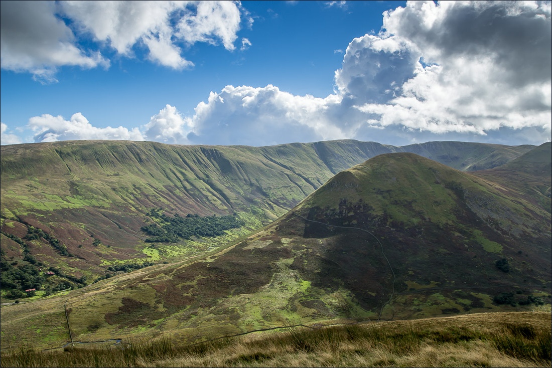
…and the head of Bannerdale, which is an extension of Howe Grain

The Nab

Having left the ridge, I start the gentle descent back into Howe Grain

Red deer on the slopes of Beda Fell

Almost back down to valley level

More red deer


Dale Head

One of several old stone barns on the way back along the valley

The remainder of the walk is along a narrow road but as it’s a dead end there’s little or no traffic

Looking across Howe Grain


Looking back down the valley

Christy Bridge, and the end of the walk is just round the corner

From the bridge, a last look along this beautiful valley
