
Route: Whiteside
Area: North Western Lake District
Date of walk: 5th June 2018
Walkers: Andrew
Distance: 5.6 miles
Ascent: 2,100 feet
Weather: Sunshine and blue skies
It’s been a while since I was last up Whiteside, one of my favourite fells, and a return visit was overdue. I parked in the small parking area (room for 4 or 5 cars only) on the gated road to High Swinside. For anyone else following this walk, and wanting to get the climbing out of the way early, another good starting point would be Lanthwaite Green. Either way, the route should be walked anti-clockwise in order to enjoy the lovely views along Lorton Vale, and also in order to tackle the Whin Ben route as an ascent and not a descent
From the parking space I followed the terraced path above Lorton Vale, keeping the intake wall on my right. The views along the path get better and better, though several boggy sections will be encountered no matter how dry the weather has been
Eventually it was time to leave the valley path as I arrived at the foot of Whin Ben (‘incomparably the best route up’ according to Wainwright), and here the collar work began. There are 3 steep sections along the way when hands need to be taken out of pockets: the final section before Whin Ben top, a rocky mount mid way between Whin Ben and Whiteside, and the final push to the summit. These all involve some enjoyable and perfectly safe clambering, though I wouldn’t like to descend this way
I arrived at the summit cairn, which is not the highest point, and after gazing at the wonderful views made my way along to the true summit. I resisted the temptation to carry on along the ridge to Hopegill Head, and started the gentle descent down the path to Dodd – this provides an easy way off the fell. On arriving at Dodd Pass I headed down to Hope Beck and forded it lower down (in very wet weather this can sometimes be problematic). From here it was a short stroll back to the start of a superb walk
For other walks here, visit my Find Walks page and enter the name in the ‘Search site’ box
Click on the icon below for the route map (subscribers to OS Maps can view detailed maps of the route, visualise it in aerial 3D, and download the GPX file. Non-subscribers will see a base map)

Scroll down – or click on any photo to enlarge it and you can then view as a slideshow

View from the parking space by the gated road to High Swinside at the start of today's walk

Lorton Dodd - the ridge behind it, hidden from view, will be the descent route at the end of the walk

Hopegill Head and Whiteside

The wonderful path which runs along Lorton Vale with a soggy section ahead despite the lack of rain for many days

Looking across the vale to Low Fell

A view back along the path

Miller Place below

Looking back towards Lorton and Cockermouth - on a clearer day Scotland and the Solway Firth would be visible from here

I follow the path between these two dry stone walls

Mellbreak ahead, and Lanthwaite Hill below it

Left to right: Mellbreak, Hen Comb, Gavel Fell and Low Fell

Mellbreak again

The rounded cone of Red Pike

The last photo along the valley path before I turn off to the left to start the ascent of Whiteside via Whin Ben

An early view back to Crummock Water and Mellbreak

Heading for Whin Ben - easy going in the early stages

Looking along Gasgale Gill as the gradient steepens

Low Fell and Fellbarrow across Lorton Vale

A view back down the path

Above Whin Ben, a brief respite on a grassy plateau as Whiteside comes into view

Looking back to Crummock Water

An easy section follows, until the rocky knoll ahead is reached

A view back to Whin Ben and Mellbreak

Gasgale Gill, and Grasmoor on the right

The path continues to trend up to the left

Grasmoor

Crummock Water

A view back along the path

Gasgale Gill as I approach the summit of Whiteside...

...and again

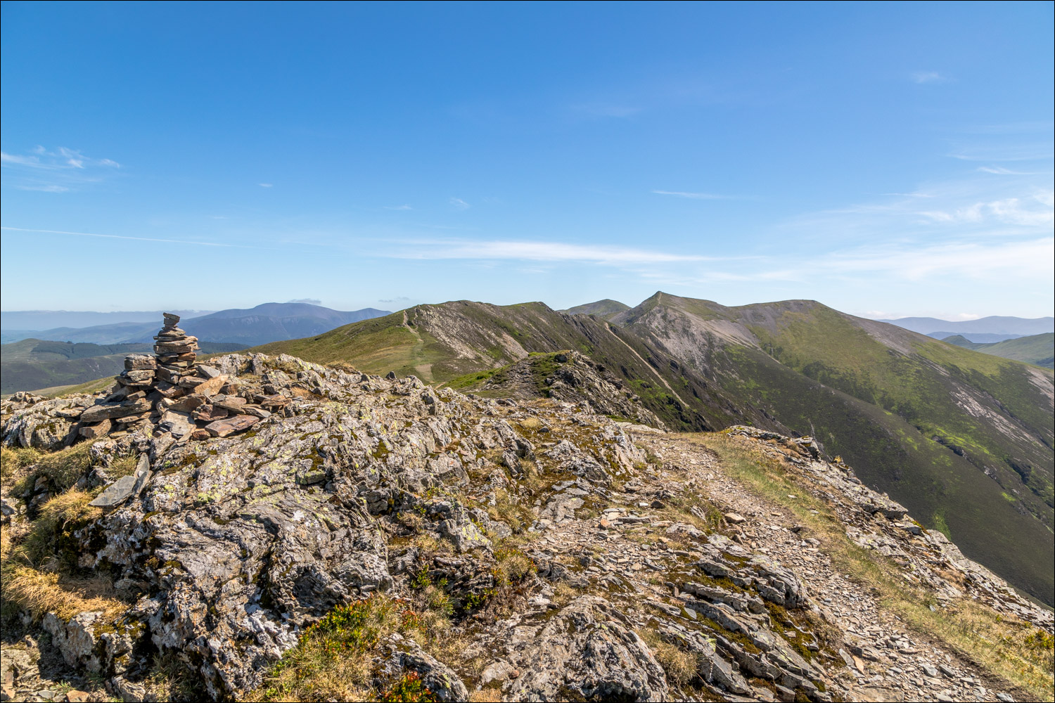
Summit cairn on Whiteside, looking along the ridge to Hopegill Head

Crummock Water from Whiteside...

...and Loweswater

Grasmoor

Spectacular views over Gasgale Crags

A view back to the summit cairn as I continue along the ridge

The wonderful path to Hopegill Head, one of my favourites in the district, but there's no time for that today, and I'll descend to the left near this point

A final view of Crummock Water

Start of the descent down the Dodd ridge, with Lorton beyond

Dodd Pass, where I turn right to head towards Hope Beck

Looking back up the valley to Hopegill Head

Lorton Vale, as I follow a series of faint paths down to Hope Beck

The circuit is complete, and a final look back along the path I'd taken at the start of the walk

Later in the day, it was a privilege to enjoy more sightings of the endangered spotted flycatcher in the garden


