
Route: The Ullswater Way Stage 1
Area: North Eastern Lake District
Date of walk: 4th May 2016
Walkers: Andrew and Gilly
Distance: 11.3 miles
Ascent: 1,700 feet
Weather: Cloudy with sunny intervals
The Ullswater Way is a new 20 mile long walking route which circumnavigates Ullswater using existing rights of way and quiet public roads. Walkers are encouraged to start from any point, travel in any direction, and break the route down into sections. What an excellent idea, and congratulations to the partnership which promoted this, including the Lake District National Park Authority, See More Cumbria and the Lake District, The National Trust, Eden District Council, Ullswater Steamers and the Ullswater Association
We decided to take advantage of the Ullswater Steamers and having purchased tickets for 2 adults and 1 dog at Glenridding we disembarked at Pooley Bridge an hour or so later after a wonderful boat trip along the length of the lake
I strongly recommend that anyone following this route walks the way we did today – from the foot of Ullswater to its head. In this way, the best scenery is ahead of you as you walk, and the best is kept until last. The section from Pooley Bridge to Gowbarrow Park was unfamiliar to us, and followed unfrequented paths and lanes through gently rolling countryside. When we reached Gowbarrow Park there followed a walk in heaven – the elevated path around the flanks of the fell with its superlative views to the head of the lake. This is one of the best paths in the district and one that you hope will never end
When the path finally does come to an end at Aira Force there’s no anti climax as the huge waterfall and the surrounding parkland await, followed by a stroll through Glencoyne Park and a final section close to the shore of the lake. Strong walkers with plenty of available daylight hours could no doubt accomplish the walk in a single day but we were perfectly content with our efforts today which left us with a sense of anticipation about the next stage of this great walk
Click on the icon below for the route map (subscribers to OS Maps can view detailed maps of the route, visualise it in aerial 3D, and download the GPX file. Non-subscribers will see a base map)

Scroll down – or click on any photo to enlarge it and you can then view as a slideshow

Red squirrel in the garden before we set off this morning

Later on at Glenridding Pier and waiting for the 9.45am Ullswater Steamer to Pooley Bridge


Looking into Patterdale as we leave Glenridding


Near Pooley Bridge we pass by another Ullswater Steamer - Lady Wakefield, which was beached following Storm Desmond a few months ago


We disembark at the landing stage near Pooley Bridge

Another reminder of the havoc caused by this dreadful storm

We walk along the road and this path across the foot of the lake for a short distance before heading inland to Waterfoot

The path is well waymarked, though this is presently work in progress and it’s best to take an OS map

Looking back to Dunmallard Hill, with the North Pennines in the distance

Lovely countryside near Waterfoot

Ullswater from Maiden Castle (nothing remains of the castle itself, but its footprint is clearly visible)

A road section on the way to Bennethead, but these are quiet country lanes and we didn’t encounter any traffic

We pass through Bennethead

Looking across to Ullswater


We approach Swinburn Park

Tree felling operations around here made the hillside rather unsightly, but had the benefit of opening up the views

A woodland section further along

We emerge from the woods to more fine views…

Gowbarrow Park ahead - we’d been keenly anticipating this section

Looking across to Howtown

One of the Ullswater Steamers on the way back to Glenridding

The start of the heavenly terrace path which runs round the flanks of Gowbarrow Fell

Looking towards the foot of the lake

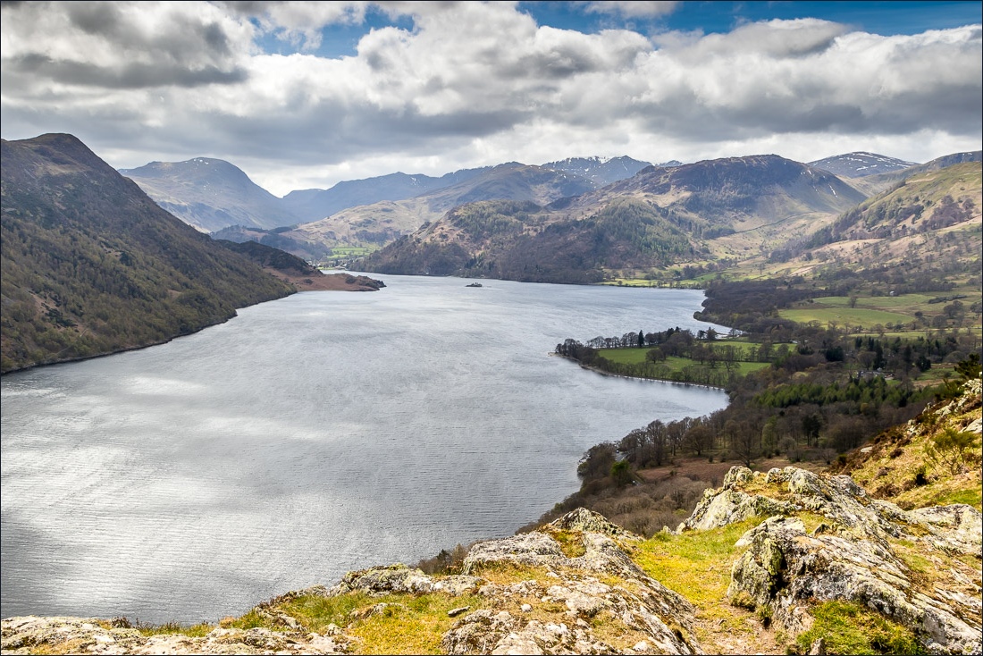
As we round the corner of the fell, superb views to the head of the lake open up

The cairn above Yew Crag - a spectacular viewpoint…


The path gradually descends in the direction of Glencoyne

Aira Point again

Glencoyne ahead. We’ll be walking through there shortly but first a diversion…

…Aira Force


After refreshments at the National Trust tearoom we walked into Glencoyne Park


Walking through Glencoyne Park

The path hugs the shore of Ullswater all the way back to Glenridding

Norfolk Island


The end is in sight as we approach Glenridding Pier

Back to the start - a wonderful walk and thanks to all those who devised the Ullswater Way
