
Route: Circuit of Rydal Water
Area: Central Lake District
Date of walk: 19th December 2016
Walkers: Andrew
Distance: 3.3 miles
Weather: Very misty
Today’s walk was an unplanned one – I’d prepared for a longer walk in the Langdale area, but as I drove over Dunmail Raise I was confronted by a thick bank of cloud, and on the descent towards Grasmere I became surrounded by murky fog. It was clear that there would be no long distance views in this part of the lakes, so it was time for a re-think
I decided instead to walk round Rydal Water which looked quite atmospheric as I drove by. I parked on the roadside at Rydal Mount and after crossing the A591 I joined the footpath which leads to the foot of Rydal Water
I followed the easy path which runs along the southern shore of the lake (heavenly Loughrigg Terrace is higher up but there would have been no views from there), and after crossing the footbridge over the river I set out along the return leg. In better weather I’d have followed the higher level Coffin Road but had to compromise again. I followed the footpath beside the busy A591, not a route I’d recommend normally but at least I had some views of the lake which would have been invisible from higher up
For other walks here, visit my Find Walks page and enter the name in the ‘Search site’ box
Click on the icon below for the route map (subscribers to OS Maps can view detailed maps of the route, visualise it in aerial 3D, and download the GPX file. Non-subscribers will see a base map)

Scroll down – or click on any photo to enlarge it and you can then view as a slideshow

The start of the walk as I cross the footbridge over the River Rothay

The River Rothay, which eventually flows into Windermere

First sight of Rydal Water

Rydal Woods

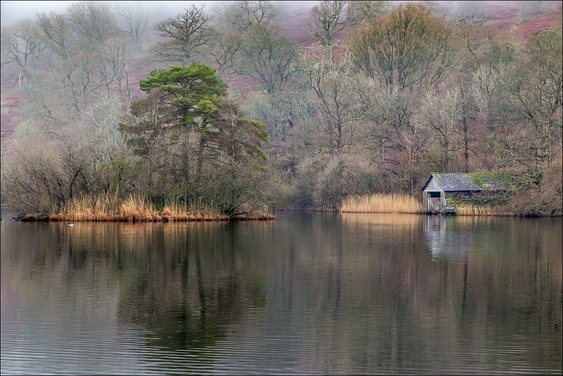
The boathouse

There is a higher level path to the left, but I stick to the lakeshore path

Little Isle and Heron Island

Little Isle, and my thanks to this pair of swans for posing so obligingly


The path rises gently above the lake

I pass by the ruins of an old barn

A woodland section beyond the head of the lake

I cross the attractive footbridge over the River Rothay as it flows from Grasmere into Rydal Water


The lakeshore section beside the A591


A flock of Canada Geese on the other side of the road, below Nab Scar

The geese take flight…

…but I catch up with them a little further along

Looking across to Little Isle

The boathouse again, and from here it’s a short stroll back to the start

Before setting off for home I made a quick diversion to visit the nearby ‘Grot’, built in 1694 in order to view Rydal Falls
