
Route: Rothbury Circular
Area: Northumberland
Date of walk: 30th March 2015
Walkers: Andrew and Gilly
Distance: 5.8 miles
Weather: Hazy sunshine, bitterly cold wind
It was the last day of our wonderful short walking holiday in Northumberland. We’d been staying at b Cottage in the attractive and unspoilt village of Rothbury and would highly recommend the cottage to anyone planning to visit the area
We walked out of the cottage door and just before the village centre we turned right along a lane which took us down to the River Coquet. We crossed the river over the footbridge and walked up the road to the lovely village of Whitton
A track known as Hillhead Road took us to the highest part of the walk at 700 feet, Whitton Hillhead. Hats and gloves were needed as there was a bitingly cold wind up there
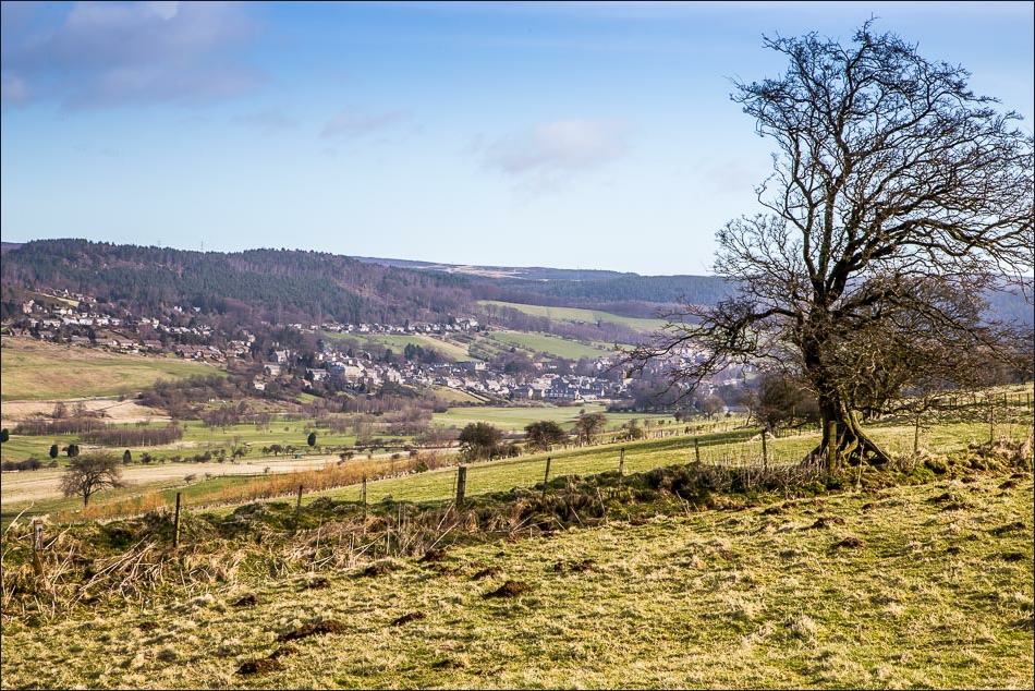
We then made the gentle descent through fields into Coquetdale, with big views ahead of us all the way down – a delighful section of the walk
The last leg was along the bank of the River Coquet. A well made path took us back into Rothbury, and after a wander round the village we returned to our cottage and set off for home, already planning our next visit to Northumberland with its infinite walking opportunities
Click on the icon below for the route map (subscribers to OS Maps can view detailed maps of the route, visualise it in aerial 3D, and download the GPX file. Non-subscribers will see a base map)

Scroll down – or click on any photo to enlarge it and you can then view as a slideshow

No car journey needed - we started the walk from the doorstep of the cottage

We walked into the attractive little town

Just before the town centre we turned off down a quiet street leading to the River Coquet

We crossed the footbridge

Looking along the River Coquet

We walk uphill to the nearby village of Whitton

Looking down Whitton Bank back to Rothbury

Leaving Whitton along Hillhead Road

Sharp’s Folly


Hillhead Road

Looking across to Rothbury

Approaching Whitton Hillhead

Lovely Coquetdale

Descending into Coquetdale

Looking across to Rothbury

Spring lambs


We pass through the small village of Newtown


Walking along Coquetdale

We cross the footbridge over the River Coquet

Looking along the river from the footbridge

Looking back along the valley path

A well made path along the riverbank takes us back into Rothbury

Back in Rothbury

A Dipper

Walking back through the town

The end of the walk, and the end of our short walking holiday in this beautiful county
