
Route: Riggindale Horseshoe
Area: Far Eastern Lake District
Date of walk: 5th June 2014
Walkers: Andrew
Distance: 8.0 miles
Weather: drizzle and rain to start, clearing later on
I parked at the head of Haweswater, not a lake but a reservoir, created in 1929 when a dam was built to raise the level of the original lake, drowning two villages in the process. The reservoir now supplies a quarter of the water supply of the North West
As I drove along the shore I could see the whole round at a glance and it seemed that all the tops I was heading for were clear, so it was game on and no need to resort to my low level alternative of walking round the lake
A long ridge leads to the first fell on the Riggindale Horseshoe round – High Street – but when I was half way up the mist came down and it started to rain quite heavily, to the extent that I considered abandoning the walk. I dithered around for a while weighing up the pros and cons and in the end decided to soldier on, hoping it would clear. Luckily it did, though High Street was still in the mist when I finally reached the end of the ridge. I walked along the Straits of Riggindale, keeping a look out for England’s only resident golden eagle who has lived here since 2001 and is looking for a mate. He didn’t make an appearance today
The next fells in order of appearance were The Knott (which wasn’t on my planned route but was so close that it seemed rude not to pay a visit), Rampsgill Head and finally Kidsty Pike. The weather cleared up towards the end and it was a pleasant descent back to the start
Click on the icon below for the route map (subscribers to OS Maps can view detailed maps of the route, visualise it in aerial 3D, and download the GPX file. Non-subscribers will see a base map)

Scroll down – or click on any photo to enlarge it and you can then view as a slideshow

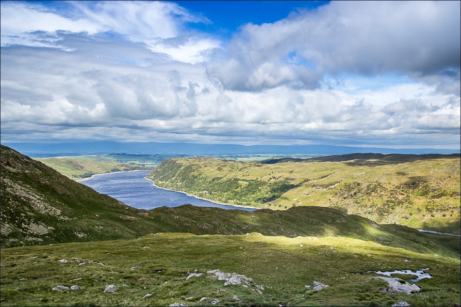
Shortly before the car park, I can see the horseshoe clearly - the ridge to High Street in the middle and the final fell Kidsty Pike to the right

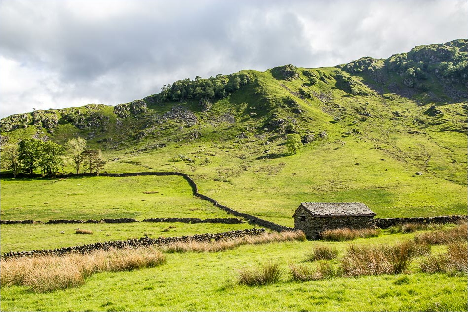
Walking beside the head of Haweswater before the start of the climb up the ridge to the left
Looking back to the car park at Mardale Head

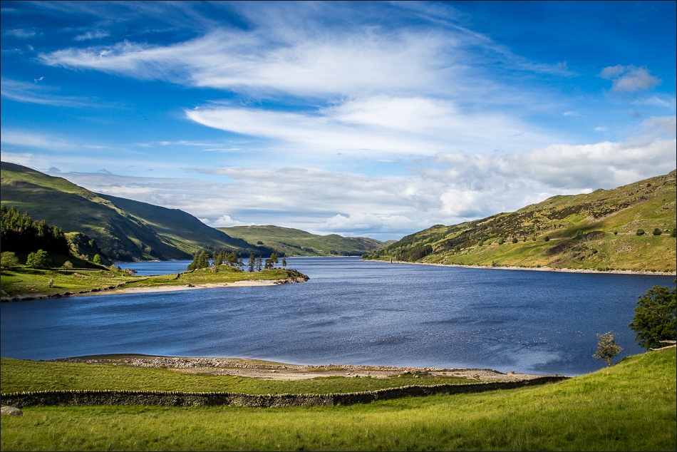
Haweswater

… and again from higher up - the reservoir has blended into its surroundings now and seems like a natural lake

After a spell of quite heavy rain and low mist, the weather clears and I carry on up the ridge

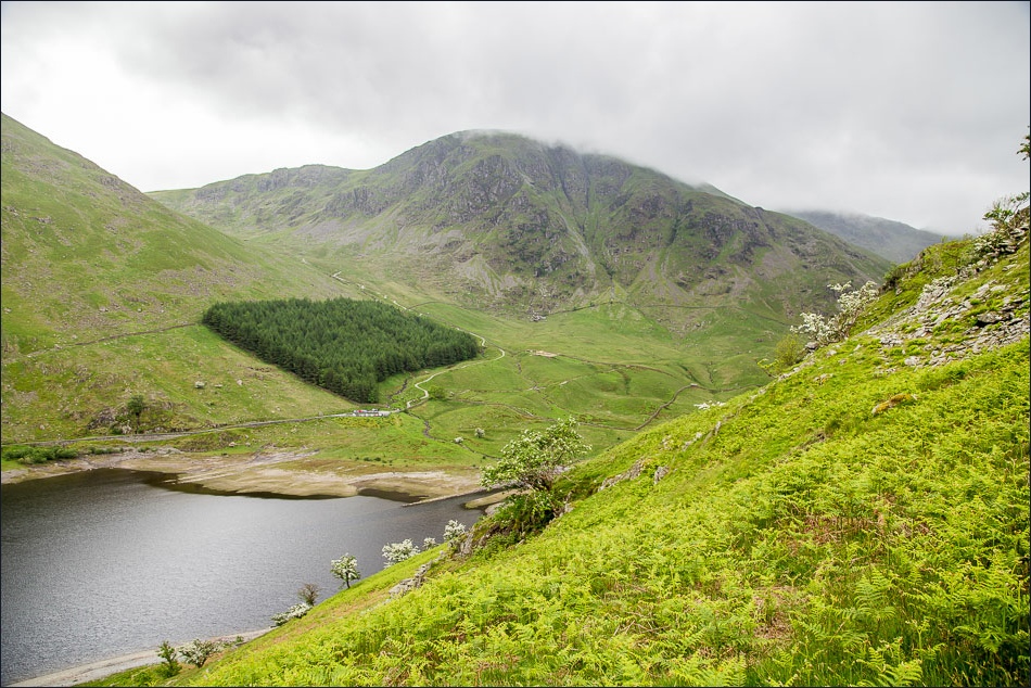
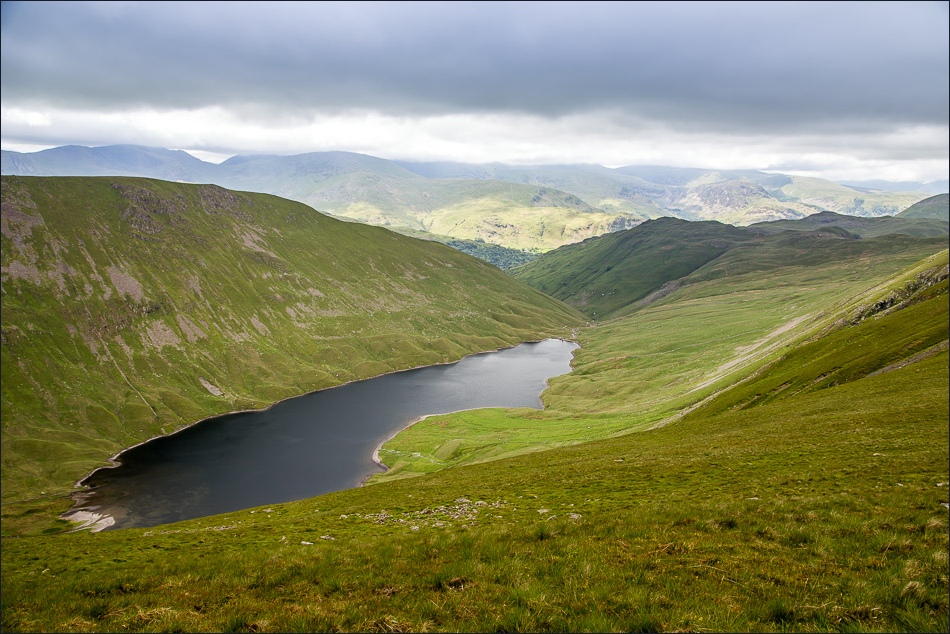
Blea Water

My pulse quickens as I look up to Riggindale Crag before the final push to the summit of High Street, out of sight in the mist

Blea Water and Blea Water Crag

Looking back along the ridge

Nearly up to High Street now

OS trig point at the summit of High Street - no views as I was in the mist

Below the cloud base now, and walking along the Straits of Riggindale, a view of Deepdale appears

My route is over to the right but at this point I decide to visit The Knott, just beyond the brow ahead

Looking back to Haweswater along the ridge I’d climbed earlier
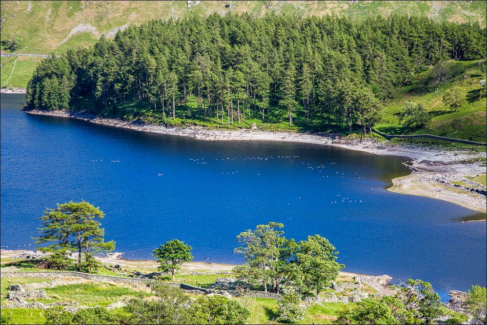
Hayeswater

The Knott ahead

Looking back to High Street

Summit of The Knott, with a glimpse of Ullswater

The Nab on the left - and the Deer Forest, not much of a forest but there is a thriving red deer population in the valley

From the summit of Rampsgill Head looking back to High Street

Leaving Kidsty Pike to descend back down to Haweswater

Further down the path, some sun and blue sky

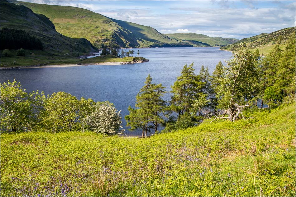
Haweswater

Haweswater, with The Rigg pointing towards the little island of Wood Howe
The Rigg
Down to valley level now, and I walk round the foot of the ridge which I’d climbed earlier
What a rapid change in the weather!

As I round the corner of The Rigg, the car park comes into view, just below the wood

On the way back I stop the car to take this photo of the dam at the other end of Haweswater, holding back 84 billion litres of water
