
Route: Nunnington
Area: North Yorkshire
Date of walk: 9th October 2015
Walkers: Andrew
Distance: 8.5 miles
Ascent: 500 feet
Weather: Sun and blue skies but hazy
I parked in the National Trust car park at Nunnington Hall (parking is free for members) and walked into the grounds of the hall, an old manor house famed for its picturesque location. The hall itself was not due to open for an hour or so, which was a bonus in some ways as I had the gardens to myself
After strolling round the beautiful grounds for a while I followed a quiet lane for a short distance, heading west, before joining the path beside the River Rye
At Low Moor Plantation I left the riverside path to walk steadily uphill to Stonegrave, and then folowed another path which took me up to Caulkelys Bank. A bridleway follows the top of the bank for about 1.5 miles and this was a stunning section of the walk, with huge views over the surrounding countryside, though marred today by a persistent haze
I made the gradual descent down Caulkleys Lane to West Ness to rejoin the River Rye and followed its banks back into Nunnington. It had been another great walk in this Area of Outstanding Natural Beauty
Click on the icon below for the route map (subscribers to OS Maps can view detailed maps of the route, visualise it in aerial 3D, and download the GPX file. Non-subscribers will see a base map)

Scroll down – or click on any photo to enlarge it and you can then view as a slideshow

From the car park, crossing the footbridge to Nunnington Hall

The River Rye

I enter the beautiful grounds of the hall


Autumn crocus

I leave Nunnington Hall and walk through the unspolit village


Near the end of the village I pass through the gate ahead to join the riverside path

The River Rye

My route follows the river as far as the track known as High Moor Lane


The end of the riverside section as I approach Low Moor Plantation

Looking back along the path

High Moor Lane

I cross over a quiet lane

I continue gently uphill - this is looking back along the track

Descending to Stonegrave

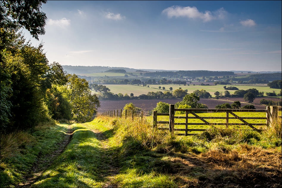
Just beyond this point I turn left to climb up to Caulkleys Bank


Looking back


On Caulkleys Bank


Speckled Wood butterfly

I descend from the bank along Caulkleys Lane


After walking through the small settlement of West Ness I join the riverside path which takes me back to Nunnington

The River Rye again


A flock of greylag geese


Approaching Nunnington

I pass by Nunnington Hall and return to the car park to end a wonderful walk
