
Route: Macleod’s Stone and Traigh Iar
Area: Scotland, Isle of Harris
Date of walk: 7th March 2018
Walkers: Andrew and Gilly
Distance: 2.0 miles
Ascent: 400 feet
Weather: Sunny spells
After this morning’s short but stunning walk, there was still plenty of time for another walk and, inspired by the beach scenery we’d enjoyed earlier, we drove north along the coast and parked in one of the roadside spaces at the south end of Traigh Iar. We passed through a gate and descended to the beautiful little beach, which was completely deserted. As we looked out to sea we spotted two large birds circling in the skies, and the binoculars confirmed that it was a pair of eagles, a thrilling moment. They were too distant for a photo unfortunately
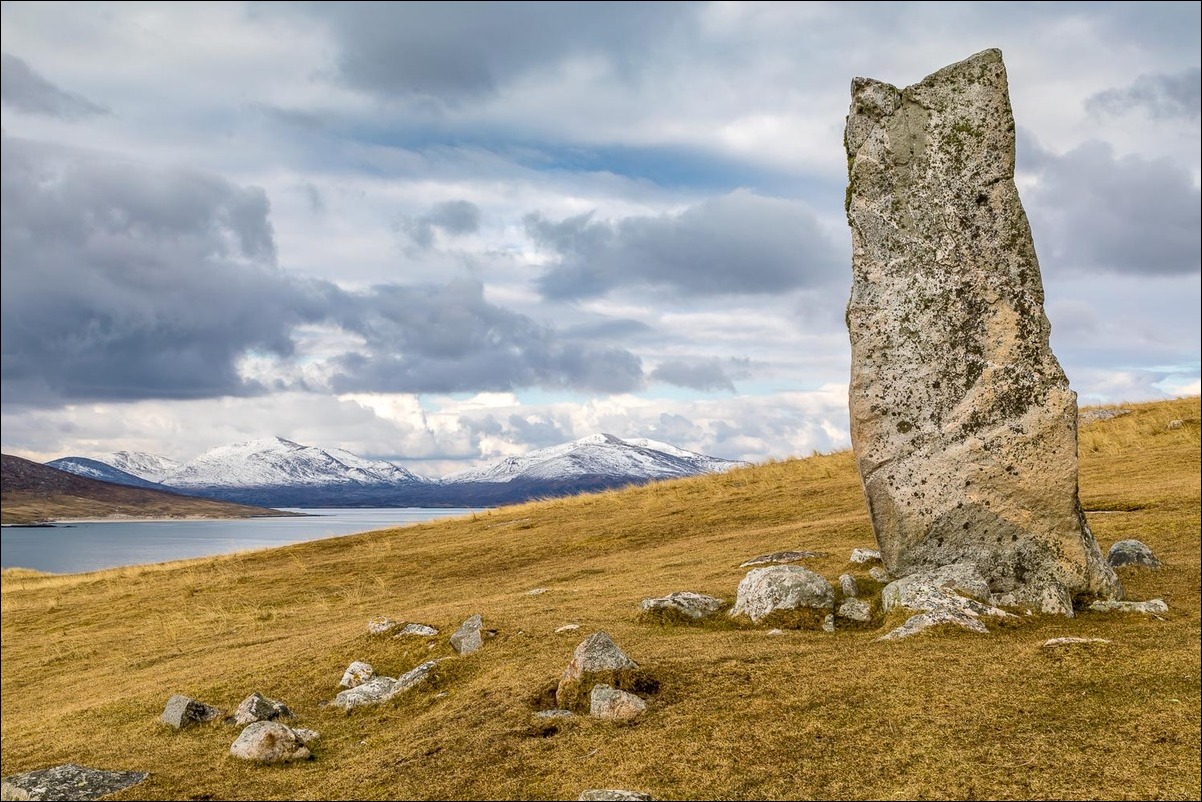
At the end of the beach we climbed up through the dunes to ascend the small hill which is home to the massive standing stone known as Macleod’s Stone. Erected more than 4,500 years ago, its purpose is now unclear but it may just have been a navigational aid to guide boats into the bay. It now serves as a foreground for wonderful views of the surrounding mountains and islands
We carried on to the summit cairn, though ‘summit’ is rather a grand name for this modest little hill which is easily climbed in 10 minutes or so, with a minimal expenditure of energy. We descended by a fence to reach a track leading back to the road, and then followed the road back to the start. It had been a wonderful little walk
Click on the icon below for the route map (subscribers to OS Maps can view detailed maps of the route, visualise it in aerial 3D, and download the GPX file. Non-subscribers will see a base map)

Scroll down – or click on any photo to enlarge it and you can then view as a slideshow

Bench with a view near our parking space

Traigh Iar beach

From the start of the walk there's a short section along the road, but only for a few yards

We pass through this gate...

...and descend through the dunes down to the beach


We can just make out Macleod's Stone on the hillside

The only footsteps in the sand were ours

Looking back

We reach the end of the beach


We follow a grassy path up the headland

A view back from the headland

Mountains of North Harris in the distance

Macleod's Stone...

The stone is about 9 feet tall


Looking across to North Harris

Traigh Iar beach

After reaching the top of the headland we descend towards the track on the left

We carry on beside the fence

We pass by another lovely beach, Traigh Niosaboist...


The remainder of the walk is along the road, with some wonderful views as we progress...


Beinn Dhubh

Looking towards Luskentyre

A passing shower leaves some perfect light in its wake...


Luskentyre


The end of the walk, and a view of Beinn Dhubh above Luskentyre - we'll be up there the day after tomorrow

The wonderful view from Blue Reef Cottages - a perfect base for this short walking holiday
