
Route: Loweswater
Area: Western Lake District
Date of walk: 6th October 2016
Walkers: Andrew
Distance: 5.9 miles
Weather: Sunny
This is one of our favourite local walks which in the space of 6 miles manages to cram in a huge variety of scenery including farmland, ancient woodland, a lake, a tarn, open moorland, a lonely valley and along the way offers wonderful views to Scotland looking north and to the high lakeland fells looking south
I parked as usual at Maggie’s Bridge where there is space for 8-10 cars and followed the track to the head of Loweswater and then joined the lakeshore path through Holme Wood. I walked past Hudson Palce and Jenkinson Place to a point near Fangs Brow on the very edge of the Lake District and from there started the return journey along the lovely terraced path which runs along the flanks of Burnbank Fell and Carling Knott
The path reaches a height of over 1,000 feet, higher than one or two lakeland fells, but the climbing is so gentle that it’s hardly noticed. I then descended to High Nook and followed the farm track back to the start
The weather was superb, as was the walk
For other walks here, visit my Find Walks page and enter the name in the ‘Search site’ box
Click on the icon below for the route map (subscribers to OS Maps can view detailed maps of the route, visualise it in aerial 3D, and download the GPX file. Non-subscribers will see a base map)

Scroll down – or click on any photo to enlarge it and you can then view as a slideshow

The night before the walk, the Milky Way over Lorton Vale

A 20 second exposure on a 24 mm lens at f1.4 for those interested in such things

Next day, a red squirrel in the garden…


A short while later, looking across to the Loweswater fells after leaving the car park at Maggie’s Bridge

I follow the track to Watergate Farm at the head of Loweswater

Loweswater and Holme Wood

Low Fell

I hardly ever carry a tripod, but time was on my side for once so I set it up and took a few long exposure shots…


I follow the lakeshore path and arrive at the bothy (available to rent from the National Trust)

View from the bothy

Path through Holme Wood

There are lovely views back across Loweswater after emerging from the wood…


After passing by Hudson Place I turn off the lane through this gate


Heading through the fields towards Iredale Place

Darling Fell

Red admiral feeding on ivy

Another view of Loweswater

The halfway point of the walk, looking back to Darling Fell (not a Wainwright, but well worth climbing for the superlative view)

Near Fangs Brow on the edge of the Lake District now, before turning left here to return towards Loweswater

Looking north, the hills in the distance are in Scotland

I follow the inviting path

Fell ponies…


After crossing the ladder stile I climb up the terrace path along the flanks of Burnbank Fell and Carling Knott - a wonderful section of the walk…

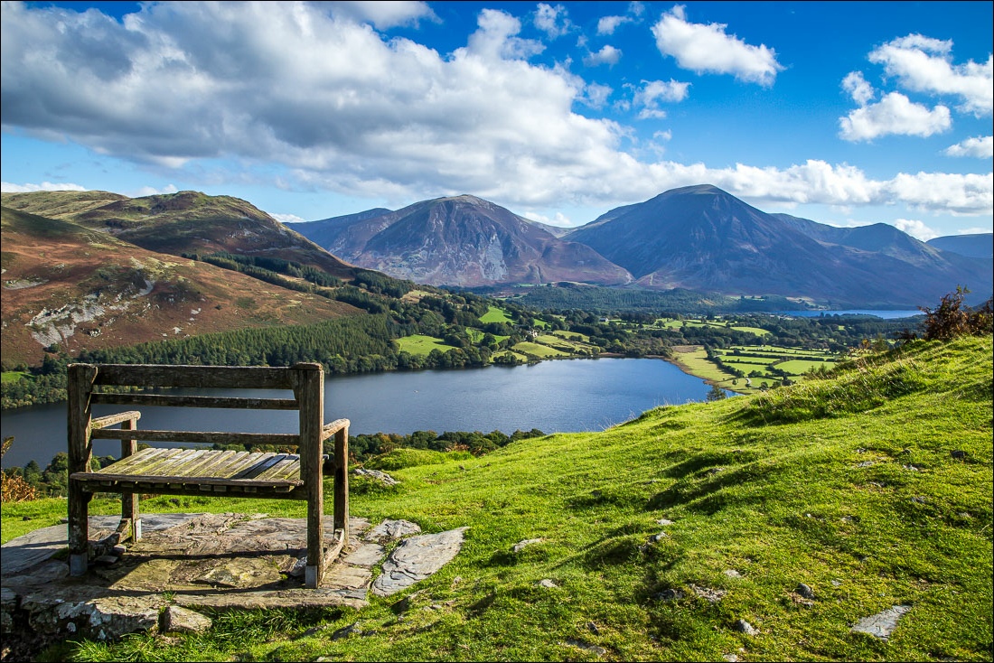
The head of Loweswater and the foot of Crummock Water


Holme Wood below and Low Fell, Whiteside and Grasmoor beyond


Looking down to the track I’d followed at the start of the walk

A shortcut is on offer here, by forking left and descending through Holme Wood, but that was of no interest to me on a day such as this

Looking back as the path snakes round the foot of Burnbank Fell

Grasmoor and Crummock Water


From the edge of Holme Wood, looking towards Whiteside, Grasmoor and Mellbreak

Looking back to Holme Wood

I follow the path downhill and before reaching High Nook Tarn turn left down the valley

Grasmoor and Mellbreak

Looking back up the valley

I cross the small footbridge over Highnook Beck

Sweet Lorton Vale…


I arrive back at Maggie’s Bridge to end a wonderful walk
