
Route: Loughrigg Fell
Area: Central Lake District
Date of walk: 11th May 2016
Walkers: Andrew
Distance: 5.3 miles
Ascent: 1,200 feet
Weather: warm, but insipid sky and poor light most of the time
Today was the day that the A591 re-opened, having been closed since December 2015 when Storm Desmond caused a landslip near Dunmail Raise. The closure of the road in effect divided the Lake District into two halves, making it impossible to travel from north to south and vice versa without a long diversion
After driving along the excellent new road I parked at Pelter Bridge near Rydal and followed the path to Loughrigg Terrace – a classic vantage point – and from there I followed the path up to the summit of the fell. The normally superb views from both the terrace and the summit were a disappointment thanks to the dull flat light
The summit area of Loughrigg Fell is quite a complicated place, with lots of overlapping paths and minor tops making it easy to take a wrong turn, and concentration was needed to keep on the right course even though I’ve been up here several times before
Eventually I made it back down the the bank of the River Rothay and from there it was a short stroll back to Pelter Bridge. It was good to be able to revisit this lovely area after an enforced five month absence
For other walks here, visit my Find Walks page and enter the name in the ‘Search site’ box
Click on the icon below for the route map (subscribers to OS Maps can view detailed maps of the route, visualise it in aerial 3D, and download the GPX file. Non-subscribers will see a base map)

Scroll down – or click on any photo to enlarge it and you can then view as a slideshow

The evening before the walk, sunset over Lorton Vale


Early next morning I visited Rannerdale to see the famous bluebells (for some reason the sign spells it ‘Rannadale’)

The Rannerdale bluebells are unusual as they grow on open fellside

Some bluebell photos…


Later on, the start of the walk as I leave the Pelter Bridge car park to head towards Rydal Water

More bluebells in Rough Intake

I take the higher of the two paths along the shore of Rydal Water


The big cave in Loughrigg Quarries - big enough to shelter the population of Ambleside according to Wainwright ‘although, admittedly many people would be standing in water’

Rydal Water from Loughrigg Terrace

Loughrigg Terrace


Looking back to Rydal Water

Baneriggs Wood below White Moss Common

Bluebells below Loughrigg Terrace


Looking along Grasmere as I start the climb up to Loughrigg Fell…


Dunmail Raise, the access between north and south lakeland - its re-opening today had made this walk possible

Summit of Loughrigg Fell looking toward the Langdale Pikes - on a good day the views are superb in all directions but today was not that day

The knobbly summit area is a complicated place with lots of criss crossing paths, making it easy to go astray


The descent is towards Ambleside at first, before turning left at the coppice

Windermere

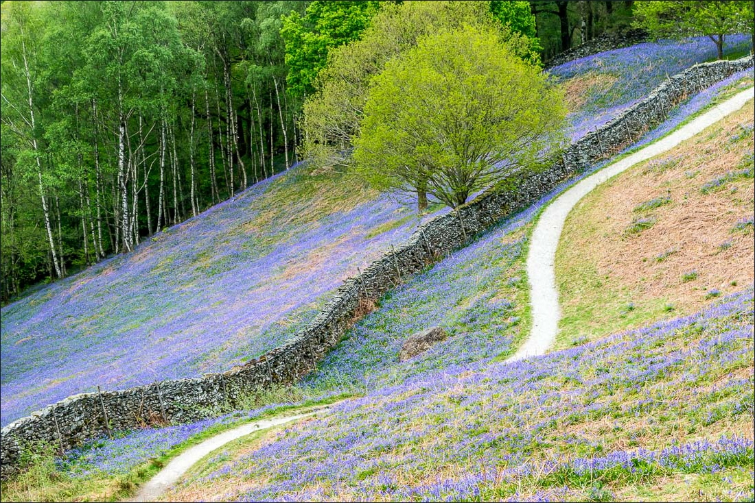
I follow the path beside the dry stone wall


Footbridge near Fox Ghyll

Back to valley level and I follow the quiet lane back to Pelter Bridge


An old barn by the bank of the River Rothay

The River Rothay

Pelter Bridge, and the end of the walk

Another reason to be grateful for the re-opening of the A591 - I could stock up at the Grasmere Gingerbread Shop

