
Route: Long Meg and Lacy’s Caves
Area: Eden Valley
Date of walk: 10th March 2017
Walkers: Andrew
Distance: 6.1 miles
Weather: mostly grey and overcast, light drizzle later on
I sourced this walk from an excellent guide book to the area ‘Walking in Cumbria’s Eden Valley’ by Vivienne Crow and published by Cicerone. After parking in the village of Little Salkeld, and following a short road section, I walked along a rough track and before long reached the first point of interest on this walk – Long Meg and Her Daughters. This is a huge stone circle consisting of 69 stones, the largest of which is Long Meg standing at 12 feet and weighing in at 9 tons. It’s a fascinating and atmospheric place and well worth a visit in its own right
After walking across the fields and along quiet lanes I reached the next point of interest, St Michael and All Angels Church, which stands on its own as the village which it once served was washed away by the River Eden in the 12th century
I then descended to Daleraven Bridge to be confronted by a sign erected by the council indicating that the path ahead was closed due to river erosion. A quick look at the map confirmed there was no alternative route, apart from returning the way I’d come and this would mean missing Lacy’s Caves – and so I decided to press on in the hope that a zealous health and safety official was being over cautious. This proved to be the case and although the path had fallen into the river at one point it was possible to climb over the adjoining barbed wire fence (exercising caution). Near here I chatted to one of the locals who wasn’t even aware of the so-called closure, and I also passed by several fellow walkers using the same route
I was glad to have persevered, since the riverside section was one of the highlights of the walk, especially Lacy’s Caves, a series of chambers in the red sandstone cliffs. Having explored the caves I followed a path beside the river through woodland which then emerged onto a wider track above the railway line and from there back into Little Salkeld
The weather was rather dull and insipid and didn’t show the countryside in its best light, but there was so much of interest along the way that I hardly noticed, and I can highly recommend this walk
Click on the icon below for the route map (subscribers to OS Maps can view detailed maps of the route, visualise it in aerial 3D, and download the GPX file. Non-subscribers will see a base map)

Scroll down – or click on any photo to enlarge it and you can then view as a slideshow

Red squirrel in the garden before I set off this morning…


Leaving Little Salkeld at the start of the walk

After a short walk along the road I join a farm track

I arrive at the stone circle known as Long Meg and her Daughters - the track runs through the circle

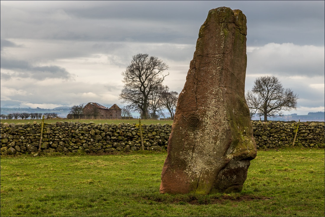
Long Meg, which stands outside the circle


About 15 minutes later I arrive at St Michael’s and All Angels Church - its village was washed away by the River Eden and it stands isolated in open countryside

The route runs through the church grounds


After leaving the church I walked through a woodland section, where a stoat ran across the path

I turn right here to descend to Daleraven Bridge

A short road section before the bridge

Rolling Eden Valley countryside

Daleraven Bridge, which marks the furthest point of the walk and the start of the return leg…

…and a very bad start - the river rules out alternative routes, leaving no choice other than to return the way I’d come or take my chances

I decide to press on and descend to the bank of the River Eden

The reason for the sign

…and someone’s solution, a few feet away - on with the walk

A boardwalk gives some relief from the muddy path

Tib Wood - too early to see the wild garlic in flower

Approaching Lacy’s Caves

The path isn’t as terrifying as the sign suggests

I follow the path above the river, the caves are just around the corner

Colonel Lacy commissioned the carving of the caves in the 18th century - he once attempted to blow up the Long Meg stone circle but was thwarted by a thunderstorm


Long Wood

Looking back to the caves

The weir at Force Mill

The final section of the walk follows the course of the railway line, which is below to the right

In truth it was a disappointing end to the walk, thanks to several abandoned old railway buildings, an electricity substation, drizzle and poor light

Nonetheless it was a walk packed full of interest and one that I’d like to repeat in better weather
